Estimated Value: $642,000 - $791,000
3
Beds
3
Baths
3,356
Sq Ft
$207/Sq Ft
Est. Value
About This Home
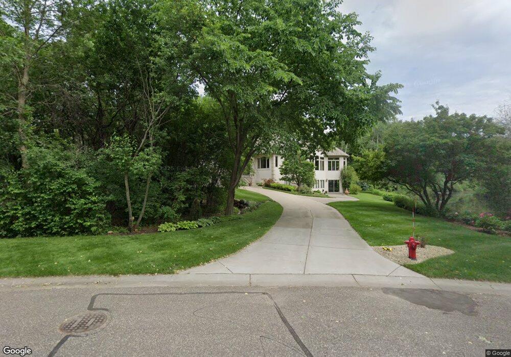
This home is located at 1432 Pheasant Hills Dr, Hugo, MN 55038 and is currently estimated at $696,156, approximately $207 per square foot. 1432 Pheasant Hills Dr is a home located in Anoka County with nearby schools including Centerville Elementary School, Centennial Middle School, and Centennial High School.
Ownership History
Date
Name
Owned For
Owner Type
Purchase Details
Closed on
Jul 29, 2010
Sold by
Vaughan Dolores E
Bought by
Newham Daniel J and Newham Lori S
Current Estimated Value
Home Financials for this Owner
Home Financials are based on the most recent Mortgage that was taken out on this home.
Original Mortgage
$360,000
Outstanding Balance
$239,075
Interest Rate
4.63%
Mortgage Type
New Conventional
Estimated Equity
$457,081
Create a Home Valuation Report for This Property
The Home Valuation Report is an in-depth analysis detailing your home's value as well as a comparison with similar homes in the area
Home Values in the Area
Average Home Value in this Area
Purchase History
| Date | Buyer | Sale Price | Title Company |
|---|---|---|---|
| Newham Daniel J | $455,000 | -- |
Source: Public Records
Mortgage History
| Date | Status | Borrower | Loan Amount |
|---|---|---|---|
| Open | Newham Daniel J | $360,000 |
Source: Public Records
Tax History Compared to Growth
Tax History
| Year | Tax Paid | Tax Assessment Tax Assessment Total Assessment is a certain percentage of the fair market value that is determined by local assessors to be the total taxable value of land and additions on the property. | Land | Improvement |
|---|---|---|---|---|
| 2025 | $7,812 | $643,000 | $132,000 | $511,000 |
| 2024 | $7,812 | $626,300 | $125,600 | $500,700 |
| 2023 | $6,871 | $633,200 | $128,900 | $504,300 |
| 2022 | $7,055 | $600,800 | $116,200 | $484,600 |
| 2021 | $7,014 | $538,100 | $89,100 | $449,000 |
| 2020 | $6,539 | $523,000 | $99,000 | $424,000 |
| 2019 | $6,512 | $472,900 | $95,600 | $377,300 |
| 2018 | $5,860 | $444,700 | $0 | $0 |
| 2017 | $5,777 | $435,800 | $0 | $0 |
| 2016 | $6,053 | $411,000 | $0 | $0 |
| 2015 | $5,970 | $411,000 | $113,400 | $297,600 |
| 2014 | -- | $383,100 | $110,800 | $272,300 |
Source: Public Records
Map
Nearby Homes
- 1428 Sherman Lake Rd
- 1469 Sherman Lake Rd
- 1351 Hunters Ridge
- 6733 Timberwolf Trail
- 6445 Pheasant Hills Dr
- 1610 Widgeon Cir
- 1707 Dupre Rd
- 6391 Centerville Rd
- 1159 Durango Point
- 6484 Killdeer Dr
- 6478 Fox Rd
- 1988 Norma Way
- 6457 Fox Rd
- 907 Fox Rd
- 2113 21st Ave S
- 22 Leaf Wing Dr
- 7159 Shad Ave
- 8 Leaf Wing Dr
- 6246 Otter Lake Rd
- 66 Monarch Way
- 1454 Pheasant Hills Dr
- 1466 Pheasant Hills Dr
- 1430 Pheasant Hills Dr
- 1425 Pheasant Hills Dr
- 1472 Pheasant Hills Dr
- 1424 Pheasant Hills Dr
- 1461 Pheasant Hills Dr
- 1481 Birch St
- 1439 Hawk Ridge Cir
- 1419 Pheasant Hills Dr
- 1463 Pheasant Hills Dr
- 1478 Pheasant Hills Dr
- 1418 Pheasant Hills Dr
- 1457 Hawk Ridge Cir
- 1485 Birch St
- 1445 Hawk Ridge Cir
- 1465 Snow Goose Trail
- 1413 Pheasant Hills Dr
- 1451 Hawk Ridge Cir
- 1412 Pheasant Hills Dr