Estimated Value: $814,000 - $935,000
3
Beds
1
Bath
958
Sq Ft
$923/Sq Ft
Est. Value
About This Home
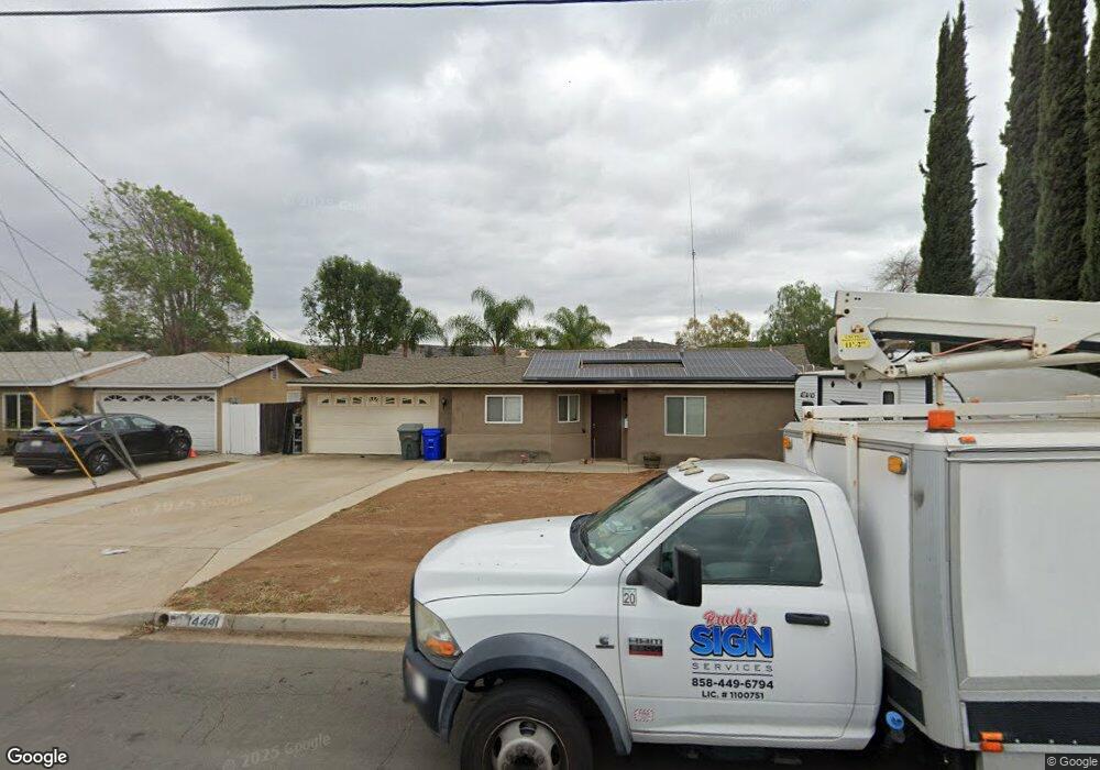
This home is located at 14441 Springvale St, Poway, CA 92064 and is currently estimated at $884,568, approximately $923 per square foot. 14441 Springvale St is a home located in San Diego County with nearby schools including Garden Road Elementary, Twin Peaks Middle, and Poway High.
Ownership History
Date
Name
Owned For
Owner Type
Purchase Details
Closed on
Jan 16, 2014
Sold by
Spoon Connie L
Bought by
Brady Carol F and Brady Patrick S
Current Estimated Value
Home Financials for this Owner
Home Financials are based on the most recent Mortgage that was taken out on this home.
Original Mortgage
$296,000
Outstanding Balance
$223,550
Interest Rate
4.4%
Mortgage Type
New Conventional
Estimated Equity
$661,018
Purchase Details
Closed on
Sep 23, 1998
Sold by
Phillips Connie L and Phillips Connie L
Bought by
Spoon Connie L
Home Financials for this Owner
Home Financials are based on the most recent Mortgage that was taken out on this home.
Original Mortgage
$135,500
Interest Rate
6.6%
Purchase Details
Closed on
May 9, 1995
Sold by
Phillips Mark T
Bought by
Phillips Connie L
Purchase Details
Closed on
Feb 24, 1989
Purchase Details
Closed on
Sep 5, 1986
Create a Home Valuation Report for This Property
The Home Valuation Report is an in-depth analysis detailing your home's value as well as a comparison with similar homes in the area
Home Values in the Area
Average Home Value in this Area
Purchase History
| Date | Buyer | Sale Price | Title Company |
|---|---|---|---|
| Brady Carol F | $370,000 | Chicago Title | |
| Spoon Connie L | -- | First American Title Ins Co | |
| Phillips Connie L | -- | -- | |
| -- | $130,900 | -- | |
| -- | $93,500 | -- |
Source: Public Records
Mortgage History
| Date | Status | Borrower | Loan Amount |
|---|---|---|---|
| Open | Brady Carol F | $296,000 | |
| Previous Owner | Spoon Connie L | $135,500 |
Source: Public Records
Tax History
| Year | Tax Paid | Tax Assessment Tax Assessment Total Assessment is a certain percentage of the fair market value that is determined by local assessors to be the total taxable value of land and additions on the property. | Land | Improvement |
|---|---|---|---|---|
| 2025 | $5,940 | $532,477 | $330,976 | $201,501 |
| 2024 | $5,940 | $522,037 | $324,487 | $197,550 |
| 2023 | $5,815 | $511,802 | $318,125 | $193,677 |
| 2022 | $5,719 | $501,768 | $311,888 | $189,880 |
| 2021 | $5,645 | $491,930 | $305,773 | $186,157 |
| 2020 | $5,570 | $486,887 | $302,638 | $184,249 |
| 2019 | $5,427 | $477,341 | $296,704 | $180,637 |
| 2018 | $5,275 | $467,983 | $290,887 | $177,096 |
| 2017 | $5,136 | $458,808 | $285,184 | $173,624 |
| 2016 | $4,628 | $413,146 | $279,593 | $133,553 |
| 2015 | $4,235 | $377,392 | $275,394 | $101,998 |
| 2014 | $2,203 | $200,365 | $107,149 | $93,216 |
Source: Public Records
Map
Nearby Homes
- 13419 Sebago Ave
- 13428 Standish Dr
- 13209 Neddick Ave
- 14525 Kittery St
- 14610 Fairburn St
- 13435 Frey Ct
- 14550 Dehia St
- 13001 Standish Dr
- 12671 Claire Dr
- 14298 Ipava Dr
- 13643 Melissa Ln
- 13735 Fairgate Dr
- 13746 Paseo Bonita
- 000 Carlson Ct 9 Unit 9
- 14003 Jasmine Ave Unit 193
- 14089 Pomegranate Ave Unit 214
- 13908 Hibiscus Ave Unit 40
- 13941 Wisteria Ave
- 13947 Midland Rd
- 0 Indian Springs Rd Unit NDP2602071
- 14435 Springvale St
- 14503 Springvale St
- 13309 Rollin Glen Rd
- 13334 Rollin Glen Rd
- 14509 Springvale St
- 14440 Springvale St
- 14508 Springvale St
- 13334 Red Cloud Ln
- 13341 Leaning Tree Ln
- 14428 Springvale St
- 14423 Springvale St
- 14515 Springvale St
- 13412 Sebago Ave
- 13315 Rollin Glen Rd
- 13330 Rollin Glen Rd
- 13411 Sebago Ave
- 13333 Leaning Tree Ln
- 13332 Red Cloud Ln
- 14516 Springvale St
- 13325 Leaning Tree Ln
Your Personal Tour Guide
Ask me questions while you tour the home.