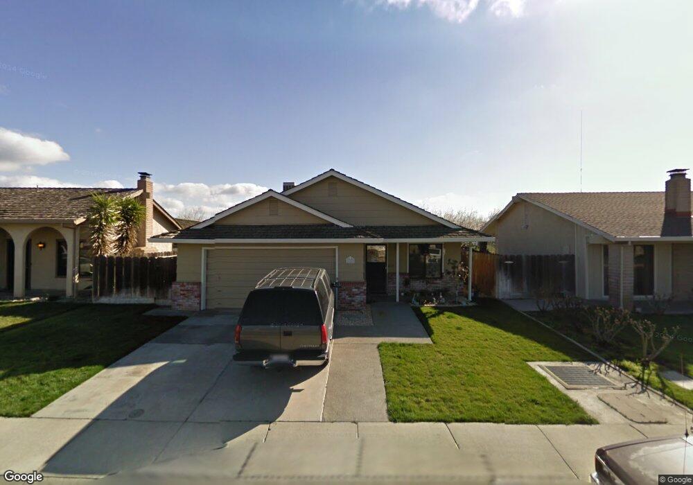
14442 Arapaho Way Manteca, CA 95336
Estimated Value: $419,000 - $524,000
3
Beds
2
Baths
1,453
Sq Ft
$339/Sq Ft
Est. Value
About This Home
This home is located at 14442 Arapaho Way, Manteca, CA 95336 and is currently estimated at $491,990, approximately $338 per square foot. 14442 Arapaho Way is a home located in San Joaquin County with nearby schools including New Haven Elementary School and East Union High School.
Ownership History
Date
Name
Owned For
Owner Type
Purchase Details
Closed on
Aug 17, 2023
Sold by
Snyder Bryan K and Snyder Linda D
Bought by
Bryan K Snyder And Linda D Snyder Family Trus and Snyder
Current Estimated Value
Purchase Details
Closed on
Nov 13, 1998
Sold by
Va
Bought by
Snyder Bryan K and Snyder Linda D
Home Financials for this Owner
Home Financials are based on the most recent Mortgage that was taken out on this home.
Original Mortgage
$108,750
Interest Rate
6.66%
Create a Home Valuation Report for This Property
The Home Valuation Report is an in-depth analysis detailing your home's value as well as a comparison with similar homes in the area
Home Values in the Area
Average Home Value in this Area
Purchase History
| Date | Buyer | Sale Price | Title Company |
|---|---|---|---|
| Bryan K Snyder And Linda D Snyder Family Trus | -- | None Listed On Document | |
| Snyder Bryan K | -- | Fidelity National Title Co |
Source: Public Records
Mortgage History
| Date | Status | Borrower | Loan Amount |
|---|---|---|---|
| Previous Owner | Snyder Bryan K | $108,750 |
Source: Public Records
Tax History Compared to Growth
Tax History
| Year | Tax Paid | Tax Assessment Tax Assessment Total Assessment is a certain percentage of the fair market value that is determined by local assessors to be the total taxable value of land and additions on the property. | Land | Improvement |
|---|---|---|---|---|
| 2025 | $3,593 | $190,321 | $40,611 | $149,710 |
| 2024 | $3,523 | $186,590 | $39,815 | $146,775 |
| 2023 | $3,463 | $182,933 | $39,035 | $143,898 |
| 2022 | $3,432 | $179,347 | $38,270 | $141,077 |
| 2021 | $3,407 | $175,831 | $37,520 | $138,311 |
| 2020 | $3,329 | $174,029 | $37,136 | $136,893 |
| 2019 | $3,304 | $170,617 | $36,408 | $134,209 |
| 2018 | $3,242 | $167,273 | $35,695 | $131,578 |
| 2017 | $3,215 | $163,995 | $34,996 | $128,999 |
| 2016 | $3,149 | $160,780 | $34,310 | $126,470 |
| 2014 | $2,949 | $155,265 | $33,133 | $122,132 |
Source: Public Records
Map
Nearby Homes
- 14665 Cree Ct
- 6236 Choctaw Ct
- 5862 Northland Rd
- 5958 E Lathrop Rd
- 1052 Camborne Dr
- 6288 E Lathrop Rd
- 1624 S Frontage Rd Unit 21
- 1624 S Frontage Rd Unit 81
- 7001 Southland Rd
- 137 Quarry Stone Way
- 2021 Holbrook Place
- 753 Conrad St
- 1340 Crimson Place
- 771 Conrad St
- 732 Conrad Ct
- 732 Conrad St
- 762 Conrad St
- 13120 S Frontage Rd
- 484 Pinehurst St
- 1870 Pecanwood Ave
- 14432 Arapaho Way
- 14452 Arapaho Way
- 14422 Arapaho Way
- 14462 Arapaho Way
- 2316 Belle Glade Ln
- 8701 S Austin Rd
- 11717 S Austin Rd
- 2229 Hickory Woods Ln
- 1316 Camara Way
- 14066 S St Rt 99 E Frontage Rd
- 0 N Main St Unit 16050369
- 0 N Main St Unit 17051633
- 1896 Concannon Dr
- 7171 E Lathrop
- 2003 Main Street Ave
- 14066 S State Rt Fron Rd
- 13085 S State Route 99 W Fron Road Hwy
- 13701 S State Route 99 W Fron Rd
- 14066 S State Route 99 E Fron Rd
- 1 Lathrop Rd