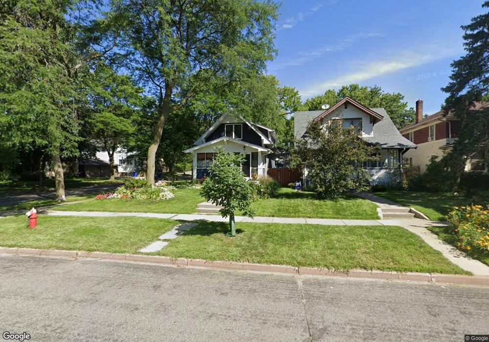
1457 Portland Ave Saint Paul, MN 55104
Union Park NeighborhoodEstimated Value: $526,000 - $672,193
3
Beds
2
Baths
2,088
Sq Ft
$297/Sq Ft
Est. Value
About This Home
This home is located at 1457 Portland Ave, Saint Paul, MN 55104 and is currently estimated at $619,298, approximately $296 per square foot. 1457 Portland Ave is a home located in Ramsey County with nearby schools including Maxfield Magnet Elementary School, Hidden River Middle School, and Central Senior High School.
Ownership History
Date
Name
Owned For
Owner Type
Purchase Details
Closed on
Feb 27, 2013
Sold by
Haider Anthony F and Haider Suzanne J
Bought by
Glanz Brandon and Glanz Jennifer
Current Estimated Value
Home Financials for this Owner
Home Financials are based on the most recent Mortgage that was taken out on this home.
Original Mortgage
$294,500
Outstanding Balance
$206,308
Interest Rate
3.38%
Mortgage Type
New Conventional
Estimated Equity
$412,990
Purchase Details
Closed on
Aug 28, 2003
Sold by
Pilot Robert A and Pilot Mary J
Bought by
Haider Anthony F
Create a Home Valuation Report for This Property
The Home Valuation Report is an in-depth analysis detailing your home's value as well as a comparison with similar homes in the area
Home Values in the Area
Average Home Value in this Area
Purchase History
| Date | Buyer | Sale Price | Title Company |
|---|---|---|---|
| Glanz Brandon | $310,000 | Land Title Inc | |
| Haider Anthony F | $224,000 | -- |
Source: Public Records
Mortgage History
| Date | Status | Borrower | Loan Amount |
|---|---|---|---|
| Open | Glanz Brandon | $294,500 |
Source: Public Records
Tax History Compared to Growth
Tax History
| Year | Tax Paid | Tax Assessment Tax Assessment Total Assessment is a certain percentage of the fair market value that is determined by local assessors to be the total taxable value of land and additions on the property. | Land | Improvement |
|---|---|---|---|---|
| 2025 | $10,200 | $668,800 | $100,800 | $568,000 |
| 2023 | $10,200 | $636,100 | $100,800 | $535,300 |
| 2022 | $9,298 | $624,000 | $100,800 | $523,200 |
| 2021 | $8,256 | $562,700 | $100,800 | $461,900 |
| 2020 | $7,942 | $519,600 | $100,800 | $418,800 |
| 2019 | $7,098 | $473,500 | $100,800 | $372,700 |
| 2018 | $6,550 | $411,700 | $100,800 | $310,900 |
| 2017 | $5,400 | $397,400 | $100,800 | $296,600 |
| 2016 | $5,200 | $0 | $0 | $0 |
| 2015 | $4,528 | $320,400 | $100,800 | $219,600 |
| 2014 | $3,612 | $0 | $0 | $0 |
Source: Public Records
Map
Nearby Homes
- 750 Summit Ave
- 1510 Laurel Ave
- 1540 Ashland Ave Unit 12
- 1447 Hague Ave
- 1354 Grand Ave
- 184 Saratoga St N
- 1253 Ashland Ave
- 1325 Dayton Ave
- 1319 Dayton Ave
- 1670 Ashland Ave
- 1259 Hague Ave
- 1247 Selby Ave
- 1217 Grand Ave
- 12XX Marshall Ave
- 1200 Portland Ave
- 266 Fry St
- 193 Griggs St N
- 1201 Hague Ave
- 1174 Grand Ave Unit 5
- 142 Cambridge St
- 1457 1457 Portland Ave
- 1455 Portland Ave
- 1451 Portland Ave
- 1463 Portland Ave
- 1447 1447 Portland Ave
- 1443 Portland Ave
- 1443 1443 Portland Ave
- 65 Pascal St N
- 1458 Ashland Ave
- 1458 1458 Ashland Ave
- 1452 Ashland Ave
- 1452 1452 Ashland Ave
- 1471 Portland Ave
- 1471 Portland Ave Unit 1
- 1460 Ashland Ave
- 1439 Portland Ave
- 1446 Ashland Ave
- 1466 Ashland Ave
- 1456 Portland Ave
- 1452 Portland Ave