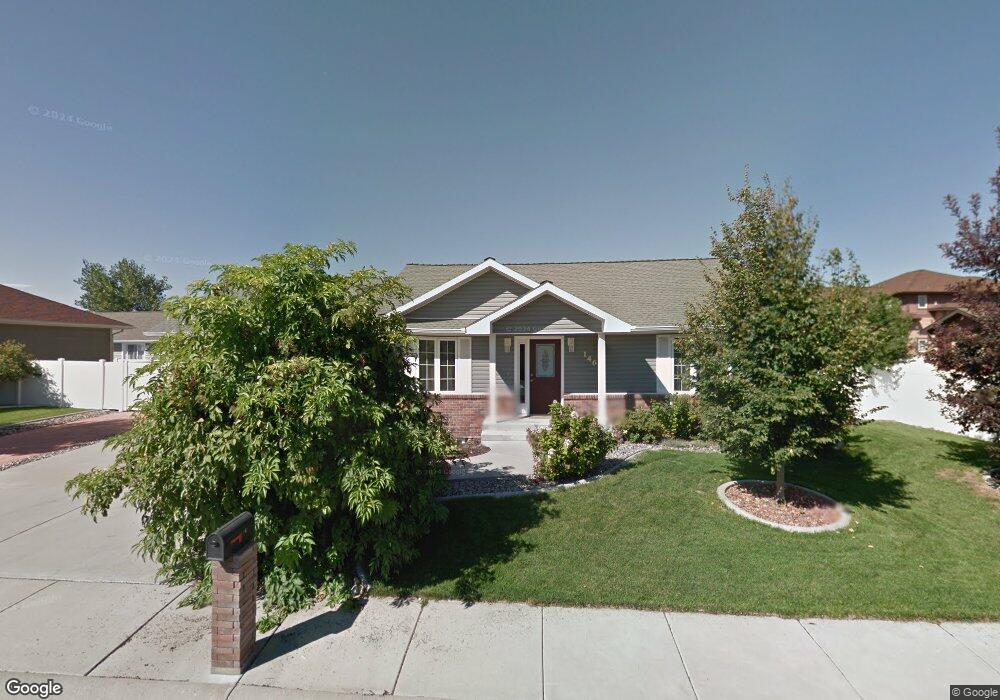
146 Colt Trail Billings, MT 59102
West End NeighborhoodEstimated Value: $361,984 - $378,000
2
Beds
2
Baths
1,080
Sq Ft
$343/Sq Ft
Est. Value
About This Home
This home is located at 146 Colt Trail, Billings, MT 59102 and is currently estimated at $370,496, approximately $343 per square foot. 146 Colt Trail is a home located in Yellowstone County with nearby schools including Central Heights School, Will James Junior High School, and Billings West High School.
Ownership History
Date
Name
Owned For
Owner Type
Purchase Details
Closed on
May 16, 2006
Sold by
Madco Inc
Bought by
Dewey Carlton P and Dewey Janeen P
Current Estimated Value
Purchase Details
Closed on
May 3, 2005
Sold by
Bach Builders & Developers Llc
Bought by
Madco Inc
Home Financials for this Owner
Home Financials are based on the most recent Mortgage that was taken out on this home.
Original Mortgage
$50,000
Interest Rate
5.99%
Mortgage Type
Purchase Money Mortgage
Create a Home Valuation Report for This Property
The Home Valuation Report is an in-depth analysis detailing your home's value as well as a comparison with similar homes in the area
Home Values in the Area
Average Home Value in this Area
Purchase History
| Date | Buyer | Sale Price | Title Company |
|---|---|---|---|
| Dewey Carlton P | -- | None Available | |
| Madco Inc | -- | None Available |
Source: Public Records
Mortgage History
| Date | Status | Borrower | Loan Amount |
|---|---|---|---|
| Previous Owner | Madco Inc | $50,000 |
Source: Public Records
Tax History Compared to Growth
Tax History
| Year | Tax Paid | Tax Assessment Tax Assessment Total Assessment is a certain percentage of the fair market value that is determined by local assessors to be the total taxable value of land and additions on the property. | Land | Improvement |
|---|---|---|---|---|
| 2025 | $3,146 | $379,500 | $84,717 | $294,783 |
| 2024 | $3,146 | $330,600 | $89,995 | $240,605 |
| 2023 | $3,141 | $330,600 | $89,995 | $240,605 |
| 2022 | $2,405 | $254,700 | $0 | $0 |
| 2021 | $2,628 | $254,700 | $0 | $0 |
| 2020 | $2,742 | $254,300 | $0 | $0 |
| 2019 | $2,615 | $254,300 | $0 | $0 |
| 2018 | $2,415 | $229,600 | $0 | $0 |
| 2017 | $2,346 | $229,600 | $0 | $0 |
| 2016 | $2,339 | $232,200 | $0 | $0 |
| 2015 | $2,286 | $232,200 | $0 | $0 |
| 2014 | $1,886 | $100,859 | $0 | $0 |
Source: Public Records
Map
Nearby Homes
- 3030 Hunters Ridge Loop
- 3087 Hunters Ridge Loop
- 2968 Daystar Dr
- 3175 Solar Blvd Unit 14
- 3121 New Hope Dr
- 3121 New Hope Dr Unit 9
- 3291 Banff Ave
- 260 Brookshire Blvd
- 3297 Banff Ave Unit 10
- 2930 Lynn Ave
- 3482 Shenandoah Dr
- 3468 Shenandoah Dr
- 3136 Saint Johns Ave
- 3220 Lynn Ave
- 3231 Central Ave
- 3142 Saint Johns Ave
- 3340 Tahoe Dr
- 2916 Monad Rd
- 371 W Daffodil Dr
- 499 Greenspring Place
- 3023 Hunters Ridge Loop
- 152 Colt Trail
- 3096 Hunters Ridge Loop
- 147 Colt Trail
- 3102 Hunters Ridge Loop
- 3090 Hunters Ridge Loop
- 153 Colt Trail
- 3043 Hunters Ridge Loop
- 3072 Hunters Ridge Loop
- 3037 Hunters Ridge Loop
- 3049 Hunters Ridge Loop
- 3026 Hunter's Ridge Loop
- 159 Colt Trail
- 3068 Hunters Ridge Loop
- 3076 Hunters Ridge Loop
- 3103 Hunters Ridge Loop
- 3091 Hunters Ridge Loop
- 3116 Hunters Ridge Loop
- 3053 Hunters Ridge Loop
- 3110 Hunters Ridge Loop