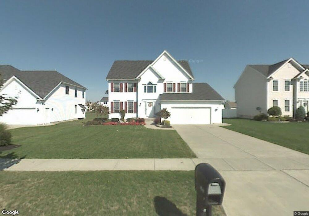
146 Nathans Trail Lancaster, NY 14086
Estimated Value: $519,252 - $578,000
3
Beds
3
Baths
2,200
Sq Ft
$250/Sq Ft
Est. Value
About This Home
This home is located at 146 Nathans Trail, Lancaster, NY 14086 and is currently estimated at $551,063, approximately $250 per square foot. 146 Nathans Trail is a home located in Erie County with nearby schools including William Street School, Lancaster Middle School, and Lancaster High School.
Ownership History
Date
Name
Owned For
Owner Type
Purchase Details
Closed on
May 2, 2008
Sold by
King Kenneth and King Maureen
Bought by
Stroh David C and Stroh Kristin M
Current Estimated Value
Home Financials for this Owner
Home Financials are based on the most recent Mortgage that was taken out on this home.
Original Mortgage
$150,000
Outstanding Balance
$95,539
Interest Rate
5.99%
Mortgage Type
Purchase Money Mortgage
Estimated Equity
$455,524
Purchase Details
Closed on
Aug 6, 2001
Sold by
Ferry Walter
Bought by
King Kenneth and King Maureen
Home Financials for this Owner
Home Financials are based on the most recent Mortgage that was taken out on this home.
Original Mortgage
$127,800
Interest Rate
7.1%
Mortgage Type
Purchase Money Mortgage
Create a Home Valuation Report for This Property
The Home Valuation Report is an in-depth analysis detailing your home's value as well as a comparison with similar homes in the area
Home Values in the Area
Average Home Value in this Area
Purchase History
| Date | Buyer | Sale Price | Title Company |
|---|---|---|---|
| Stroh David C | $247,500 | None Available | |
| Stroh David C | $247,500 | None Available | |
| King Kenneth | $33,000 | -- | |
| King Kenneth | $33,000 | -- |
Source: Public Records
Mortgage History
| Date | Status | Borrower | Loan Amount |
|---|---|---|---|
| Open | Stroh David C | $150,000 | |
| Closed | Stroh David C | $150,000 | |
| Previous Owner | King Kenneth | $127,800 |
Source: Public Records
Tax History Compared to Growth
Tax History
| Year | Tax Paid | Tax Assessment Tax Assessment Total Assessment is a certain percentage of the fair market value that is determined by local assessors to be the total taxable value of land and additions on the property. | Land | Improvement |
|---|---|---|---|---|
| 2024 | -- | $310,000 | $70,000 | $240,000 |
| 2023 | $8,548 | $310,000 | $70,000 | $240,000 |
| 2022 | $8,312 | $310,000 | $70,000 | $240,000 |
| 2021 | $8,208 | $310,000 | $70,000 | $240,000 |
| 2020 | $8,199 | $310,000 | $70,000 | $240,000 |
| 2019 | $7,709 | $258,000 | $35,000 | $223,000 |
| 2018 | $7,991 | $258,000 | $35,000 | $223,000 |
| 2017 | $3,829 | $258,000 | $35,000 | $223,000 |
| 2016 | $7,734 | $258,000 | $35,000 | $223,000 |
| 2015 | -- | $258,000 | $35,000 | $223,000 |
| 2014 | -- | $258,000 | $35,000 | $223,000 |
Source: Public Records
Map
Nearby Homes
- 0 William St Unit B1586800
- 5252 William St
- 5137 William St
- 207 Siebert Rd
- 54 Village View
- 5302 William St
- 3 Kevwood Ln
- 61 Waltham Ave
- 10 Joseph Dr
- 60 Waltham Ave
- 12 Kevwood Ln
- 97 Olde Stone Ln Unit 97
- 24 Waltham Ave
- 39 Olde Stone Ln
- 3907 Bowen Rd Unit D31
- 3907 Bowen Rd Unit 35
- 3915 Bowen Rd Unit 76
- 15 Christen Ct
- 29 Olde Stone Ln
- 280 Lake Ave
- 148 Nathans Trail
- 144 Nathans Trail
- 142 Nathans Trail
- 3 Katelyn Ln
- 5 Katelyn Ln
- 1 Katelyn Ln
- 156 Nathans Trail
- 160 Nathans Trail
- 140 Nathans Trail
- 145 Nathans Trail
- 149 Nathans Trail
- 166 Nathans Trail
- 9 Katelyn Ln
- 143 Nathans Trail
- 151 Nathans Trail
- 138 Nathans Trail
- 141 Nathans Trail
- 153 Nathans Trail
- 155 Nathans Trail
- 4 Katelyn Ln