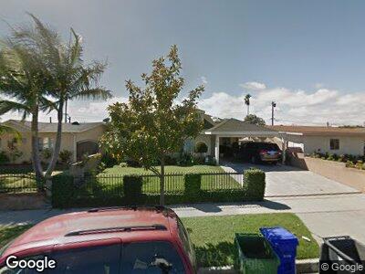
146 W 232nd Place Carson, CA 90745
Estimated Value: $783,000 - $829,000
4
Beds
2
Baths
1,636
Sq Ft
$495/Sq Ft
Est. Value
About This Home
This home is located at 146 W 232nd Place, Carson, CA 90745 and is currently estimated at $809,222, approximately $494 per square foot. 146 W 232nd Place is a home located in Los Angeles County with nearby schools including 232nd Place School, Stephen M. White Middle School, and Carson High School.
Ownership History
Date
Name
Owned For
Owner Type
Purchase Details
Closed on
Sep 20, 2020
Sold by
Moje Rodel E
Bought by
Moje Rodel
Current Estimated Value
Purchase Details
Closed on
Oct 23, 2013
Sold by
Moje Rodel E
Bought by
Moje Rodel E
Home Financials for this Owner
Home Financials are based on the most recent Mortgage that was taken out on this home.
Original Mortgage
$165,000
Interest Rate
4.17%
Mortgage Type
New Conventional
Create a Home Valuation Report for This Property
The Home Valuation Report is an in-depth analysis detailing your home's value as well as a comparison with similar homes in the area
Home Values in the Area
Average Home Value in this Area
Purchase History
| Date | Buyer | Sale Price | Title Company |
|---|---|---|---|
| Moje Rodel | -- | None Available | |
| Moje Rodel E | $130,000 | None Available |
Source: Public Records
Mortgage History
| Date | Status | Borrower | Loan Amount |
|---|---|---|---|
| Closed | Moje Rodel E | $165,000 | |
| Closed | Moje Faye G | $104,100 | |
| Closed | Moje Rodel E | $132,000 |
Source: Public Records
Tax History Compared to Growth
Tax History
| Year | Tax Paid | Tax Assessment Tax Assessment Total Assessment is a certain percentage of the fair market value that is determined by local assessors to be the total taxable value of land and additions on the property. | Land | Improvement |
|---|---|---|---|---|
| 2024 | $5,287 | $365,300 | $217,815 | $147,485 |
| 2023 | $5,182 | $358,139 | $213,545 | $144,594 |
| 2022 | $4,931 | $351,117 | $209,358 | $141,759 |
| 2021 | $4,868 | $344,233 | $205,253 | $138,980 |
| 2020 | $4,869 | $340,704 | $203,149 | $137,555 |
| 2019 | $4,691 | $334,024 | $199,166 | $134,858 |
| 2018 | $4,592 | $327,475 | $195,261 | $132,214 |
| 2016 | $4,396 | $314,761 | $187,680 | $127,081 |
| 2015 | $4,308 | $310,034 | $184,861 | $125,173 |
| 2014 | $4,300 | $303,962 | $181,240 | $122,722 |
Source: Public Records
Map
Nearby Homes
- 23030 Frigate Ave
- 22866 Baywood Dr
- 22842 Morro Dr
- 22724 Kinard Ave
- 22736 Jody Ln
- 415 W 226th St
- 22532 Venice St
- 120 W 223rd St Unit 4
- 23551 Maribel Ave
- 22519 Ravenna Ave
- 503 Bayport St Unit 107
- 121 E 223rd St Unit 5
- 121 E 223rd St Unit 4
- 23415 Anchor Ave
- 809 W 232nd St Unit M
- 22405 Caroldale Ave
- 247 W 223rd St Unit D
- 23304 Sesame St Unit A
- 832 Coriander Dr Unit B
- 832 Coriander Dr Unit A
- 146 W 232nd Place
- 142 W 232nd Place
- 150 W 232nd Place
- 136 W 232nd Place
- 147 W 233rd St
- 156 W 232nd Place
- 153 W 233rd St
- 143 W 233rd St
- 137 W 233rd St
- 157 W 233rd St
- 162 W 232nd Place
- 147 W 232nd Place
- 153 W 232nd Place
- 141 W 232nd Place
- 163 W 233rd St
- 157 W 232nd Place
- 137 W 232nd Place
- 166 W 232nd Place
- 163 W 232nd Place
- 169 W 233rd St