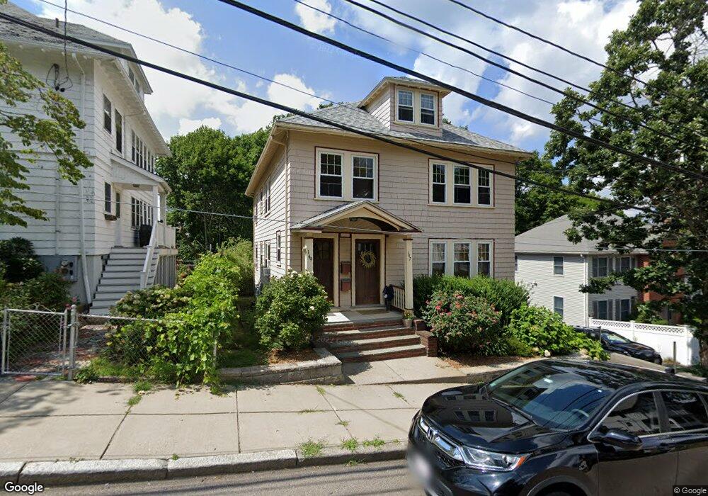
147 Kittredge St Unit 147A Roslindale, MA 02131
Roslindale NeighborhoodEstimated Value: $664,752
5
Beds
2
Baths
2,352
Sq Ft
$283/Sq Ft
Est. Value
About This Home
This home is located at 147 Kittredge St Unit 147A, Roslindale, MA 02131 and is currently estimated at $664,752, approximately $282 per square foot. 147 Kittredge St Unit 147A is a home located in Suffolk County with nearby schools including Brooke Charter School Roslindale, Sacred Heart STEM School, and St. Clare High School.
Ownership History
Date
Name
Owned For
Owner Type
Purchase Details
Closed on
Apr 29, 2011
Sold by
Insight Rt
Bought by
Dahlen Kritina M
Current Estimated Value
Home Financials for this Owner
Home Financials are based on the most recent Mortgage that was taken out on this home.
Original Mortgage
$210,000
Outstanding Balance
$145,131
Interest Rate
4.76%
Mortgage Type
Purchase Money Mortgage
Estimated Equity
$519,621
Purchase Details
Closed on
Sep 15, 2010
Sold by
Dagostino Peter M and Dagostino Antoinette M
Bought by
Mcguire Michael J and Mcguire John P
Home Financials for this Owner
Home Financials are based on the most recent Mortgage that was taken out on this home.
Original Mortgage
$288,000
Interest Rate
4.51%
Mortgage Type
Purchase Money Mortgage
Create a Home Valuation Report for This Property
The Home Valuation Report is an in-depth analysis detailing your home's value as well as a comparison with similar homes in the area
Home Values in the Area
Average Home Value in this Area
Purchase History
| Date | Buyer | Sale Price | Title Company |
|---|---|---|---|
| Dahlen Kritina M | $280,000 | -- | |
| Mcguire Michael J | $360,000 | -- |
Source: Public Records
Mortgage History
| Date | Status | Borrower | Loan Amount |
|---|---|---|---|
| Open | Dahlen Kritina M | $210,000 | |
| Previous Owner | Mcguire Michael J | $288,000 |
Source: Public Records
Tax History Compared to Growth
Tax History
| Year | Tax Paid | Tax Assessment Tax Assessment Total Assessment is a certain percentage of the fair market value that is determined by local assessors to be the total taxable value of land and additions on the property. | Land | Improvement |
|---|---|---|---|---|
| 2025 | -- | $0 | $0 | $0 |
| 2024 | -- | $0 | $0 | $0 |
| 2023 | $0 | $0 | $0 | $0 |
| 2022 | $0 | $0 | $0 | $0 |
| 2021 | $0 | $0 | $0 | $0 |
| 2020 | $0 | $0 | $0 | $0 |
| 2019 | $0 | $0 | $0 | $0 |
| 2018 | $0 | $0 | $0 | $0 |
| 2017 | $0 | $0 | $0 | $0 |
| 2016 | -- | $0 | $0 | $0 |
| 2015 | -- | $0 | $0 | $0 |
| 2014 | -- | $0 | $0 | $0 |
Source: Public Records
Map
Nearby Homes
- 69 Metropolitan Ave
- 55 Metropolitan Ave
- 142 Metropolitan Ave Unit A
- 5 7 Hemman St
- 295 Kittredge St
- 25 Crandall St
- 142 Birch St
- 142 Birch St Unit 1
- 142 Birch St Unit 2
- 34 Averton St
- 0 Averton St
- 112 Roslindale Ave Unit 2
- 124 Glendower Rd Unit 2
- 89 Glendower Rd
- 80 Roslindale Ave Unit 3
- 75 Glendower Rd
- 276 Cornell St
- 65 Birch St Unit 3
- 16 Hilburn Place
- 67 Hautevale St
- 149 Kittredge St Unit 2
- 147 Kittredge St Unit 1
- 147-149 Kittredge St Unit 1
- 151 Kittredge St
- 151 Kittredge St Unit 2
- 151 Kittredge St Unit 1
- 151 Kittredge St Unit 151
- 151 Kittredge St Unit 3
- 143 Kittredge St
- 143 Kittredge St
- 66 Metropolitan Ave
- 92 Metropolitan Ave
- 92 Metropolitan Ave Unit 2
- 92 Metropolitan Ave Unit 3
- 14 Rosecliff Terrace
- 152 Kittredge St Unit 2
- 152 Kittredge St Unit 1
- 139 Kittredge St
- 64 Metropolitan Ave
- 96 Metropolitan Ave