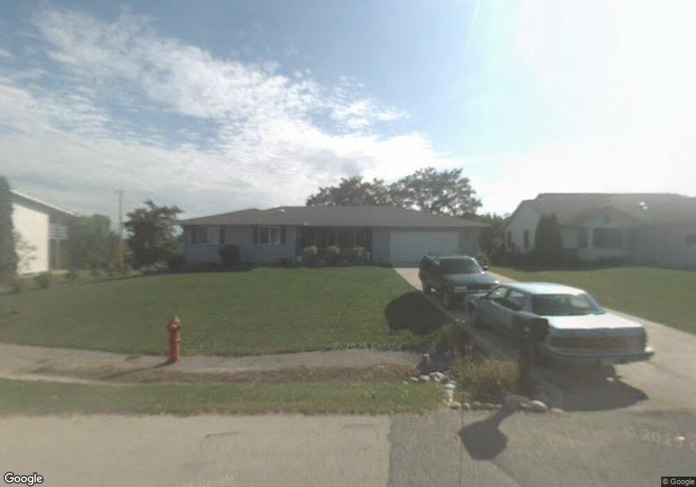
149 Cornforth Rd La Crescent, MN 55947
Estimated Value: $312,000 - $393,000
4
Beds
2
Baths
1,724
Sq Ft
$206/Sq Ft
Est. Value
About This Home
This home is located at 149 Cornforth Rd, La Crescent, MN 55947 and is currently estimated at $354,472, approximately $205 per square foot. 149 Cornforth Rd is a home located in Houston County with nearby schools including La Crescent-Hokah Elementary School, La Crescent-Hokah Middle School, and La Crescent-Hokah High School.
Ownership History
Date
Name
Owned For
Owner Type
Purchase Details
Closed on
Jun 13, 2017
Sold by
Dahlquist Daniel J and Dahlquist Alyson L
Bought by
Bennett Mark A
Current Estimated Value
Home Financials for this Owner
Home Financials are based on the most recent Mortgage that was taken out on this home.
Original Mortgage
$201,400
Outstanding Balance
$167,523
Interest Rate
4.02%
Mortgage Type
New Conventional
Estimated Equity
$186,949
Create a Home Valuation Report for This Property
The Home Valuation Report is an in-depth analysis detailing your home's value as well as a comparison with similar homes in the area
Home Values in the Area
Average Home Value in this Area
Purchase History
| Date | Buyer | Sale Price | Title Company |
|---|---|---|---|
| Bennett Mark A | $212,000 | None Available |
Source: Public Records
Mortgage History
| Date | Status | Borrower | Loan Amount |
|---|---|---|---|
| Open | Bennett Mark A | $201,400 |
Source: Public Records
Tax History
| Year | Tax Paid | Tax Assessment Tax Assessment Total Assessment is a certain percentage of the fair market value that is determined by local assessors to be the total taxable value of land and additions on the property. | Land | Improvement |
|---|---|---|---|---|
| 2025 | $4,598 | $356,100 | $76,400 | $279,700 |
| 2024 | $4,404 | $327,900 | $76,400 | $251,500 |
| 2023 | $4,390 | $298,400 | $37,600 | $260,800 |
| 2022 | $3,752 | $298,400 | $37,600 | $260,800 |
| 2021 | $3,724 | $222,600 | $37,600 | $185,000 |
| 2020 | $3,534 | $222,600 | $37,600 | $185,000 |
| 2019 | $1,412 | $212,200 | $35,000 | $177,200 |
| 2018 | $2,522 | $190,000 | $35,000 | $155,000 |
| 2017 | $2,522 | $140,500 | $30,495 | $110,005 |
| 2016 | $2,228 | $163,100 | $35,400 | $127,700 |
| 2015 | $2,098 | $154,400 | $33,500 | $120,900 |
| 2014 | $2,098 | $131,100 | $28,445 | $102,655 |
Source: Public Records
Map
Nearby Homes
- 36 Skunk Hollow Rd
- 709 Wildwood Ct
- 1600 West Ln
- 604 Hickory Ct
- 812 Bridle Ln
- 0 Hickory Ln
- 912 S Oak St
- 440 S 7th St
- 519 S 2nd St
- 109 N Hill St
- 517 N 3rd St
- 512 N Hill St
- 307 N Walnut St
- 0 Hill St N
- 221 N 4th St
- Lot 7 & 8 Crescent Hills Dr
- 726 N 4th St
- 114 Fireside Ct
- 203 Eagles Bluff Rd
- 348 Regent Dr
- 151 Cornforth Rd
- 90 Skunk Hollow Rd
- 122 Skunk Hollow Rd
- 153 Cornforth Rd
- 144 Skunk Hollow Rd
- 1356 Claudia Ave
- 74 Skunk Hollow Rd
- 61 Cornforth Rd
- 54 Skunk Hollow Rd
- 318 Skunk Hollow Rd
- 300 Skunk Hollow Rd
- 162 Skunk Hollow Rd
- 1360 Claudia Ave
- 919 S 12th St
- 135 Skunk Hollow Rd
- 57 Cornforth Rd
- 105 Dell Ave
- 157 Skunk Hollow Rd
- 183 Cornforth Rd
- 186 Skunk Hollow Rd
Your Personal Tour Guide
Ask me questions while you tour the home.