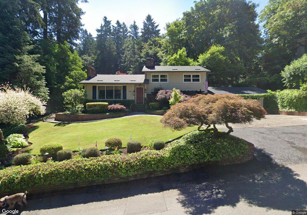
1492 Burns St Unit D West Linn, OR 97068
Bolton NeighborhoodEstimated Value: $628,000 - $779,000
3
Beds
2
Baths
1,868
Sq Ft
$378/Sq Ft
Est. Value
About This Home
This home is located at 1492 Burns St Unit D, West Linn, OR 97068 and is currently estimated at $706,583, approximately $378 per square foot. 1492 Burns St Unit D is a home located in Clackamas County with nearby schools including Bolton Primary School, West Linn High School, and Clackamas Academy of Industrial Sciences (CAIS).
Ownership History
Date
Name
Owned For
Owner Type
Purchase Details
Closed on
May 14, 2012
Sold by
Dusseau Gary L and Dusseau Reed S
Bought by
Wolfe Troy R and Wolfe Kristin L
Current Estimated Value
Home Financials for this Owner
Home Financials are based on the most recent Mortgage that was taken out on this home.
Original Mortgage
$205,000
Outstanding Balance
$142,063
Interest Rate
3.98%
Mortgage Type
New Conventional
Estimated Equity
$564,521
Purchase Details
Closed on
Mar 8, 1995
Sold by
Braido Louis and Braido Kathleen M
Bought by
Dusseau Gary L and Dusseau Reed S
Home Financials for this Owner
Home Financials are based on the most recent Mortgage that was taken out on this home.
Original Mortgage
$160,500
Interest Rate
8.37%
Create a Home Valuation Report for This Property
The Home Valuation Report is an in-depth analysis detailing your home's value as well as a comparison with similar homes in the area
Home Values in the Area
Average Home Value in this Area
Purchase History
| Date | Buyer | Sale Price | Title Company |
|---|---|---|---|
| Wolfe Troy R | $329,900 | Chicago Title Company Oregon | |
| Dusseau Gary L | $168,950 | Stewart Title |
Source: Public Records
Mortgage History
| Date | Status | Borrower | Loan Amount |
|---|---|---|---|
| Open | Wolfe Troy R | $205,000 | |
| Previous Owner | Dusseau Gary L | $160,500 |
Source: Public Records
Tax History Compared to Growth
Tax History
| Year | Tax Paid | Tax Assessment Tax Assessment Total Assessment is a certain percentage of the fair market value that is determined by local assessors to be the total taxable value of land and additions on the property. | Land | Improvement |
|---|---|---|---|---|
| 2025 | $6,615 | $343,240 | -- | -- |
| 2024 | $6,367 | $333,243 | -- | -- |
| 2023 | $6,367 | $323,537 | $0 | $0 |
| 2022 | $6,010 | $314,114 | $0 | $0 |
| 2021 | $5,705 | $304,966 | $0 | $0 |
| 2020 | $5,744 | $296,084 | $0 | $0 |
| 2019 | $5,477 | $287,461 | $0 | $0 |
| 2018 | $5,233 | $279,088 | $0 | $0 |
| 2017 | $5,030 | $270,959 | $0 | $0 |
| 2016 | $4,900 | $263,067 | $0 | $0 |
| 2015 | $4,760 | $255,405 | $0 | $0 |
| 2014 | $4,541 | $247,966 | $0 | $0 |
Source: Public Records
Map
Nearby Homes
- 5687 River St
- 5390 Grove St
- 5910 W A St
- 5089 Territorial Dr
- 1954 Buck St
- 6345 Caufield St
- 6403 Tompkins Ct
- 4711 Alder St
- 5128 Firwood Dr
- 909 Center St
- 22691 Oregon City Loop
- 19575 River Rd Unit 53
- 824 Center St
- 4645 Pine St
- 22881 Oregon City Loop
- 5062 Prospect St
- 1870 Hemlock St
- 5219 Summit St
- 709 10th St
- 20930 Fawn Ct Unit 26