Estimated Value: $548,000 - $586,000
3
Beds
1
Bath
1,618
Sq Ft
$347/Sq Ft
Est. Value
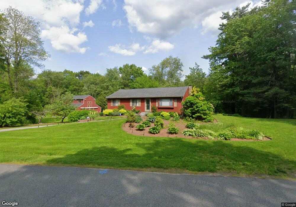
About This Home
This home is located at 15 Maxwell Dr, Derry, NH 03038 and is currently estimated at $560,651, approximately $346 per square foot. 15 Maxwell Dr is a home located in Rockingham County with nearby schools including East Derry Memorial Elementary School, West Running Brook Middle School, and Pinkerton Academy.
Ownership History
Date
Name
Owned For
Owner Type
Purchase Details
Closed on
Sep 13, 2016
Sold by
Saliba John E
Bought by
Saliba John E and Archilla Anabela F
Current Estimated Value
Purchase Details
Closed on
Oct 5, 2011
Sold by
Groder 3Rd Kenneth E and Groder Cindy P
Bought by
Saliba John E
Create a Home Valuation Report for This Property
The Home Valuation Report is an in-depth analysis detailing your home's value as well as a comparison with similar homes in the area
Home Values in the Area
Average Home Value in this Area
Purchase History
| Date | Buyer | Sale Price | Title Company |
|---|---|---|---|
| Saliba John E | -- | -- | |
| Saliba John E | $215,000 | -- |
Source: Public Records
Mortgage History
| Date | Status | Borrower | Loan Amount |
|---|---|---|---|
| Previous Owner | Saliba John E | $150,000 |
Source: Public Records
Tax History
| Year | Tax Paid | Tax Assessment Tax Assessment Total Assessment is a certain percentage of the fair market value that is determined by local assessors to be the total taxable value of land and additions on the property. | Land | Improvement |
|---|---|---|---|---|
| 2025 | $9,504 | $500,500 | $209,600 | $290,900 |
| 2024 | $9,354 | $500,500 | $209,600 | $290,900 |
| 2023 | $8,837 | $427,300 | $178,100 | $249,200 |
| 2022 | $8,136 | $427,300 | $178,100 | $249,200 |
| 2021 | $8,253 | $333,300 | $138,000 | $195,300 |
| 2020 | $8,113 | $333,300 | $138,000 | $195,300 |
| 2019 | $7,786 | $298,100 | $108,400 | $189,700 |
| 2018 | $7,760 | $298,100 | $108,400 | $189,700 |
| 2017 | $7,668 | $265,700 | $101,400 | $164,300 |
| 2016 | $7,190 | $265,700 | $101,400 | $164,300 |
| 2015 | $7,272 | $248,800 | $101,400 | $147,400 |
| 2014 | $7,320 | $248,800 | $101,400 | $147,400 |
| 2013 | $6,619 | $210,200 | $91,400 | $118,800 |
Source: Public Records
Map
Nearby Homes
- 15 Eastman Dr
- 7 Cameron Ct Unit 7
- 1 Cameron Ct Unit 1
- 50 Page Ln
- 47 Drew Woods Dr
- 128 N Shore Rd
- 12 Halls Village Rd
- 118-1 Mills Shore Dr
- 118 Mills Shore Dr
- 11 Sunset Ave
- 72 Lantern Dr
- 67 Lantern Dr
- 83 Lantern Dr
- 4 Shore Dr
- 54 Hampstead Rd
- 42 N Shore Rd
- 35 Steele Rd
- 24 Oak Ridge Rd
- 343 Island Pond Rd
- 12 Glastombury Dr
Your Personal Tour Guide
Ask me questions while you tour the home.