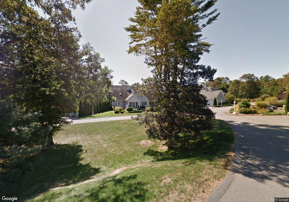
15 Red Cedar Rd Mashpee, MA 02649
Estimated Value: $593,833 - $711,000
2
Beds
3
Baths
1,569
Sq Ft
$422/Sq Ft
Est. Value
About This Home
This home is located at 15 Red Cedar Rd, Mashpee, MA 02649 and is currently estimated at $661,708, approximately $421 per square foot. 15 Red Cedar Rd is a home located in Barnstable County with nearby schools including Kenneth C. Coombs School, Quashnet School, and Mashpee Middle School.
Ownership History
Date
Name
Owned For
Owner Type
Purchase Details
Closed on
Jan 20, 2005
Sold by
Castelli Eileen R and Castelli Stephen F
Bought by
Castelli Rt
Current Estimated Value
Purchase Details
Closed on
Feb 24, 2003
Sold by
Barcelou Normand
Bought by
Castelli Stephen F
Home Financials for this Owner
Home Financials are based on the most recent Mortgage that was taken out on this home.
Original Mortgage
$220,000
Interest Rate
5.98%
Mortgage Type
Purchase Money Mortgage
Purchase Details
Closed on
Sep 14, 1999
Sold by
Windchime Pt Dev Grp
Bought by
Barcelou Norman
Create a Home Valuation Report for This Property
The Home Valuation Report is an in-depth analysis detailing your home's value as well as a comparison with similar homes in the area
Purchase History
| Date | Buyer | Sale Price | Title Company |
|---|---|---|---|
| Castelli Rt | -- | -- | |
| Castelli Stephen F | $320,000 | -- | |
| Barcelou Norman | $235,000 | -- |
Source: Public Records
Mortgage History
| Date | Status | Borrower | Loan Amount |
|---|---|---|---|
| Previous Owner | Barcelou Norman | $220,000 |
Source: Public Records
Tax History
| Year | Tax Paid | Tax Assessment Tax Assessment Total Assessment is a certain percentage of the fair market value that is determined by local assessors to be the total taxable value of land and additions on the property. | Land | Improvement |
|---|---|---|---|---|
| 2025 | $4,119 | $622,200 | $0 | $622,200 |
| 2024 | $3,987 | $620,100 | $0 | $620,100 |
| 2023 | $4,106 | $585,800 | $0 | $585,800 |
| 2022 | $3,784 | $463,200 | $0 | $463,200 |
| 2021 | $3,868 | $426,500 | $0 | $426,500 |
| 2020 | $3,786 | $416,500 | $0 | $416,500 |
| 2019 | $3,515 | $388,400 | $0 | $388,400 |
| 2018 | $3,291 | $368,900 | $0 | $368,900 |
| 2017 | $3,294 | $358,400 | $0 | $358,400 |
| 2016 | $3,188 | $345,000 | $0 | $345,000 |
| 2015 | $3,027 | $332,300 | $0 | $332,300 |
| 2014 | $2,979 | $317,300 | $0 | $317,300 |
Source: Public Records
Map
Nearby Homes
- 9 Red Cedar Rd Unit 9
- 9 Red Cedar Rd Unit 9
- 16 Gold Leaf Ln Unit 16
- 16 Gold Leaf Ln
- 70 Quinaquisset Ave
- 97 Shellback Way Unit O-97
- 97 Shellback Way Unit 97
- 40 Shellback Way Unit F
- 121 Shellback Way Unit 121
- 183 Simons Narrows Rd
- 300 Falmouth Rd Unit 6B
- 300 Falmouth Rd Unit 20C
- 300 Falmouth Rd Unit 6B
- 300 Falmouth Rd Unit 21E
- 300 Falmouth Rd Unit 21E
- 300 Falmouth Rd Unit 51
- 300 Falmouth Rd Unit 16A
- 300 Falmouth Rd Unit 16A
- 11 Watson Dr
- 25 Rainbow Ln
- 11 Red Cedar Rd
- 9 Red Cedar Rd
- 7 Red Cedar Rd
- 7 Red Cedar Rd Unit 7
- 7 Red Cedar Rd Unit 158
- 17 Red Cedar Rd
- 19 Red Cedar Rd
- 8 Red Cedar Rd
- 16 Red Cedar Rd
- 14 Red Cedar Rd
- 10 Red Cedar Rd
- 14 Red Cedar Rd Unit 14
- 14 Red Cedar Rd Unit n/a
- 5 Red Cedar Rd
- 25 Red Cedar Rd
- 29 Red Cedar Rd
- 6 Red Cedar Rd
- 27 Red Cedar Rd
- 24 Red Cedar Rd
- 20 Red Cedar Rd
Your Personal Tour Guide
Ask me questions while you tour the home.