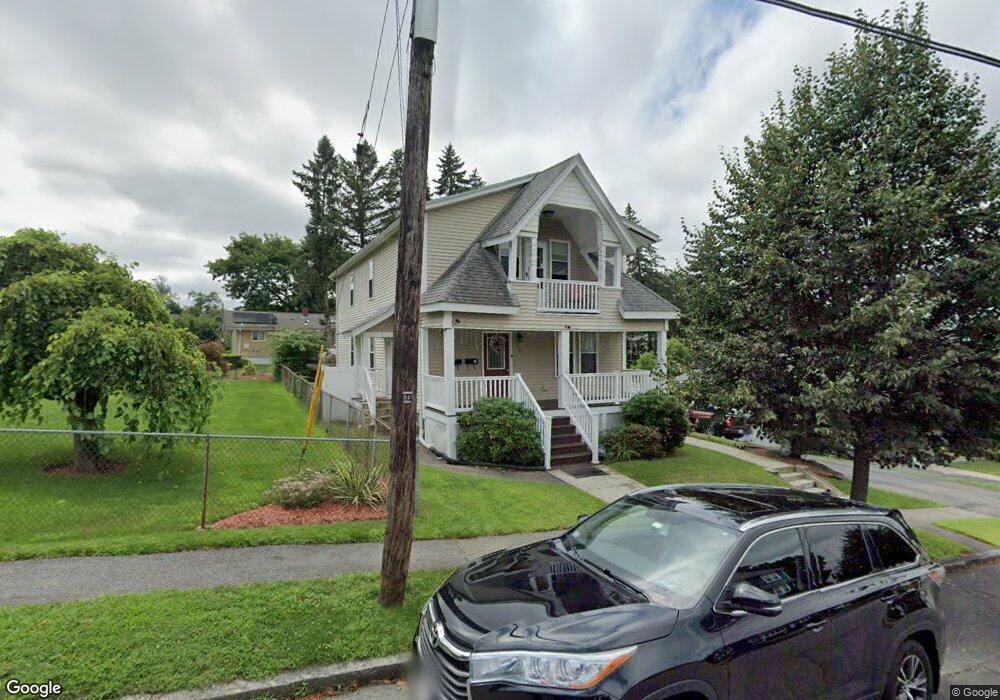
150 King Philip Rd Worcester, MA 01606
Greendale NeighborhoodEstimated Value: $585,000 - $728,000
4
Beds
2
Baths
2,080
Sq Ft
$310/Sq Ft
Est. Value
About This Home
This home is located at 150 King Philip Rd, Worcester, MA 01606 and is currently estimated at $644,295, approximately $309 per square foot. 150 King Philip Rd is a home located in Worcester County with nearby schools including Jacob Hiatt Magnet School, Chandler Magnet, and Thorndyke Road School.
Ownership History
Date
Name
Owned For
Owner Type
Purchase Details
Closed on
May 5, 2016
Sold by
Bisceglia Joseph P
Bought by
Cardenas Stephanie C
Current Estimated Value
Home Financials for this Owner
Home Financials are based on the most recent Mortgage that was taken out on this home.
Original Mortgage
$265,567
Outstanding Balance
$208,541
Interest Rate
3.25%
Mortgage Type
FHA
Estimated Equity
$435,754
Purchase Details
Closed on
Aug 3, 2011
Sold by
Props Central Llc
Bought by
Bisceglia Joseph Paul
Home Financials for this Owner
Home Financials are based on the most recent Mortgage that was taken out on this home.
Original Mortgage
$233,818
Interest Rate
5.5%
Mortgage Type
FHA
Purchase Details
Closed on
Nov 18, 2010
Sold by
Machonis George M and Machonis Mary C
Bought by
Prop Central Llc
Home Financials for this Owner
Home Financials are based on the most recent Mortgage that was taken out on this home.
Original Mortgage
$140,000
Interest Rate
4.3%
Mortgage Type
Purchase Money Mortgage
Create a Home Valuation Report for This Property
The Home Valuation Report is an in-depth analysis detailing your home's value as well as a comparison with similar homes in the area
Home Values in the Area
Average Home Value in this Area
Purchase History
| Date | Buyer | Sale Price | Title Company |
|---|---|---|---|
| Cardenas Stephanie C | $290,000 | -- | |
| Bisceglia Joseph Paul | $239,900 | -- | |
| Prop Central Llc | $69,000 | -- |
Source: Public Records
Mortgage History
| Date | Status | Borrower | Loan Amount |
|---|---|---|---|
| Open | Cardenas Stephanie C | $265,567 | |
| Previous Owner | Bisceglia Joseph Paul | $233,818 | |
| Previous Owner | Prop Central Llc | $140,000 |
Source: Public Records
Tax History Compared to Growth
Tax History
| Year | Tax Paid | Tax Assessment Tax Assessment Total Assessment is a certain percentage of the fair market value that is determined by local assessors to be the total taxable value of land and additions on the property. | Land | Improvement |
|---|---|---|---|---|
| 2025 | $8,341 | $632,400 | $117,400 | $515,000 |
| 2024 | $7,917 | $575,800 | $117,400 | $458,400 |
| 2023 | $7,411 | $516,800 | $102,100 | $414,700 |
| 2022 | $6,846 | $450,100 | $81,700 | $368,400 |
| 2021 | $5,884 | $361,400 | $65,300 | $296,100 |
| 2020 | $5,517 | $324,500 | $65,300 | $259,200 |
| 2019 | $5,544 | $308,000 | $58,700 | $249,300 |
| 2018 | $5,421 | $286,700 | $58,700 | $228,000 |
| 2017 | $5,164 | $268,700 | $58,700 | $210,000 |
| 2016 | $5,136 | $249,200 | $42,700 | $206,500 |
| 2015 | $5,001 | $249,200 | $42,700 | $206,500 |
| 2014 | $4,869 | $249,200 | $42,700 | $206,500 |
Source: Public Records
Map
Nearby Homes
- 18 Claffey Ave
- 39 Whitmarsh Ave
- 15 Ericsson St
- 323 Burncoat St
- 55 Clark St
- 331 Burncoat St
- 30 Fales St
- 66 Eunice Ave
- 28 Brooks St
- 30 Danielles Way
- 130 Beverly Rd
- 37 Kenwood Ave
- 95 Saint Nicholas Ave
- 44 Boardman St
- 45 Goldthwaite Rd
- 35 Arbutus Rd
- 13 Fatima Ln
- 30 Melrose St
- 89 W Boylston St Unit 4
- 5 Wakefield St
- 142 King Philip Rd
- 91 Kalmar St
- 158 King Philip Rd
- 85 Kalmar St
- 140 King Philip Rd
- 140 King Philip Rd Unit 2
- 155 King Philip Rd
- 149 King Philip Rd
- 101 Kalmar St
- 77 Kalmar St
- 145 King Philip Rd
- 162 King Philip Rd
- 159 King Philip Rd
- 141 King Philip Rd
- 138 King Philip Rd
- 167 King Philip Rd
- 84 Kalmar St
- 96 Kalmar St
- 137 King Philip Rd
- 150 Whitmarsh Ave