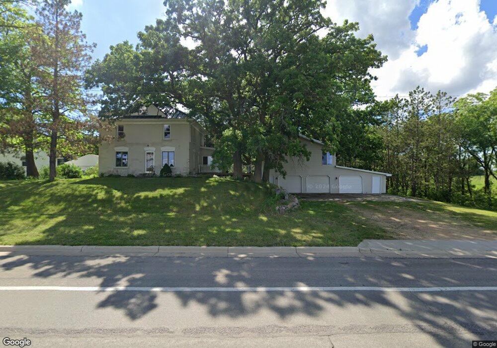
150 State Highway 66 Good Thunder, MN 56037
Estimated Value: $283,000 - $334,918
4
Beds
2
Baths
2,792
Sq Ft
$112/Sq Ft
Est. Value
About This Home
This home is located at 150 State Highway 66, Good Thunder, MN 56037 and is currently estimated at $311,730, approximately $111 per square foot. 150 State Highway 66 is a home located in Blue Earth County with nearby schools including Maple River Secondary School and St. John Lutheran School.
Ownership History
Date
Name
Owned For
Owner Type
Purchase Details
Closed on
Sep 26, 2018
Sold by
Bartell Lorellee R
Bought by
Hall Alexander
Current Estimated Value
Home Financials for this Owner
Home Financials are based on the most recent Mortgage that was taken out on this home.
Original Mortgage
$190,000
Outstanding Balance
$165,691
Interest Rate
4.5%
Mortgage Type
VA
Estimated Equity
$146,039
Purchase Details
Closed on
Dec 9, 2015
Sold by
Bartell Leorelee R
Bought by
Blue Earth County
Create a Home Valuation Report for This Property
The Home Valuation Report is an in-depth analysis detailing your home's value as well as a comparison with similar homes in the area
Home Values in the Area
Average Home Value in this Area
Purchase History
| Date | Buyer | Sale Price | Title Company |
|---|---|---|---|
| Hall Alexander | $207,400 | Minnesota River Valley Title | |
| Blue Earth County | $2,500 | -- |
Source: Public Records
Mortgage History
| Date | Status | Borrower | Loan Amount |
|---|---|---|---|
| Open | Hall Alexander | $190,000 |
Source: Public Records
Tax History Compared to Growth
Tax History
| Year | Tax Paid | Tax Assessment Tax Assessment Total Assessment is a certain percentage of the fair market value that is determined by local assessors to be the total taxable value of land and additions on the property. | Land | Improvement |
|---|---|---|---|---|
| 2025 | $2,792 | $326,800 | $35,400 | $291,400 |
| 2024 | $2,792 | $306,200 | $35,400 | $270,800 |
| 2023 | $2,766 | $318,800 | $35,400 | $283,400 |
| 2022 | $4,478 | $297,500 | $35,400 | $262,100 |
| 2021 | $4,476 | $212,600 | $35,400 | $177,200 |
| 2020 | $3,676 | $203,500 | $35,400 | $168,100 |
| 2019 | $3,124 | $203,500 | $35,400 | $168,100 |
| 2018 | $3,004 | $164,800 | $35,400 | $129,400 |
| 2017 | $2,984 | $164,800 | $35,400 | $129,400 |
| 2016 | $2,720 | $165,500 | $36,100 | $129,400 |
| 2015 | $24 | $156,900 | $36,100 | $120,800 |
| 2014 | $2,414 | $155,600 | $36,100 | $119,500 |
Source: Public Records
Map
Nearby Homes
- 210 N Halladay St
- 217 S Houk St
- 721 Main St
- 331 S Ewing St
- 16280 552nd Ave
- 16225 563rd Ave
- 55997 132nd St
- 3136 River Meadows Dr
- 120 Mapleridge Dr
- 0 Tbd E 161st St
- E Tbd
- 57396 181st Ln
- 305 E Main St
- 205 Park Ave N
- 201 Park Ave N
- 57868 179th St
- 277 Red Ridge Rd
- 103 Calm Ct SW
- 202 Silver St E
- 507 6th Ave NE
- 150 150 Old Hwy 66
- 150 150 Old Hwy 66
- 138 State Highway 66
- 120 N Hubbell St
- 114 State Highway 66
- 141 N Houk St
- 131 N Houk St
- 121 N Houk St
- 230 Main St
- 310 Main St
- 140 N Houk St
- 322 Main St
- 332 Main St
- 340 Main St
- 134 N Houk St
- 130 N Houk St
- 237 N Front St
- 247 N Front St
- 147 N Front St
- 201 N Front St