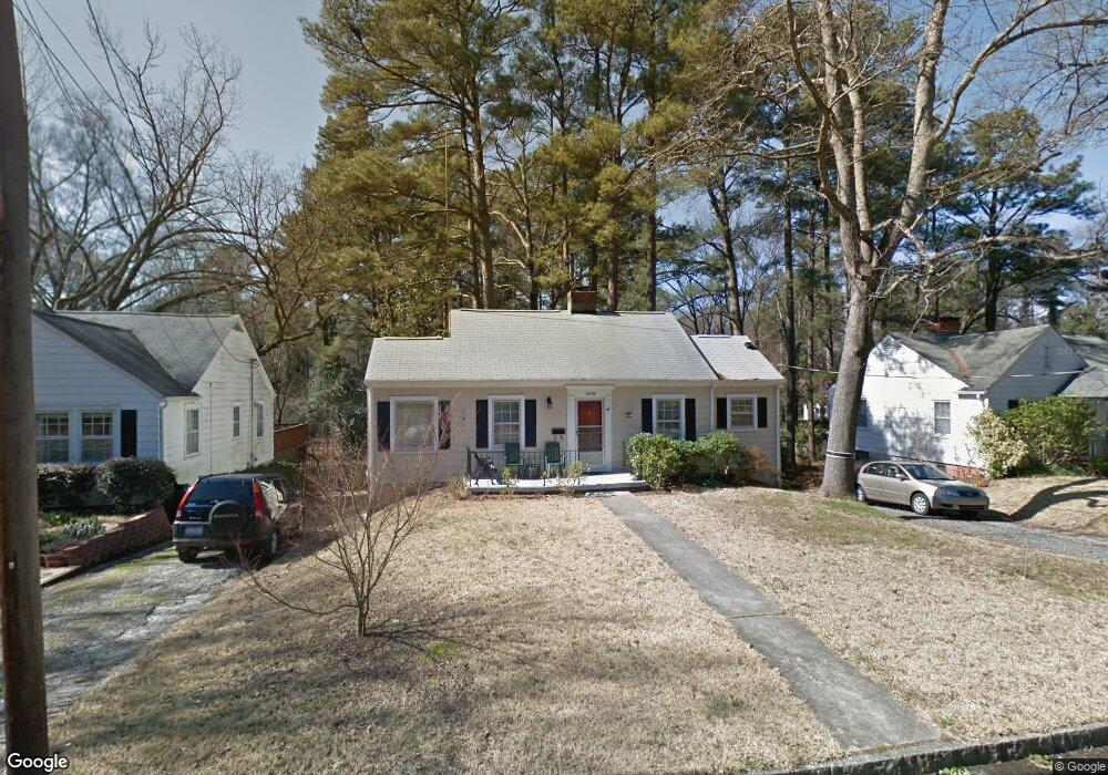
1505 Carolina Ave Durham, NC 27705
Watts Hospital-Hillandale NeighborhoodEstimated Value: $358,000 - $459,000
2
Beds
2
Baths
1,100
Sq Ft
$375/Sq Ft
Est. Value
About This Home
This home is located at 1505 Carolina Ave, Durham, NC 27705 and is currently estimated at $412,854, approximately $375 per square foot. 1505 Carolina Ave is a home located in Durham County with nearby schools including E K Powe Elementary, W.G. Pearson Elementary School, and Brogden Middle.
Ownership History
Date
Name
Owned For
Owner Type
Purchase Details
Closed on
Mar 21, 2021
Sold by
Daniel Roger B and Hylton Daniel Alicia
Bought by
Hylton Daniel Properties Llc
Current Estimated Value
Home Financials for this Owner
Home Financials are based on the most recent Mortgage that was taken out on this home.
Original Mortgage
$409,500
Interest Rate
3%
Mortgage Type
Construction
Purchase Details
Closed on
May 31, 2020
Sold by
Johnson Doris W
Bought by
Daniel Roger and Hylton Daniel Alicia
Create a Home Valuation Report for This Property
The Home Valuation Report is an in-depth analysis detailing your home's value as well as a comparison with similar homes in the area
Home Values in the Area
Average Home Value in this Area
Purchase History
| Date | Buyer | Sale Price | Title Company |
|---|---|---|---|
| Hylton Daniel Properties Llc | -- | None Available | |
| Daniel Roger | $245,000 | None Available |
Source: Public Records
Mortgage History
| Date | Status | Borrower | Loan Amount |
|---|---|---|---|
| Closed | Hylton Daniel Properties Llc | $409,500 |
Source: Public Records
Tax History Compared to Growth
Tax History
| Year | Tax Paid | Tax Assessment Tax Assessment Total Assessment is a certain percentage of the fair market value that is determined by local assessors to be the total taxable value of land and additions on the property. | Land | Improvement |
|---|---|---|---|---|
| 2025 | $3,211 | $497,863 | $317,625 | $180,238 |
| 2024 | $3,211 | $230,166 | $108,900 | $121,266 |
| 2023 | $3,015 | $229,716 | $108,450 | $121,266 |
| 2022 | $2,632 | $205,663 | $108,450 | $97,213 |
| 2021 | $2,620 | $205,663 | $108,450 | $97,213 |
| 2020 | $2,558 | $205,663 | $108,450 | $97,213 |
| 2019 | $1,279 | $205,663 | $108,450 | $97,213 |
| 2018 | $1,564 | $230,618 | $54,225 | $176,393 |
| 2017 | $1,553 | $230,618 | $54,225 | $176,393 |
| 2016 | $1,500 | $245,957 | $54,225 | $191,732 |
| 2015 | $2,312 | $167,033 | $47,341 | $119,692 |
| 2014 | $2,312 | $167,033 | $47,341 | $119,692 |
Source: Public Records
Map
Nearby Homes
- 2013 Walnut St
- 2012 Englewood Ave
- 1300 Broad St Unit A
- 1022 Carolina Ave
- 1838 Forest Rd
- 2217 Stroller Ave
- 1409 Sedgefield St
- 2658 Lawndale Ave
- 2551 Drake Ave
- 2205 Tampa Ave
- 1009 Iredell St Unit D
- 1708 Forest Rd
- 919 Sedgefield St
- 2701 Lawndale Ave
- 1423 Hudson Ave
- 2515 W Club Blvd
- 2524 Indian Trail
- 1008 Clarendon St
- 1411 Leon St
- 1314 Hudson Ave
- 1503 Carolina Ave
- 1507 Carolina Ave
- 1501 Carolina Ave
- 1509 Carolina Ave
- 2107 Sprunt Ave
- 2104 Pershing St
- 2109 Sprunt Ave
- 1506 Carolina Ave
- 1508 Carolina Ave
- 2028 Pershing St
- 1510 Carolina Ave
- 2108 Pershing St
- 2101 Pershing St
- 2115 Sprunt Ave
- 1407 Carolina Ave
- 2107 Pershing St
- 2025 Sprunt Ave
- 2106 Sprunt Ave
- 2104 Sprunt Ave
- 2026 Pershing St