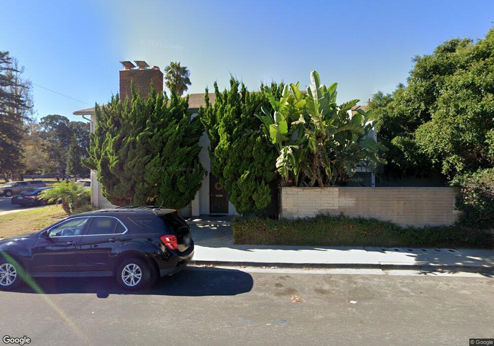
1505 N F St Oxnard, CA 93030
Carriage Square NeighborhoodEstimated Value: $537,000 - $691,807
2
Beds
2
Baths
1,742
Sq Ft
$357/Sq Ft
Est. Value
About This Home
This home is located at 1505 N F St, Oxnard, CA 93030 and is currently estimated at $622,452, approximately $357 per square foot. 1505 N F St is a home located in Ventura County with nearby schools including Sierra Linda Elementary School and Pacifica High School.
Ownership History
Date
Name
Owned For
Owner Type
Purchase Details
Closed on
Oct 27, 2004
Sold by
Cordle James S and Mcfarland Jon M
Bought by
Little Dale
Current Estimated Value
Home Financials for this Owner
Home Financials are based on the most recent Mortgage that was taken out on this home.
Original Mortgage
$249,000
Outstanding Balance
$124,342
Interest Rate
5.79%
Mortgage Type
New Conventional
Estimated Equity
$498,110
Purchase Details
Closed on
May 10, 2003
Sold by
Paul Edward F and Paul Diana W
Bought by
Cordie James S and Mcfarland Jon M
Home Financials for this Owner
Home Financials are based on the most recent Mortgage that was taken out on this home.
Original Mortgage
$211,600
Interest Rate
5.12%
Mortgage Type
Purchase Money Mortgage
Purchase Details
Closed on
Jul 1, 2002
Sold by
Paul Edward F and Paul Diana W
Bought by
Paul Edward F and Paul Diana W
Create a Home Valuation Report for This Property
The Home Valuation Report is an in-depth analysis detailing your home's value as well as a comparison with similar homes in the area
Home Values in the Area
Average Home Value in this Area
Purchase History
| Date | Buyer | Sale Price | Title Company |
|---|---|---|---|
| Little Dale | $435,000 | Ticor Title Company | |
| Cordie James S | $264,500 | First American Title Co | |
| Paul Edward F | -- | -- | |
| Paul Edward F | -- | -- |
Source: Public Records
Mortgage History
| Date | Status | Borrower | Loan Amount |
|---|---|---|---|
| Open | Little Dale | $249,000 | |
| Previous Owner | Cordie James S | $211,600 | |
| Closed | Cordie James S | $26,450 |
Source: Public Records
Tax History Compared to Growth
Tax History
| Year | Tax Paid | Tax Assessment Tax Assessment Total Assessment is a certain percentage of the fair market value that is determined by local assessors to be the total taxable value of land and additions on the property. | Land | Improvement |
|---|---|---|---|---|
| 2025 | $7,262 | $606,335 | $303,169 | $303,166 |
| 2024 | $7,262 | $594,447 | $297,225 | $297,222 |
| 2023 | $6,995 | $582,792 | $291,397 | $291,395 |
| 2022 | $6,766 | $570,000 | $371,000 | $199,000 |
| 2021 | $5,564 | $464,000 | $233,000 | $231,000 |
| 2020 | $6,124 | $496,000 | $249,000 | $247,000 |
| 2019 | $6,058 | $495,000 | $248,000 | $247,000 |
| 2018 | $4,988 | $406,000 | $203,000 | $203,000 |
| 2017 | $4,828 | $406,000 | $203,000 | $203,000 |
| 2016 | $4,184 | $358,000 | $179,000 | $179,000 |
| 2015 | $4,293 | $358,000 | $232,000 | $126,000 |
| 2014 | $4,012 | $332,000 | $215,000 | $117,000 |
Source: Public Records
Map
Nearby Homes
- 550 Lawnwood Way
- 521 Glenwood Dr
- 620 W Gonzales Rd Unit D
- 620 W Gonzales Rd Unit C
- 620 W Gonzales Rd Unit B
- 620 W Gonzales Rd Unit A
- 620 W Gonzales Rd
- 560 W Gonzales Rd
- 1920 N H St Unit 251
- 2020 Ironbark Dr
- 2027 Blackberry Cir
- 1110 Devonshire Dr
- 800 S A St
- 2077 Blackberry Cir
- 1340 Huntswood Way
- 2085 Koala Place
- 1337 Edgewood Way Unit 37
- 748 Douglas Ave
- 1349 Edgewood Way Unit 49
- 1363 Edgewood Way Unit 63
- 1511 N F St Unit 1511
- 703 Ivywood Dr
- 707 Ivywood Dr
- 705 Ivywood Dr
- 711 Ivywood Dr
- 709 Ivywood Dr
- 717 Ivywood Dr Unit 3
- 717 Ivywood Dr
- 661 Ivywood Dr
- 710 Janetwood Dr
- 725 Ivywood Dr Unit 727
- 727 Ivywood Dr
- 718 Janetwood Dr
- 651 Ivywood Dr
- 650 Janetwood Dr
- 733 Ivywood Dr
- 729 Ivywood Dr Unit 3
- 729 Ivywood Dr
- 730 Janetwood Dr Unit A
- 730 Janetwood Dr