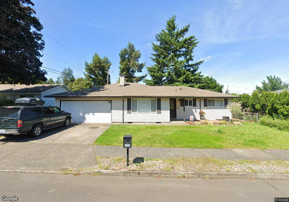
1509 SE 211th Ave Gresham, OR 97030
Northwest Gresham NeighborhoodEstimated Value: $409,261 - $438,000
3
Beds
2
Baths
1,309
Sq Ft
$325/Sq Ft
Est. Value
About This Home
This home is located at 1509 SE 211th Ave, Gresham, OR 97030 and is currently estimated at $425,065, approximately $324 per square foot. 1509 SE 211th Ave is a home located in Multnomah County with nearby schools including North Gresham Elementary School, Clear Creek Middle School, and Gresham High School.
Ownership History
Date
Name
Owned For
Owner Type
Purchase Details
Closed on
Jan 30, 2025
Sold by
Ligman Kaitlyn and Swyers Kevin
Bought by
Swyers Family Trust and Ligman
Current Estimated Value
Purchase Details
Closed on
Jun 22, 2020
Sold by
Isaac J Rinald J and Isaac John Junior
Bought by
Swyers Kevin E and Swyers Jodi R
Home Financials for this Owner
Home Financials are based on the most recent Mortgage that was taken out on this home.
Original Mortgage
$305,000
Interest Rate
3.2%
Mortgage Type
New Conventional
Create a Home Valuation Report for This Property
The Home Valuation Report is an in-depth analysis detailing your home's value as well as a comparison with similar homes in the area
Home Values in the Area
Average Home Value in this Area
Purchase History
| Date | Buyer | Sale Price | Title Company |
|---|---|---|---|
| Swyers Family Trust | -- | None Listed On Document | |
| Swyers Kevin E | $340,000 | Fidelity Natl Ttl Co Of Or |
Source: Public Records
Mortgage History
| Date | Status | Borrower | Loan Amount |
|---|---|---|---|
| Previous Owner | Swyers Kevin E | $305,000 |
Source: Public Records
Tax History
| Year | Tax Paid | Tax Assessment Tax Assessment Total Assessment is a certain percentage of the fair market value that is determined by local assessors to be the total taxable value of land and additions on the property. | Land | Improvement |
|---|---|---|---|---|
| 2025 | $4,134 | $203,130 | -- | -- |
| 2024 | $3,957 | $197,220 | -- | -- |
| 2023 | $3,957 | $191,480 | $0 | $0 |
| 2022 | $3,504 | $185,910 | $0 | $0 |
| 2021 | $3,416 | $180,500 | $0 | $0 |
| 2020 | $3,214 | $175,250 | $0 | $0 |
| 2019 | $3,130 | $170,150 | $0 | $0 |
| 2018 | $2,985 | $165,200 | $0 | $0 |
| 2017 | $2,864 | $160,390 | $0 | $0 |
| 2016 | $2,525 | $155,720 | $0 | $0 |
Source: Public Records
Map
Nearby Homes
- 21033 SE Clay Ct
- 2013 NW Bella Vista Dr
- 1811 NW 19th St
- 1861 NW Wonderview Ave
- 1026 SE 209th Ave
- 21001 SE Yamhill St
- 920 SE 214th Ave
- 21016 SE Stark St Unit 71
- 21016 SE Stark St Unit 69
- 21532 SE Alder St
- 21260 SE Stark St
- 21400 SE Stark St Unit 2
- 1387 NW Riverview Ave Unit 14B
- 994 NW Wallula Ave
- 1325 NW 9th St
- 209 SE 214th Ave
- 21525 SE Oak St
- 970 NW Wonderview Ct Unit 980
- 132 SE 214th Ave
- 765 NW Angeline Ave
- 1521 SE 211th Ave
- 1431 SE 211th Ave
- 1508 SE 210th Ave
- 1430 SE 210th Ave
- 1520 SE 210th Ave
- 1510 SE 211th Ave
- 1535 SE 211th Ave
- 1522 SE 211th Ave
- 1432 SE 211th Ave
- 1418 SE 210th Ave
- 1411 SE 211th Ave
- 21011 SE Clay Ct
- 1534 SE 211th Ave
- 1414 SE 211th Ave
- 1402 SE 210th Ave
- 1507 SE 210th Ave
- 2079 NW Wallula Ave
- 20929 SE Clay Ct
- 1427 SE 210th Ave
- 1600 SE 211th Ave
Your Personal Tour Guide
Ask me questions while you tour the home.