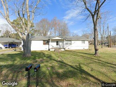
1511 Lakeshore Dr Unit 1513 Murfreesboro, TN 37130
Estimated Value: $352,096 - $366,000
--
Bed
2
Baths
1,885
Sq Ft
$190/Sq Ft
Est. Value
About This Home
This home is located at 1511 Lakeshore Dr Unit 1513, Murfreesboro, TN 37130 and is currently estimated at $357,774, approximately $189 per square foot. 1511 Lakeshore Dr Unit 1513 is a home located in Rutherford County with nearby schools including Black Fox Elementary School, Whitworth-Buchanan Middle School, and Riverdale High School.
Ownership History
Date
Name
Owned For
Owner Type
Purchase Details
Closed on
Dec 12, 2024
Sold by
Stewart John K and Daniels Linda S
Bought by
John K Stewart And Linda Daniels Trust and Stewart
Current Estimated Value
Purchase Details
Closed on
Mar 14, 2007
Sold by
Tatum Janice A
Bought by
Stewart John K
Home Financials for this Owner
Home Financials are based on the most recent Mortgage that was taken out on this home.
Original Mortgage
$78,500
Interest Rate
6.27%
Create a Home Valuation Report for This Property
The Home Valuation Report is an in-depth analysis detailing your home's value as well as a comparison with similar homes in the area
Home Values in the Area
Average Home Value in this Area
Purchase History
| Date | Buyer | Sale Price | Title Company |
|---|---|---|---|
| John K Stewart And Linda Daniels Trust | -- | None Listed On Document | |
| John K Stewart And Linda Daniels Trust | -- | None Listed On Document | |
| Stewart John K | $150,000 | -- |
Source: Public Records
Mortgage History
| Date | Status | Borrower | Loan Amount |
|---|---|---|---|
| Previous Owner | Stewart John K | $72,800 | |
| Previous Owner | Stewart John K | $78,500 |
Source: Public Records
Tax History Compared to Growth
Tax History
| Year | Tax Paid | Tax Assessment Tax Assessment Total Assessment is a certain percentage of the fair market value that is determined by local assessors to be the total taxable value of land and additions on the property. | Land | Improvement |
|---|---|---|---|---|
| 2024 | $2,661 | $94,080 | $19,000 | $75,080 |
| 2023 | $1,765 | $94,080 | $19,000 | $75,080 |
| 2022 | $1,521 | $94,080 | $19,000 | $75,080 |
| 2021 | $1,185 | $53,400 | $15,000 | $38,400 |
| 2020 | $1,185 | $53,400 | $15,000 | $38,400 |
| 2019 | $1,185 | $53,400 | $15,000 | $38,400 |
| 2018 | $1,628 | $53,400 | $0 | $0 |
| 2017 | $1,780 | $45,800 | $0 | $0 |
| 2016 | $1,780 | $45,800 | $0 | $0 |
| 2015 | $1,780 | $45,800 | $0 | $0 |
| 2014 | $1,139 | $45,800 | $0 | $0 |
| 2013 | -- | $31,360 | $0 | $0 |
Source: Public Records
Map
Nearby Homes
- 1806 Greerson Dr
- 1902 Bradyville Pike
- 2010 Bartway Dr Unit 2012
- 1602 Cypress Dr
- 1410 Wall St
- 1434 Kensington Square Ct
- 1902 Ransom Dr
- 1015 S Baird Ln
- 1706 Fowler St
- 1902 Fowler St
- 2209 Seahunter Ct
- 1214 Rutherford St
- 2218 Seahunter Ct
- 2217 Seahunter Ct
- 2226 Seahunter Ct
- 79 Seahunter Ct
- 2210 Seahunter Ct
- 82 Brady Estates
- 78 Brady Estates
- 1010 Olympia Place
- 1511 Lakeshore Dr Unit 1513
- 1607 Gordon Terrace
- 1507 Lakeshore Dr Unit 1509
- 1611 Gordon Terrace
- 1510 Lakeshore Dr
- 1506 Bartway Dr
- 1603 Lakeshore Dr
- 1514 Lakeshore Dr
- 1602 Bartway Dr
- 1502 Bartway Dr
- 1600 Lakeshore Dr
- 1615 Gordon Terrace
- 1506 Lakeshore Dr
- 1606 Bartway Dr
- 1607 Lakeshore Dr
- 1606 Gordon Terrace
- 1502 Lakeshore Dr
- 1606 Lakeshore Dr
- 1619 Gordon Terrace
- 1610 Bartway Dr