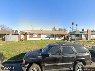
1512 Moreland Way Bakersfield, CA 93307
South Wible Orchard NeighborhoodEstimated Value: $261,866 - $328,000
3
Beds
2
Baths
1,170
Sq Ft
$244/Sq Ft
Est. Value
About This Home
This home is located at 1512 Moreland Way, Bakersfield, CA 93307 and is currently estimated at $284,967, approximately $243 per square foot. 1512 Moreland Way is a home located in Kern County with nearby schools including Raffaello Palla Elementary School, Leon H. Ollivier Middle School, and Golden Valley High School.
Ownership History
Date
Name
Owned For
Owner Type
Purchase Details
Closed on
Jun 21, 2000
Sold by
Jasper Mark F
Bought by
Bell Odis L
Current Estimated Value
Home Financials for this Owner
Home Financials are based on the most recent Mortgage that was taken out on this home.
Original Mortgage
$69,836
Interest Rate
8.55%
Mortgage Type
FHA
Create a Home Valuation Report for This Property
The Home Valuation Report is an in-depth analysis detailing your home's value as well as a comparison with similar homes in the area
Home Values in the Area
Average Home Value in this Area
Purchase History
| Date | Buyer | Sale Price | Title Company |
|---|---|---|---|
| Bell Odis L | $70,000 | American Title Co |
Source: Public Records
Mortgage History
| Date | Status | Borrower | Loan Amount |
|---|---|---|---|
| Open | Bell Odis L | $108,800 | |
| Closed | Bell Odis L | $95,800 | |
| Closed | Bell Odis L | $76,500 | |
| Closed | Bell Odis L | $69,836 | |
| Closed | Bell Odis L | $3,497 |
Source: Public Records
Tax History Compared to Growth
Tax History
| Year | Tax Paid | Tax Assessment Tax Assessment Total Assessment is a certain percentage of the fair market value that is determined by local assessors to be the total taxable value of land and additions on the property. | Land | Improvement |
|---|---|---|---|---|
| 2024 | $1,821 | $103,388 | $29,535 | $73,853 |
| 2023 | $1,821 | $101,361 | $28,956 | $72,405 |
| 2022 | $1,786 | $99,375 | $28,389 | $70,986 |
| 2021 | $1,674 | $97,428 | $27,833 | $69,595 |
| 2020 | $1,623 | $96,430 | $27,548 | $68,882 |
| 2019 | $1,596 | $96,430 | $27,548 | $68,882 |
| 2018 | $1,532 | $92,687 | $26,479 | $66,208 |
| 2017 | $1,515 | $90,870 | $25,960 | $64,910 |
| 2016 | $1,433 | $89,089 | $25,451 | $63,638 |
| 2015 | $1,409 | $87,752 | $25,069 | $62,683 |
| 2014 | $1,383 | $86,034 | $24,578 | $61,456 |
Source: Public Records
Map
Nearby Homes
- 1405 Fairview Rd
- 1412 Canyon Ct
- 5712 Midas St
- 5908 Ream Way
- 5909 Ream Way
- 5716 Osborne St
- 6201 Regina Way
- 1116 Adelaide Ave
- 5609 Monitor St
- 1116 Delwood Ave
- 6313 Regina Way
- 1105 Adelaide Ave
- 6405 Springbrook Dr
- 5900 Monitor St Unit 1
- 2100 Butterfield Ave
- 5117 Centaur St
- 1209 Eubanks Ave
- 2017 William F Halsey Ave
- 4924 Centaur St
- 5016 Yellow Rose Ct
- 1512 Moreland Way
- 1516 Moreland Way
- 1508 Moreland Way
- 1520 Moreland Way
- 1504 Moreland Way
- 1513 Fairview Rd
- 1517 Fairview Rd
- 1509 Fairview Rd
- 5800 Webb Way
- 5801 Webb Way
- 1505 Fairview Rd
- 1600 Moreland Way
- 1500 Moreland Way
- 5804 Webb Way
- 5801 Camp St
- 1601 Fairview Rd
- 1501 Fairview Rd
- 5805 Webb Way
- 1604 Moreland Way
- 5800 Ream Way