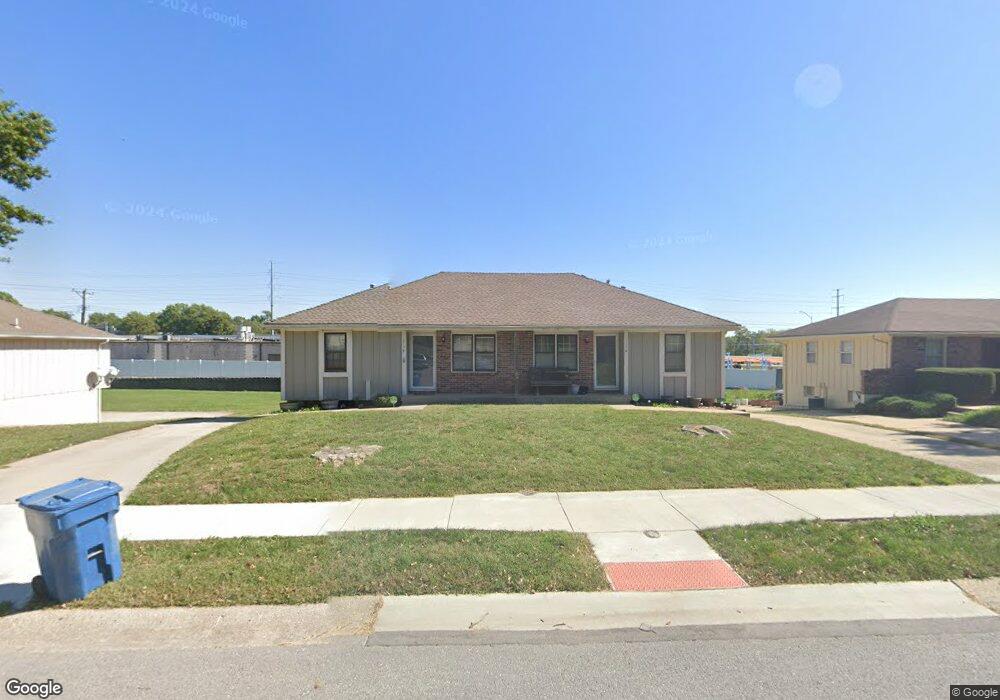
1515 NE White Dr Unit A Lees Summit, MO 64086
Estimated Value: $308,000 - $328,000
4
Beds
4
Baths
1,608
Sq Ft
$197/Sq Ft
Est. Value
About This Home
This home is located at 1515 NE White Dr Unit A, Lees Summit, MO 64086 and is currently estimated at $317,418, approximately $197 per square foot. 1515 NE White Dr Unit A is a home located in Jackson County with nearby schools including Meadow Lane Elementary School, Bernard C. Campbell Middle School, and Lee's Summit North High School.
Ownership History
Date
Name
Owned For
Owner Type
Purchase Details
Closed on
Oct 12, 2022
Sold by
Cox Kevin and Cox Diane
Bought by
Powell Matthew and Powell Shayna L
Current Estimated Value
Home Financials for this Owner
Home Financials are based on the most recent Mortgage that was taken out on this home.
Original Mortgage
$215,625
Outstanding Balance
$206,933
Interest Rate
5.66%
Mortgage Type
Balloon
Estimated Equity
$110,485
Purchase Details
Closed on
Jul 9, 2004
Sold by
Crabb Richard W and Lee Janice A
Bought by
Cox Kevin and Cox Diane
Home Financials for this Owner
Home Financials are based on the most recent Mortgage that was taken out on this home.
Original Mortgage
$100,000
Interest Rate
6.3%
Mortgage Type
Purchase Money Mortgage
Purchase Details
Closed on
Feb 19, 1998
Sold by
Crabb Richard W and Crabb Lee A
Bought by
Crabb Richard W and Lee Janice
Create a Home Valuation Report for This Property
The Home Valuation Report is an in-depth analysis detailing your home's value as well as a comparison with similar homes in the area
Home Values in the Area
Average Home Value in this Area
Purchase History
| Date | Buyer | Sale Price | Title Company |
|---|---|---|---|
| Powell Matthew | -- | Continental Title | |
| Cox Kevin | -- | -- | |
| Crabb Richard W | -- | -- |
Source: Public Records
Mortgage History
| Date | Status | Borrower | Loan Amount |
|---|---|---|---|
| Open | Powell Matthew | $215,625 | |
| Previous Owner | Cox Kevin | $100,000 |
Source: Public Records
Tax History Compared to Growth
Tax History
| Year | Tax Paid | Tax Assessment Tax Assessment Total Assessment is a certain percentage of the fair market value that is determined by local assessors to be the total taxable value of land and additions on the property. | Land | Improvement |
|---|---|---|---|---|
| 2025 | $3,478 | $43,721 | $9,487 | $34,234 |
| 2024 | $3,453 | $48,167 | $7,102 | $41,065 |
| 2023 | $3,453 | $48,167 | $5,046 | $43,121 |
| 2022 | $2,669 | $33,060 | $3,392 | $29,668 |
| 2021 | $2,724 | $33,060 | $3,392 | $29,668 |
| 2020 | $2,413 | $28,997 | $3,392 | $25,605 |
| 2019 | $2,347 | $28,997 | $3,392 | $25,605 |
| 2018 | $2,201 | $25,238 | $2,953 | $22,285 |
| 2017 | $2,201 | $25,238 | $2,953 | $22,285 |
| 2016 | $2,168 | $24,605 | $3,059 | $21,546 |
| 2014 | $2,255 | $25,084 | $2,787 | $22,297 |
Source: Public Records
Map
Nearby Homes
- 810 NE Cedar St
- 811 NE Mulberry St
- 809 NE Mulberry St
- 1708 NE Balboa St
- 715 NE Cambridge Dr
- 1138 NE Mulberry St
- 716 NE Thames Dr
- 510 NE Thames Dr
- 1300 NE Browning Ln
- 1505 NE Deer Ct
- 1108 NE Ridgeview Dr
- 1020 NE Woodbury Ln
- 1020 NE Lindsay Ave
- 1400 NE Colbern Rd
- 27104 E Cedar Grove Dr
- 703 NE Swann Cir
- 1345 NE Foxwood Dr
- 1317 NE Foxwood Dr
- 1325 NE Foxwood Dr
- 1717 NE Luther Rd
- 1515 NE White Dr
- 1601 NE White Dr Unit A
- 1511 NE White Dr Unit A
- 818 NE Chestnut St
- 1603 NE White Dr Unit A
- 1509 NE White Dr Unit A
- 819 NE Chestnut St
- 816 NE Chestnut St
- 1507 NE White Dr
- 1507 NE White Dr Unit A
- 1605 NE White Dr
- 1605 NE White Dr Unit A
- 818 NE Mulberry St
- 817 NE Chestnut St
- 814 NE Chestnut St
- 821 NE Cedar St
- 816 NE Mulberry St
- 27301 NE Cedar St
- 27315 NE Cedar St
- 27307 NE Cedar St