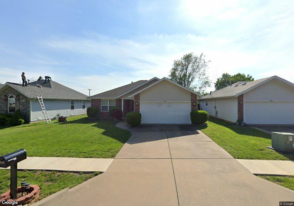
1515 S Lone Pine Ave Springfield, MO 65804
Oak Grove NeighborhoodEstimated Value: $227,998 - $238,000
3
Beds
2
Baths
1,280
Sq Ft
$183/Sq Ft
Est. Value
About This Home
This home is located at 1515 S Lone Pine Ave, Springfield, MO 65804 and is currently estimated at $234,000, approximately $182 per square foot. 1515 S Lone Pine Ave is a home located in Greene County with nearby schools including Pittman Elementary School, Hickory Hills K-8 School, and Glendale High School.
Ownership History
Date
Name
Owned For
Owner Type
Purchase Details
Closed on
Apr 8, 2008
Sold by
Atwell Carl E
Bought by
Johnston Jeanne
Current Estimated Value
Purchase Details
Closed on
Aug 30, 2007
Sold by
Haverstick Joseph David and Haverstick Nicole
Bought by
Atwell Carl E
Home Financials for this Owner
Home Financials are based on the most recent Mortgage that was taken out on this home.
Original Mortgage
$77,000
Interest Rate
6.72%
Mortgage Type
New Conventional
Create a Home Valuation Report for This Property
The Home Valuation Report is an in-depth analysis detailing your home's value as well as a comparison with similar homes in the area
Home Values in the Area
Average Home Value in this Area
Purchase History
| Date | Buyer | Sale Price | Title Company |
|---|---|---|---|
| Johnston Jeanne | -- | None Available | |
| Atwell Carl E | -- | Synergy Title Services Llc |
Source: Public Records
Mortgage History
| Date | Status | Borrower | Loan Amount |
|---|---|---|---|
| Previous Owner | Atwell Carl E | $77,000 |
Source: Public Records
Tax History
| Year | Tax Paid | Tax Assessment Tax Assessment Total Assessment is a certain percentage of the fair market value that is determined by local assessors to be the total taxable value of land and additions on the property. | Land | Improvement |
|---|---|---|---|---|
| 2025 | $1,378 | $28,650 | $5,700 | $22,950 |
| 2024 | $1,378 | $25,690 | $4,750 | $20,940 |
| 2023 | $1,370 | $25,690 | $4,750 | $20,940 |
| 2022 | $1,155 | $21,150 | $4,750 | $16,400 |
| 2021 | $1,155 | $21,150 | $4,750 | $16,400 |
| 2020 | $1,131 | $19,800 | $4,750 | $15,050 |
| 2019 | $1,099 | $19,800 | $4,750 | $15,050 |
| 2018 | $1,022 | $18,430 | $3,800 | $14,630 |
| 2017 | $1,012 | $17,860 | $3,800 | $14,060 |
| 2016 | $979 | $17,860 | $3,800 | $14,060 |
| 2015 | $970 | $17,860 | $3,800 | $14,060 |
| 2014 | $942 | $17,230 | $3,800 | $13,430 |
Source: Public Records
Map
Nearby Homes
- 1702 S Oak Grove Ave
- 1721 S Oak Grove Ave
- 1259 S Willow Ln
- 2251 E Washita St
- 1623 S Link Ave
- 2308 E Latoka St
- 1942 S Luster Ave
- 1503 S Sieger Dr
- 1984 S Meadowview Ave
- 2101 S Glendale Ave
- 1357 S Catalina Ave
- 1140 S Crutcher Ave
- 2134 S Luster Ave
- 1901 S Sieger Dr
- 846 S Barnes Ave
- 2810 E Madison St
- 2845 E Lombard St
- 1626 S Saint Charles Ave
- 1634 S Saint Charles Ave
- 2926 E Lombard St
- 1509 S Lone Pine Ave
- 1521 S Lone Pine Ave
- 1527 S Lone Pine Ave
- 1503 S Lone Pine Ave
- 1514 S Lone Pine Ave
- 1533 S Lone Pine Ave
- 1508 S Lone Pine Ave
- 1465 S Lone Pine Ave
- 1520 S Lone Pine Ave
- 1502 S Lone Pine Ave
- 1530 S Lone Pine Ave
- 1539 S Lone Pine Ave
- 1460 S Lone Pine Ave
- 1453 S Lone Pine Ave
- 2541 E Linwood Dr
- 1454 S Lone Pine Ave
- 2534 E Linwood Dr
- 2534 E Linwood St
- 2528 E Verona St
- 2508 E Verona St
Your Personal Tour Guide
Ask me questions while you tour the home.