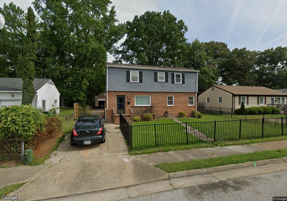
1519 Adams Cir Hampton, VA 23663
Buckroe Beach NeighborhoodEstimated Value: $300,000 - $318,576
4
Beds
2
Baths
1,985
Sq Ft
$156/Sq Ft
Est. Value
About This Home
This home is located at 1519 Adams Cir, Hampton, VA 23663 and is currently estimated at $308,894, approximately $155 per square foot. 1519 Adams Cir is a home located in Hampton City with nearby schools including Capt. John Smith Elementary School, Benjamin Syms Middle School, and Phoebus High School.
Ownership History
Date
Name
Owned For
Owner Type
Purchase Details
Closed on
Aug 7, 2008
Sold by
Lasalle Bank Tr
Bought by
Lynn Paul A
Current Estimated Value
Home Financials for this Owner
Home Financials are based on the most recent Mortgage that was taken out on this home.
Original Mortgage
$173,600
Outstanding Balance
$114,830
Interest Rate
6.49%
Mortgage Type
New Conventional
Estimated Equity
$194,064
Purchase Details
Closed on
Aug 28, 2006
Sold by
Hartmann Eric M
Bought by
Capehart Robert S
Home Financials for this Owner
Home Financials are based on the most recent Mortgage that was taken out on this home.
Original Mortgage
$154,300
Interest Rate
6.71%
Mortgage Type
New Conventional
Purchase Details
Closed on
Apr 18, 2002
Sold by
The Chase Manhattan Bank
Bought by
Chartwell Invest Corp
Create a Home Valuation Report for This Property
The Home Valuation Report is an in-depth analysis detailing your home's value as well as a comparison with similar homes in the area
Home Values in the Area
Average Home Value in this Area
Purchase History
| Date | Buyer | Sale Price | Title Company |
|---|---|---|---|
| Lynn Paul A | $175,000 | -- | |
| Capehart Robert S | $192,875 | -- | |
| Chartwell Invest Corp | $65,500 | -- |
Source: Public Records
Mortgage History
| Date | Status | Borrower | Loan Amount |
|---|---|---|---|
| Open | Lynn Paul A | $173,600 | |
| Previous Owner | Capehart Robert S | $154,300 |
Source: Public Records
Tax History
| Year | Tax Paid | Tax Assessment Tax Assessment Total Assessment is a certain percentage of the fair market value that is determined by local assessors to be the total taxable value of land and additions on the property. | Land | Improvement |
|---|---|---|---|---|
| 2025 | $3,371 | $281,500 | $57,000 | $224,500 |
| 2024 | $3,237 | $281,500 | $57,000 | $224,500 |
| 2023 | $2,723 | $234,700 | $52,500 | $182,200 |
| 2022 | $2,700 | $228,800 | $52,500 | $176,300 |
| 2021 | $2,363 | $180,100 | $42,000 | $138,100 |
| 2020 | $2,096 | $169,000 | $38,200 | $130,800 |
| 2019 | $2,096 | $169,000 | $38,200 | $130,800 |
| 2018 | $2,166 | $165,200 | $38,200 | $127,000 |
| 2017 | $2,142 | $0 | $0 | $0 |
| 2016 | $2,142 | $165,200 | $0 | $0 |
| 2015 | $2,142 | $0 | $0 | $0 |
| 2014 | $2,198 | $170,500 | $38,200 | $132,300 |
Source: Public Records
Map
Nearby Homes
- 1845 Kensington Dr
- 1530 Morgan Dr
- 1814 Somerville Dr
- 706 Grimes Rd
- 531 Price St
- 54 George Ct
- 304 Woodland Rd
- 1504 E Pembroke Ave
- 213 Ireland St
- 1909 Long Green Ln
- 1915 Long Green Ln
- 1923 Rawood Dr
- 1926 Somerville Dr
- 438 Shelton Rd
- 1358 Coral Place
- 1307 Colebrook Dr
- 1912 Beall Dr
- 208 Woodland Rd
- 237 Canford Dr
- 64 Ireland St
- 1517 Adams Cir
- 1521 Adams Cir
- 1515 Adams Cir
- 1523 Adams Cir
- 1836 Kensington Dr
- 1834 Kensington Dr
- 1838 Kensington Dr
- 1513 Adams Cir
- 1525 Adams Cir
- 1840 Kensington Dr
- 701 Morris St
- 1518 Adams Cir
- 1520 Adams Cir
- 1516 Adams Cir
- 1522 Adams Cir
- 1842 Kensington Dr
- 1511 Adams Cir
- 1527 Adams Cir
- 1524 Adams Cir
- 1514 Adams Cir
Your Personal Tour Guide
Ask me questions while you tour the home.