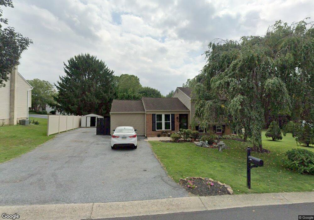
152 Kent Rd Lancaster, PA 17603
Wheatland NeighborhoodEstimated Value: $345,713 - $413,000
3
Beds
3
Baths
1,600
Sq Ft
$234/Sq Ft
Est. Value
About This Home
This home is located at 152 Kent Rd, Lancaster, PA 17603 and is currently estimated at $375,178, approximately $234 per square foot. 152 Kent Rd is a home located in Lancaster County with nearby schools including Hambright Elementary School, Manor Middle School, and Penn Manor High School.
Ownership History
Date
Name
Owned For
Owner Type
Purchase Details
Closed on
Feb 8, 2016
Sold by
The Estate Of Ruth D Rielly and Canfield Jerralynn
Bought by
Eshelman Emory E and Eshelman Jerralynn C
Current Estimated Value
Home Financials for this Owner
Home Financials are based on the most recent Mortgage that was taken out on this home.
Original Mortgage
$121,500
Outstanding Balance
$97,077
Interest Rate
4.02%
Mortgage Type
New Conventional
Estimated Equity
$278,101
Purchase Details
Closed on
Dec 15, 2005
Sold by
Dart Michael P and Dart Jean M
Bought by
Rielly Ruth D
Home Financials for this Owner
Home Financials are based on the most recent Mortgage that was taken out on this home.
Original Mortgage
$150,000
Interest Rate
6.39%
Mortgage Type
Fannie Mae Freddie Mac
Create a Home Valuation Report for This Property
The Home Valuation Report is an in-depth analysis detailing your home's value as well as a comparison with similar homes in the area
Home Values in the Area
Average Home Value in this Area
Purchase History
| Date | Buyer | Sale Price | Title Company |
|---|---|---|---|
| Eshelman Emory E | -- | Attorney | |
| Rielly Ruth D | $170,000 | None Available |
Source: Public Records
Mortgage History
| Date | Status | Borrower | Loan Amount |
|---|---|---|---|
| Open | Eshelman Emory E | $121,500 | |
| Previous Owner | Rielly Ruth D | $150,000 |
Source: Public Records
Tax History Compared to Growth
Tax History
| Year | Tax Paid | Tax Assessment Tax Assessment Total Assessment is a certain percentage of the fair market value that is determined by local assessors to be the total taxable value of land and additions on the property. | Land | Improvement |
|---|---|---|---|---|
| 2025 | $3,557 | $162,900 | $45,200 | $117,700 |
| 2024 | $3,557 | $162,900 | $45,200 | $117,700 |
| 2023 | $3,557 | $162,900 | $45,200 | $117,700 |
| 2022 | $3,490 | $162,900 | $45,200 | $117,700 |
| 2021 | $3,402 | $162,900 | $45,200 | $117,700 |
| 2020 | $3,402 | $162,900 | $45,200 | $117,700 |
| 2019 | $3,307 | $162,900 | $45,200 | $117,700 |
| 2018 | $2,672 | $162,900 | $45,200 | $117,700 |
| 2017 | $3,344 | $137,800 | $34,400 | $103,400 |
| 2016 | $3,344 | $137,800 | $34,400 | $103,400 |
| 2015 | $688 | $137,800 | $34,400 | $103,400 |
| 2014 | $2,308 | $137,800 | $34,400 | $103,400 |
Source: Public Records
Map
Nearby Homes
- 129 Joseph Rd
- 619 + 621 Millersville Rd
- 2205 Berkshire Rd
- 2210 Berkshire Rd
- 1053 Williamsburg Rd
- 1004 Tom Paine Dr
- 4 Bunker Hill
- 1077 Monticello Ln
- 108 Wildbriar Ct S
- 115 Nursery Ln
- 2008 Manor Ridge Dr
- 105 Silverwind Ct S
- 102 Arrowwood Ct
- 1799 Heritage Ave
- 220 Harvard Ave
- 114 Pheasant Ridge Cir
- 111 Pheasant Ridge Cir
- 1 & 2 Bentley Ln
- 2005 Millersville Pike
- 112 Whitney Rd
- 148 Kent Rd
- 156 Kent Rd
- 141 Kent Rd
- 137 Kent Rd
- 144 Kent Rd
- 145 Kent Rd
- 0 Manor Blvd Unit 1004579047
- 0 Manor Blvd Unit 172669
- 0 Manor Blvd Unit PALA2030054
- 0 Manor Blvd Unit PALA2022494
- 0 Manor Blvd Unit PALA177794
- 133 Kent Rd
- 118 Townhouse Ln
- 129 Kent Rd
- 140 Kent Rd
- 120 Townhouse Ln
- 64 Ramsgate Ln
- 131 Townhouse Ln
- 125 Kent Rd
- 136 Kent Ct