Estimated Value: $195,000 - $227,000
3
Beds
2
Baths
1,372
Sq Ft
$157/Sq Ft
Est. Value
About This Home
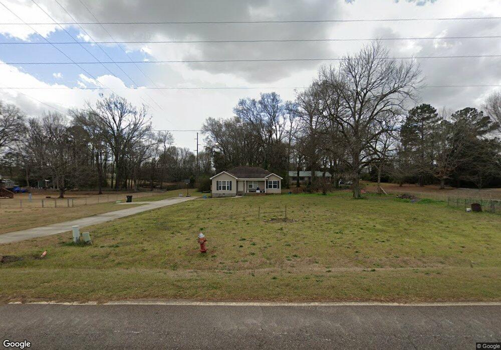
This home is located at 152 Todd Rd, Perry, GA 31069 and is currently estimated at $214,856, approximately $156 per square foot. 152 Todd Rd is a home located in Houston County with nearby schools including Langston Road Elementary School, Mossy Creek Middle School, and Perry High School.
Ownership History
Date
Name
Owned For
Owner Type
Purchase Details
Closed on
Oct 24, 2019
Sold by
Coleman Jennifer Diane
Bought by
Coleman William Ray
Current Estimated Value
Home Financials for this Owner
Home Financials are based on the most recent Mortgage that was taken out on this home.
Original Mortgage
$94,500
Interest Rate
3.74%
Mortgage Type
New Conventional
Purchase Details
Closed on
Mar 28, 2008
Sold by
Coleman William Ray
Bought by
Coleman William Ray and Miller Jennifer
Home Financials for this Owner
Home Financials are based on the most recent Mortgage that was taken out on this home.
Original Mortgage
$95,000
Interest Rate
6.75%
Mortgage Type
Stand Alone Refi Refinance Of Original Loan
Create a Home Valuation Report for This Property
The Home Valuation Report is an in-depth analysis detailing your home's value as well as a comparison with similar homes in the area
Home Values in the Area
Average Home Value in this Area
Purchase History
| Date | Buyer | Sale Price | Title Company |
|---|---|---|---|
| Coleman William Ray | -- | None Available | |
| Coleman William Ray | -- | None Available |
Source: Public Records
Mortgage History
| Date | Status | Borrower | Loan Amount |
|---|---|---|---|
| Previous Owner | Coleman William Ray | $94,500 | |
| Previous Owner | Coleman William Ray | $95,000 |
Source: Public Records
Tax History Compared to Growth
Tax History
| Year | Tax Paid | Tax Assessment Tax Assessment Total Assessment is a certain percentage of the fair market value that is determined by local assessors to be the total taxable value of land and additions on the property. | Land | Improvement |
|---|---|---|---|---|
| 2024 | $1,331 | $57,640 | $7,760 | $49,880 |
| 2023 | $1,120 | $48,320 | $7,720 | $40,600 |
| 2022 | $1,027 | $44,480 | $7,720 | $36,760 |
| 2021 | $848 | $36,920 | $3,720 | $33,200 |
| 2020 | $855 | $37,040 | $3,520 | $33,520 |
| 2019 | $855 | $37,040 | $3,520 | $33,520 |
| 2018 | $855 | $37,040 | $3,520 | $33,520 |
| 2017 | $856 | $37,040 | $3,520 | $33,520 |
| 2016 | $857 | $37,040 | $3,520 | $33,520 |
| 2015 | $859 | $37,040 | $3,520 | $33,520 |
| 2014 | -- | $37,040 | $3,520 | $33,520 |
| 2013 | -- | $37,040 | $3,520 | $33,520 |
Source: Public Records
Map
Nearby Homes
- 309 Bermuda Ridge
- 204 Chimney Rock Rd
- 124 Lake Lillian Dr
- 502 Arons Ct
- 2360 U S 41
- 150 MacK Thompson Rd
- 0 MacK Thompson Rd Unit 253661
- 149 MacK Thompson Road Common
- 0 Hwy 41 & Langston Rd Unit M170042
- 0 Langston Rd Unit 16828609
- 220 Overton Dr
- Savannah Plan at Bankstone Landing
- Newport Plan at Bankstone Landing
- Delaware Plan at Bankstone Landing
- 161 Overton Dr
- 103 Breakwater Way
- 107 Breakwater Way
- 111 Breakwater Way
- 219 Overton Dr
- 118 Bramblewood Way