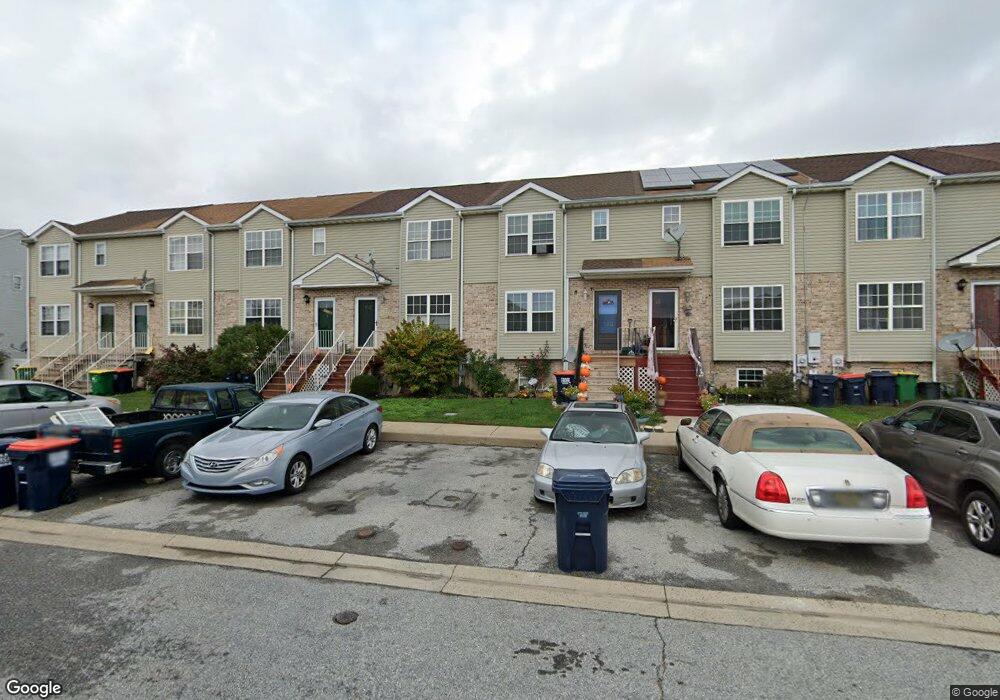
152 Vincent Cir Middletown, DE 19709
Estimated Value: $270,000 - $287,838
3
Beds
2
Baths
1,400
Sq Ft
$199/Sq Ft
Est. Value
About This Home
This home is located at 152 Vincent Cir, Middletown, DE 19709 and is currently estimated at $278,960, approximately $199 per square foot. 152 Vincent Cir is a home located in New Castle County with nearby schools including Bunker Hill Elementary School, Everett Meredith Middle School, and Appoquinimink High School.
Ownership History
Date
Name
Owned For
Owner Type
Purchase Details
Closed on
Sep 4, 2009
Sold by
Williams Kevin M and Williams Kelly M
Bought by
Bronson Angela and Bronson Gilead D
Current Estimated Value
Home Financials for this Owner
Home Financials are based on the most recent Mortgage that was taken out on this home.
Original Mortgage
$157,998
Outstanding Balance
$103,435
Interest Rate
5.21%
Mortgage Type
New Conventional
Estimated Equity
$175,525
Purchase Details
Closed on
Feb 25, 2005
Sold by
Ivey Lance D and Quirk Nicole A
Bought by
Williams Kevin M and Williams Kelly M
Home Financials for this Owner
Home Financials are based on the most recent Mortgage that was taken out on this home.
Original Mortgage
$160,000
Interest Rate
5.66%
Mortgage Type
Purchase Money Mortgage
Create a Home Valuation Report for This Property
The Home Valuation Report is an in-depth analysis detailing your home's value as well as a comparison with similar homes in the area
Home Values in the Area
Average Home Value in this Area
Purchase History
| Date | Buyer | Sale Price | Title Company |
|---|---|---|---|
| Bronson Angela | $154,900 | None Available | |
| Williams Kevin M | $154,900 | Stewart Title Guaranty Co |
Source: Public Records
Mortgage History
| Date | Status | Borrower | Loan Amount |
|---|---|---|---|
| Open | Bronson Angela | $157,998 | |
| Previous Owner | Williams Kevin M | $160,000 |
Source: Public Records
Tax History Compared to Growth
Tax History
| Year | Tax Paid | Tax Assessment Tax Assessment Total Assessment is a certain percentage of the fair market value that is determined by local assessors to be the total taxable value of land and additions on the property. | Land | Improvement |
|---|---|---|---|---|
| 2024 | $1,394 | $40,700 | $3,300 | $37,400 |
| 2023 | $26 | $40,700 | $3,300 | $37,400 |
| 2022 | $1,150 | $40,700 | $3,300 | $37,400 |
| 2021 | $1,129 | $40,700 | $3,300 | $37,400 |
| 2020 | $1,113 | $40,700 | $3,300 | $37,400 |
| 2019 | $1,135 | $40,700 | $3,300 | $37,400 |
| 2018 | $979 | $40,700 | $3,300 | $37,400 |
| 2017 | $945 | $40,700 | $3,300 | $37,400 |
| 2016 | $840 | $40,700 | $3,300 | $37,400 |
| 2015 | $834 | $40,700 | $3,300 | $37,400 |
| 2014 | $831 | $40,700 | $3,300 | $37,400 |
Source: Public Records
Map
Nearby Homes
- 367 E Harvest Ln
- 131 Rosie Dr
- 306 E Harvest Ln
- 715 Dairy Dr
- 832 Woodline Dr
- 1023 Bunker Hill Rd
- 102 Springmill Dr
- 580 Whispering Trail
- 574 Whispering Trail
- 577 Whispering Trail
- 402 Topiary Ln
- 237 Trellis Ln
- 56 Springmill Dr
- 51 Springmill Dr
- 14 W Lake St
- 47 Franklin Dr
- 47 Spring Arbor Dr
- 335 Marldale Dr
- 1167 Bunker Hill Rd
- 6 Kimberly Dr
- 150 Vincent Cir
- 154 Vincent Cir
- 148 Vincent Cir
- 156 Vincent Cir
- 146 Vincent Cir
- 158 Vincent Cir
- 144 Vincent Cir
- 160 Vincent Cir
- 142 Vincent Cir
- 162 Vincent Cir
- 500 Sally Ln
- 140 Vincent Cir
- 164 Vincent Cir
- 138 Vincent Cir
- 502 Sally Ln
- 501 Sally Ln
- 166 Vincent Cir
- 136 Vincent Cir
- 504 Sally Ln
- 503 Sally Ln