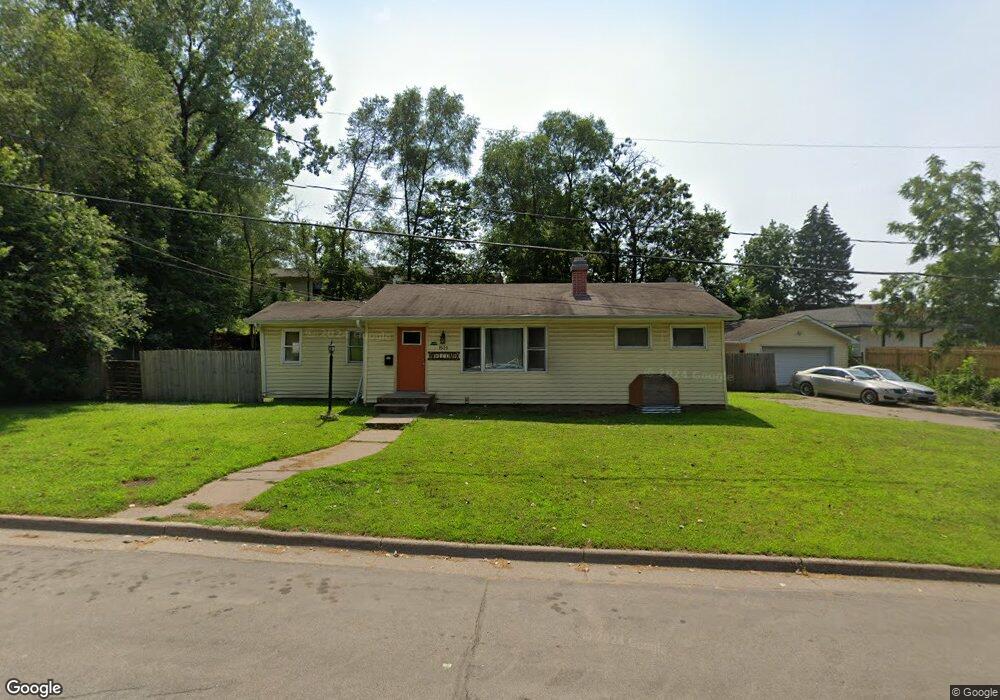
1520 1520 Old Hudson Rd St. Paul, MN 55106
Battle Creek NeighborhoodEstimated Value: $319,000 - $354,000
2
Beds
2
Baths
1,092
Sq Ft
$310/Sq Ft
Est. Value
About This Home
This home is located at 1520 1520 Old Hudson Rd, St. Paul, MN 55106 and is currently estimated at $338,246, approximately $309 per square foot. 1520 1520 Old Hudson Rd is a home located in Ramsey County with nearby schools including Battle Creek Elementary School, Battle Creek Middle School, and Harding Senior High School.
Ownership History
Date
Name
Owned For
Owner Type
Purchase Details
Closed on
Aug 16, 2019
Sold by
Lor See
Bought by
War Thei and Thoeuk Khon
Current Estimated Value
Home Financials for this Owner
Home Financials are based on the most recent Mortgage that was taken out on this home.
Original Mortgage
$11,000
Outstanding Balance
$9,634
Interest Rate
3.7%
Mortgage Type
Commercial
Estimated Equity
$328,612
Purchase Details
Closed on
Aug 16, 2001
Sold by
Hilliard Phillip C and Hilliard Laura J
Bought by
Barrett Debra
Create a Home Valuation Report for This Property
The Home Valuation Report is an in-depth analysis detailing your home's value as well as a comparison with similar homes in the area
Home Values in the Area
Average Home Value in this Area
Purchase History
| Date | Buyer | Sale Price | Title Company |
|---|---|---|---|
| War Thei | $239,000 | Land Title Inc | |
| Barrett Debra | $136,000 | -- |
Source: Public Records
Mortgage History
| Date | Status | Borrower | Loan Amount |
|---|---|---|---|
| Open | War Thei | $11,000 |
Source: Public Records
Tax History Compared to Growth
Tax History
| Year | Tax Paid | Tax Assessment Tax Assessment Total Assessment is a certain percentage of the fair market value that is determined by local assessors to be the total taxable value of land and additions on the property. | Land | Improvement |
|---|---|---|---|---|
| 2025 | $4,716 | $323,300 | $81,900 | $241,400 |
| 2023 | $4,716 | $303,300 | $46,900 | $256,400 |
| 2022 | $3,850 | $302,000 | $46,900 | $255,100 |
| 2021 | $3,688 | $248,500 | $46,900 | $201,600 |
| 2020 | $3,520 | $235,600 | $46,900 | $188,700 |
| 2019 | $2,774 | $209,700 | $46,900 | $162,800 |
| 2018 | $2,266 | $161,800 | $46,900 | $114,900 |
| 2017 | $2,744 | $142,500 | $46,900 | $95,600 |
| 2016 | $2,726 | $0 | $0 | $0 |
| 2015 | $2,712 | $146,000 | $46,900 | $99,100 |
| 2014 | $2,314 | $0 | $0 | $0 |
Source: Public Records
Map
Nearby Homes
- 1538 Wilson Ave
- 1600 Old Hudson Rd
- 1443 Pacific St
- 267 Hazelwood St
- 1450 Fremont Ave
- 201 Dora Ct W
- 1333 Pacific St
- 1320 Wilson Ave
- 237 Sigurd St
- 1351 3rd St E
- 244 Point Douglas Rd N
- 1685 Fremont Ave
- 1269 Wilson Ave
- 1489 6th St E
- 1257 Wilson Ave
- 271 English St
- 1303 Fremont Ave
- 1493 Margaret St
- 1551 Margaret St
- 401 Johnson Pkwy
- 1520 Old Hudson Rd
- 1519 Hudson Rd
- 1530 Old Hudson Rd
- 1504 Old Hudson Rd
- 1529 Hudson Rd
- 1502 Old Hudson Rd
- 1523 Old Hudson Rd
- 1523 1523 Old Hudson Rd
- 1523 1523 Old Hudson-Road-
- 1517 Old Hudson Rd
- 1517 1517 Old Hudson Rd
- 1511 Old Hudson Rd
- 1533 Old Hudson Rd
- 1505 1505 Old Hudson-Road-
- 1537 Old Hudson Rd
- 1505 Old Hudson Rd
- 1535 Hudson Rd
- 1499 Old Hudson Rd
- 1534 Wilson Ave
- 1530 Wilson Ave