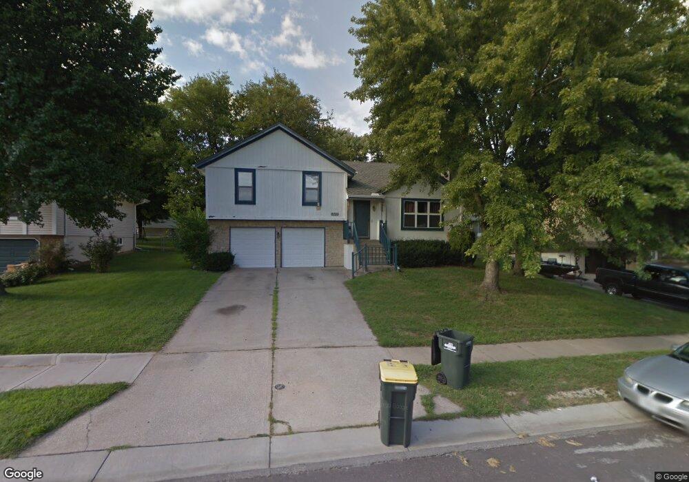
1520 NE Westwind Dr Lees Summit, MO 64086
Estimated Value: $305,670 - $333,000
3
Beds
2
Baths
1,354
Sq Ft
$236/Sq Ft
Est. Value
About This Home
This home is located at 1520 NE Westwind Dr, Lees Summit, MO 64086 and is currently estimated at $318,918, approximately $235 per square foot. 1520 NE Westwind Dr is a home located in Jackson County with nearby schools including Underwood Elementary School, Bernard C. Campbell Middle School, and Lee's Summit North High School.
Ownership History
Date
Name
Owned For
Owner Type
Purchase Details
Closed on
Mar 26, 2002
Sold by
Gooderl Brenda K and Gooderl Gary L
Bought by
Adell Dwight E and Adell Diana L
Current Estimated Value
Home Financials for this Owner
Home Financials are based on the most recent Mortgage that was taken out on this home.
Original Mortgage
$130,105
Outstanding Balance
$53,468
Interest Rate
6.83%
Mortgage Type
Purchase Money Mortgage
Estimated Equity
$265,450
Purchase Details
Closed on
Aug 25, 1995
Sold by
Baker Christopher E and Baker Amy L
Bought by
Gooderl Gary L and Gooderl Brenda K
Home Financials for this Owner
Home Financials are based on the most recent Mortgage that was taken out on this home.
Original Mortgage
$89,300
Interest Rate
7.39%
Mortgage Type
Purchase Money Mortgage
Create a Home Valuation Report for This Property
The Home Valuation Report is an in-depth analysis detailing your home's value as well as a comparison with similar homes in the area
Home Values in the Area
Average Home Value in this Area
Purchase History
We collect this data history from publicly available records. To have your information removed, we recommend requesting removal directly through your county’s website.
| Date | Buyer | Sale Price | Title Company |
|---|---|---|---|
| Adell Dwight E | -- | Metro One Title | |
| Gooderl Gary L | -- | Stewart Title |
Source: Public Records
Mortgage History
We collect this data history from publicly available records. To have your information removed, we recommend requesting removal directly through your county’s website.
| Date | Status | Borrower | Loan Amount |
|---|---|---|---|
| Open | Adell Dwight E | $130,105 | |
| Previous Owner | Gooderl Gary L | $89,300 |
Source: Public Records
Tax History
| Year | Tax Paid | Tax Assessment Tax Assessment Total Assessment is a certain percentage of the fair market value that is determined by local assessors to be the total taxable value of land and additions on the property. | Land | Improvement |
|---|---|---|---|---|
| 2025 | $3,568 | $44,976 | $7,003 | $37,973 |
| 2024 | $3,568 | $49,417 | $7,847 | $41,570 |
| 2023 | $3,542 | $49,417 | $7,847 | $41,570 |
| 2022 | $2,745 | $34,010 | $6,897 | $27,113 |
| 2021 | $2,802 | $34,010 | $6,897 | $27,113 |
| 2020 | $2,572 | $30,916 | $6,897 | $24,019 |
| 2019 | $2,502 | $30,916 | $6,897 | $24,019 |
| 2018 | $2,480 | $28,434 | $3,881 | $24,553 |
| 2017 | $2,443 | $28,434 | $3,881 | $24,553 |
| 2016 | $2,443 | $27,721 | $3,458 | $24,263 |
| 2014 | $2,498 | $27,787 | $3,239 | $24,548 |
Source: Public Records
Map
Nearby Homes
- 1412 NE Ernest Way
- 1617 NE Auburn Dr
- 809 NE Cedar St
- 1416 NE Ernest Way
- 809 NE Mulberry St
- 1401 NE Ernest Way
- 1401 NE Bronze Dr
- 1708 NE Balboa St
- 1128 NE Westwind Dr
- 1350 NE Colbern Rd
- 1490 NE Independence Ave
- 718 NE Mulberry St
- 1704 NE Stonewood Dr
- 1012 NE Barnes Dr
- 1204 NE Hendrix Dr
- 1832 NE Stonewood Dr
- 1300 NE Browning Ln
- 1525 NE Yorkshire Dr
- 410 NE Mulberry St
- 1108 NE Colleen Dr
- 1516 NE Westwind Dr
- 1530 NE Westwind Dr
- 1512 NE Westwind Dr
- 1513 NE Westwind Dr
- 1523 NE Westwind Dr
- 1600 NE Westwind Dr
- 1527 NE Westwind Dr
- 1509 NE Westwind Dr
- 1011 NE Chestnut St
- 1508 NE Westwind Dr
- 1009 NE Chestnut St
- 1013 NE Chestnut St
- 1604 NE Westwind Dr
- 1531 NE Westwind Dr
- 1505 NE Westwind Dr
- 1535 NE Westwind Dr
- 1539 NE Westwind Dr
- 1007 NE Chestnut St
- 1608 NE Westwind Dr
- 1504 NE Westwind Dr
Your Personal Tour Guide
Ask me questions while you tour the home.