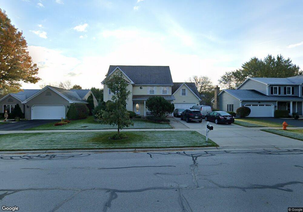
1520 Westminster Dr Naperville, IL 60563
Brookdale NeighborhoodEstimated Value: $641,000 - $690,955
5
Beds
3
Baths
2,948
Sq Ft
$226/Sq Ft
Est. Value
About This Home
This home is located at 1520 Westminster Dr, Naperville, IL 60563 and is currently estimated at $667,489, approximately $226 per square foot. 1520 Westminster Dr is a home located in DuPage County with nearby schools including Brookdale Elementary School, Thayer J. Hill Middle School, and Metea Valley High School.
Ownership History
Date
Name
Owned For
Owner Type
Purchase Details
Closed on
Feb 7, 2003
Sold by
Carr Charles W and Carr Alice M
Bought by
Wolski Edward and Wolski Stanislawa
Current Estimated Value
Home Financials for this Owner
Home Financials are based on the most recent Mortgage that was taken out on this home.
Original Mortgage
$160,000
Outstanding Balance
$69,073
Interest Rate
6.06%
Estimated Equity
$598,416
Create a Home Valuation Report for This Property
The Home Valuation Report is an in-depth analysis detailing your home's value as well as a comparison with similar homes in the area
Home Values in the Area
Average Home Value in this Area
Purchase History
| Date | Buyer | Sale Price | Title Company |
|---|---|---|---|
| Wolski Edward | $356,000 | -- |
Source: Public Records
Mortgage History
| Date | Status | Borrower | Loan Amount |
|---|---|---|---|
| Open | Wolski Edward | $160,000 |
Source: Public Records
Tax History Compared to Growth
Tax History
| Year | Tax Paid | Tax Assessment Tax Assessment Total Assessment is a certain percentage of the fair market value that is determined by local assessors to be the total taxable value of land and additions on the property. | Land | Improvement |
|---|---|---|---|---|
| 2024 | $11,791 | $204,907 | $45,184 | $159,723 |
| 2023 | $11,241 | $184,120 | $40,600 | $143,520 |
| 2022 | $10,980 | $171,660 | $37,530 | $134,130 |
| 2021 | $10,622 | $165,530 | $36,190 | $129,340 |
| 2020 | $10,607 | $165,530 | $36,190 | $129,340 |
| 2019 | $10,175 | $157,440 | $34,420 | $123,020 |
| 2018 | $10,031 | $152,700 | $33,550 | $119,150 |
| 2017 | $9,743 | $147,520 | $32,410 | $115,110 |
| 2016 | $9,551 | $141,570 | $31,100 | $110,470 |
| 2015 | $9,444 | $134,420 | $29,530 | $104,890 |
| 2014 | $9,247 | $127,650 | $27,810 | $99,840 |
| 2013 | $9,228 | $128,530 | $28,000 | $100,530 |
Source: Public Records
Map
Nearby Homes
- 1517 London Ct
- 1525 London Ct
- 1628 Westminster Dr
- 1332 Mc Dowell Rd Unit 104
- 1308 Mc Dowell Rd Unit 103
- 1561 Raymond Dr Unit 104
- 1569 Raymond Dr Unit 201
- 2755 Sheridan Ct Unit 270102
- 5S100 Pebblewood Ln Unit E4
- 1329 Queensgreen Cir Unit 1301
- 5S510 Scots Dr Unit G
- 5S022 Raymond Dr
- 893 Nelli Ct Unit 101
- 2824 Collins Ct Unit 210205
- 2813 Bond Cir
- 1022 Neudearborn Ln Unit 19-1022
- 1912 Oxley Cir Unit 13106
- 1981 Golden Gate Ln Unit 341801
- 2015 Yellow Daisy Ct
- 30W355 Claymore Ln
- 1516 Westminster Dr
- 1524 Westminster Dr
- 1513 London Ct
- 1512 Westminster Dr
- 1528 Westminster Dr
- 1379 Hastings St
- 1509 London Ct
- 1508 Westminster Dr
- 1505 London Ct
- 1527 Westminster Dr Unit 101
- 1527 Westminster Dr Unit 103
- 1527 Westminster Dr
- 1527 Westminster Dr Unit 207
- 1527 Westminster Dr Unit 209
- 1527 Westminster Dr Unit 108
- 1527 Westminster Dr Unit 208
- 1527 Westminster Dr Unit 210
- 1527 Westminster Dr Unit 106
- 1527 Westminster Dr Unit 205
- 1527 Westminster Dr Unit 206