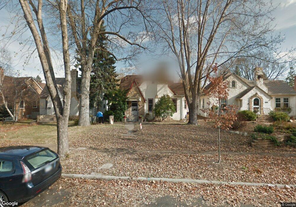
1528 Pascal St N Saint Paul, MN 55108
Como Park NeighborhoodEstimated Value: $439,000 - $461,000
3
Beds
2
Baths
2,149
Sq Ft
$209/Sq Ft
Est. Value
About This Home
This home is located at 1528 Pascal St N, Saint Paul, MN 55108 and is currently estimated at $449,552, approximately $209 per square foot. 1528 Pascal St N is a home located in Ramsey County with nearby schools including Chelsea Heights Elementary, Murray Middle School, and Como Park Senior High School.
Ownership History
Date
Name
Owned For
Owner Type
Purchase Details
Closed on
Nov 25, 2019
Sold by
Goshert Danica L
Bought by
Momsen Adam and Momsen Nina
Current Estimated Value
Purchase Details
Closed on
Apr 14, 2017
Sold by
Hoffman Matthew W and Maurer Lauren
Bought by
Fundakowski Anne and Fundakowski Cole G
Home Financials for this Owner
Home Financials are based on the most recent Mortgage that was taken out on this home.
Original Mortgage
$237,520
Interest Rate
4.1%
Mortgage Type
New Conventional
Purchase Details
Closed on
Dec 20, 2002
Sold by
Drake Doreen K
Bought by
Goshert Danica L and Goshert William E
Purchase Details
Closed on
Mar 21, 1996
Sold by
Twohy Kevin M
Bought by
Drake Doreen K
Create a Home Valuation Report for This Property
The Home Valuation Report is an in-depth analysis detailing your home's value as well as a comparison with similar homes in the area
Home Values in the Area
Average Home Value in this Area
Purchase History
| Date | Buyer | Sale Price | Title Company |
|---|---|---|---|
| Momsen Adam | $320,000 | Legacy Title | |
| Fundakowski Anne | $296,900 | Watermark Title Agency | |
| Goshert Danica L | $239,900 | -- | |
| Drake Doreen K | $126,000 | -- |
Source: Public Records
Mortgage History
| Date | Status | Borrower | Loan Amount |
|---|---|---|---|
| Previous Owner | Fundakowski Anne | $237,520 |
Source: Public Records
Tax History Compared to Growth
Tax History
| Year | Tax Paid | Tax Assessment Tax Assessment Total Assessment is a certain percentage of the fair market value that is determined by local assessors to be the total taxable value of land and additions on the property. | Land | Improvement |
|---|---|---|---|---|
| 2025 | $5,822 | $448,300 | $60,000 | $388,300 |
| 2023 | $5,822 | $378,500 | $60,000 | $318,500 |
| 2022 | $5,166 | $372,100 | $60,000 | $312,100 |
| 2021 | $5,316 | $324,900 | $60,000 | $264,900 |
| 2020 | $5,742 | $345,200 | $60,000 | $285,200 |
| 2019 | $5,228 | $332,600 | $55,000 | $277,600 |
| 2018 | $4,700 | $300,600 | $55,000 | $245,600 |
| 2017 | $4,228 | $280,200 | $39,000 | $241,200 |
| 2016 | $3,764 | $0 | $0 | $0 |
| 2015 | $3,782 | $218,100 | $39,000 | $179,100 |
| 2014 | $3,476 | $0 | $0 | $0 |
Source: Public Records
Map
Nearby Homes
- 1407 Pascal St N
- 1380 Asbury St
- 1445 Larpenteur Ave W
- 1290 Snelling Ave N
- 1436 Almond Ave
- 1284 Snelling Ave N
- 1559 Almond Ave
- 1435 Albany Ave
- 1756 Fry St
- 1890 Hamline Ave N
- 1205 Autumn St
- 1372 Carling Dr Unit 208
- 1139 Autumn St
- 1629 Ridgewood Ln S
- 1808 Tatum St
- 911 Montana Ave W
- 1845 Aglen St
- 1125 Argyle St
- 869 Iowa Ave W
- 1094 Argyle St
- 1532 Pascal St N
- 1524 Pascal St N
- 1520 Pascal St N
- 1536 Pascal St N
- 1516 Pascal St N
- 1540 Pascal St N
- 1527 Holton St
- 1523 Holton St
- 1531 Holton St
- 1544 Pascal St N
- 1512 Pascal St N
- 1521 Holton St
- 1535 Holton St
- 1515 Holton St
- 1515 1515 Holton-Street-
- 1525 Pascal St N
- 1539 Holton St
- 1529 Pascal St N
- 1523 Pascal St N
- 1548 Pascal St N