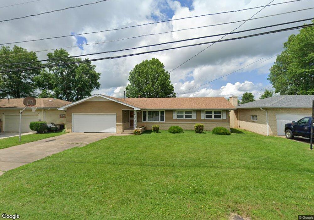
1533 E Snider St Springfield, MO 65803
Estimated Value: $198,000 - $218,000
3
Beds
2
Baths
1,460
Sq Ft
$143/Sq Ft
Est. Value
About This Home
This home is located at 1533 E Snider St, Springfield, MO 65803 and is currently estimated at $208,627, approximately $142 per square foot. 1533 E Snider St is a home located in Greene County with nearby schools including Truman Elementary School, Pleasant View K-8 School, and Hillcrest High School.
Ownership History
Date
Name
Owned For
Owner Type
Purchase Details
Closed on
May 17, 2024
Sold by
P & B Holdings Llc
Bought by
Brooke Jacob D
Current Estimated Value
Home Financials for this Owner
Home Financials are based on the most recent Mortgage that was taken out on this home.
Original Mortgage
$184,500
Outstanding Balance
$181,883
Interest Rate
6.82%
Mortgage Type
New Conventional
Estimated Equity
$26,744
Purchase Details
Closed on
Apr 17, 2024
Sold by
Jerry L Dickey Map Trust and Steele Amanda Lynn
Bought by
P & B Holdings Llc
Home Financials for this Owner
Home Financials are based on the most recent Mortgage that was taken out on this home.
Original Mortgage
$184,500
Outstanding Balance
$181,883
Interest Rate
6.82%
Mortgage Type
New Conventional
Estimated Equity
$26,744
Purchase Details
Closed on
Aug 13, 2019
Sold by
Steele Amanda Lynn and Jerry And Connie Dickey Map Tr
Bought by
Steele Amanda Lynn and Jerry L Dickey Map Trust
Create a Home Valuation Report for This Property
The Home Valuation Report is an in-depth analysis detailing your home's value as well as a comparison with similar homes in the area
Purchase History
| Date | Buyer | Sale Price | Title Company |
|---|---|---|---|
| Brooke Jacob D | -- | None Listed On Document | |
| P & B Holdings Llc | -- | None Listed On Document | |
| Steele Amanda Lynn | -- | None Available |
Source: Public Records
Mortgage History
| Date | Status | Borrower | Loan Amount |
|---|---|---|---|
| Open | Brooke Jacob D | $184,500 |
Source: Public Records
Tax History
| Year | Tax Paid | Tax Assessment Tax Assessment Total Assessment is a certain percentage of the fair market value that is determined by local assessors to be the total taxable value of land and additions on the property. | Land | Improvement |
|---|---|---|---|---|
| 2025 | $1,114 | $22,360 | $6,270 | $16,090 |
| 2024 | $1,075 | $20,030 | $4,180 | $15,850 |
| 2023 | $0 | $20,030 | $4,180 | $15,850 |
| 2022 | $998 | $18,280 | $4,180 | $14,100 |
| 2021 | $998 | $18,280 | $4,180 | $14,100 |
| 2020 | $959 | $16,800 | $4,180 | $12,620 |
| 2019 | $932 | $16,800 | $4,180 | $12,620 |
| 2018 | $730 | $13,150 | $3,230 | $9,920 |
| 2017 | $722 | $13,150 | $3,230 | $9,920 |
| 2016 | $721 | $13,150 | $3,230 | $9,920 |
| 2015 | $714 | $13,150 | $3,230 | $9,920 |
| 2014 | $719 | $13,150 | $3,230 | $9,920 |
Source: Public Records
Map
Nearby Homes
- 1414 E Smith St
- 1255 E Bonaire Dr
- 1502 E McClernon St
- 1339 E McClernon St
- 4260 N State Highway H
- 3749 N Pickwick Ave
- 3753 N Pickwick Ave
- 1113 E Smith St
- 1103 E Smith St
- 1107 E Smith St
- 1039 E Caravan St
- 1349 E Stoneridge St
- 1923 E Valley Water Mill Rd
- 1017 E McClernon St
- 1005 E McClernon St
- 1270 E Ogorman Ct
- 3839 N Stewart Ave
- 3983 N Courtney Cir
- 3975 N Stewart Ave
- 1406 E Nora St
- 1539 E Snider St
- 1527 E Snider St
- 1547 E Snider St
- 1521 E Snider St
- 3342 N Delaware Ave
- 3341 N Delaware Ave
- 1555 E Snider St
- 3334 N Delaware Ave
- 1561 E Snider St
- 1505 E Snider St
- 3333 N Delaware Ave
- 1556 E Snider St
- 3338 N Weller Ave
- 1569 E Snider St
- 3326 N Delaware Ave
- 1560 E Snider St
- 3328 N Weller Ave
- 1449 E Snider St
- 3319 N Delaware Ave
- 1570 E Snider St
Your Personal Tour Guide
Ask me questions while you tour the home.