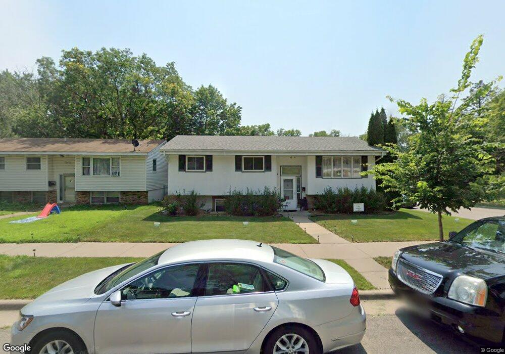
1542 Wilson Ave Saint Paul, MN 55106
Battle Creek NeighborhoodEstimated Value: $319,000 - $345,578
4
Beds
2
Baths
470
Sq Ft
$718/Sq Ft
Est. Value
About This Home
This home is located at 1542 Wilson Ave, Saint Paul, MN 55106 and is currently estimated at $337,645, approximately $718 per square foot. 1542 Wilson Ave is a home located in Ramsey County with nearby schools including Battle Creek Elementary School, Battle Creek Middle School, and Harding Senior High School.
Ownership History
Date
Name
Owned For
Owner Type
Purchase Details
Closed on
Aug 18, 2017
Sold by
Mccarthy Cathleen M and Mccarthy Christopher M
Bought by
Ellis Richard W and Ellis Sherrece F
Current Estimated Value
Home Financials for this Owner
Home Financials are based on the most recent Mortgage that was taken out on this home.
Original Mortgage
$216,200
Interest Rate
3.85%
Mortgage Type
New Conventional
Purchase Details
Closed on
Dec 3, 2014
Sold by
Ciernia Donald J
Bought by
Ciernia Donald J and Mccarthy Cathleen M
Create a Home Valuation Report for This Property
The Home Valuation Report is an in-depth analysis detailing your home's value as well as a comparison with similar homes in the area
Home Values in the Area
Average Home Value in this Area
Purchase History
| Date | Buyer | Sale Price | Title Company |
|---|---|---|---|
| Ellis Richard W | $222,900 | Titlesmart Inc | |
| Ciernia Donald J | -- | None Available |
Source: Public Records
Mortgage History
| Date | Status | Borrower | Loan Amount |
|---|---|---|---|
| Previous Owner | Ellis Richard W | $216,200 |
Source: Public Records
Tax History Compared to Growth
Tax History
| Year | Tax Paid | Tax Assessment Tax Assessment Total Assessment is a certain percentage of the fair market value that is determined by local assessors to be the total taxable value of land and additions on the property. | Land | Improvement |
|---|---|---|---|---|
| 2025 | $4,870 | $342,600 | $40,200 | $302,400 |
| 2023 | $4,870 | $296,500 | $25,000 | $271,500 |
| 2022 | $4,490 | $317,500 | $25,000 | $292,500 |
| 2021 | $4,202 | $250,000 | $25,000 | $225,000 |
| 2020 | $4,254 | $235,000 | $25,000 | $210,000 |
| 2019 | $3,342 | $218,400 | $25,000 | $193,400 |
| 2018 | $3,136 | $199,700 | $25,000 | $174,700 |
| 2017 | $2,902 | $195,500 | $25,000 | $170,500 |
| 2016 | $2,354 | $0 | $0 | $0 |
| 2015 | $2,300 | $159,000 | $25,000 | $134,000 |
| 2014 | $2,174 | $0 | $0 | $0 |
Source: Public Records
Map
Nearby Homes
- 1538 Wilson Ave
- 1600 Old Hudson Rd
- 1443 Pacific St
- 1450 Fremont Ave
- 267 Hazelwood St
- 1685 Fremont Ave
- 1351 3rd St E
- 1489 6th St E
- 1320 Wilson Ave
- 201 Dora Ct W
- 1333 Pacific St
- 237 Sigurd St
- 1551 Margaret St
- 1493 Margaret St
- 244 Point Douglas Rd N
- 1303 Fremont Ave
- 1269 Wilson Ave
- 1821 Wilson Ave
- 1257 Wilson Ave
- 1590 Minnehaha Ave E
- 1546 Wilson Ave
- 1546 1546 Wilson-Avenue-
- 408 Hazelwood St
- 1554 Wilson Ave
- 1538 1538 Wilson-Avenue-
- 1555 Wilson Ave
- 1541 Old Hudson Rd
- 1541 1541 Old Hudson-Road-
- 1541 1541 Old Hudson Rd
- 1537 Old Hudson Rd
- 1566 Wilson Ave
- 1543 Old Hudson Rd
- 1533 Old Hudson Rd
- 1549 Old Hudson Rd
- 1543 Euclid St
- 1534 Wilson Ave
- 1545 Wilson Ave
- 1555 1555 Old Hudson Rd
- 1555 Old Hudson Rd
- 1539 Wilson Ave