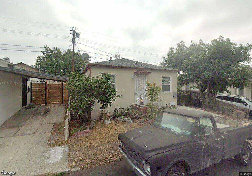
1544 N Avenue 47 Los Angeles, CA 90042
Eagle Rock NeighborhoodEstimated Value: $972,000 - $1,157,000
3
Beds
2
Baths
1,188
Sq Ft
$924/Sq Ft
Est. Value
About This Home
This home is located at 1544 N Avenue 47, Los Angeles, CA 90042 and is currently estimated at $1,097,357, approximately $923 per square foot. 1544 N Avenue 47 is a home located in Los Angeles County with nearby schools including Toland Way Elementary School, Eagle Rock High School, and Irving STEAM Magnet School.
Ownership History
Date
Name
Owned For
Owner Type
Purchase Details
Closed on
Aug 10, 2010
Sold by
Zayas Edgardo and Zayas Patricia
Bought by
Zayas Edgardo Enrique and Zayas Patricia Eva
Current Estimated Value
Purchase Details
Closed on
Nov 18, 2009
Sold by
Tanner Henry S
Bought by
Tanner Dely C
Purchase Details
Closed on
Nov 10, 2009
Sold by
Tanner Dely C and Jones Dely
Bought by
Zayas Edgardo and Zayas Patricia
Create a Home Valuation Report for This Property
The Home Valuation Report is an in-depth analysis detailing your home's value as well as a comparison with similar homes in the area
Home Values in the Area
Average Home Value in this Area
Purchase History
| Date | Buyer | Sale Price | Title Company |
|---|---|---|---|
| Zayas Edgardo Enrique | -- | None Available | |
| Tanner Dely C | -- | Old Republic Title Company | |
| Zayas Edgardo | -- | Old Republic Title Company |
Source: Public Records
Tax History Compared to Growth
Tax History
| Year | Tax Paid | Tax Assessment Tax Assessment Total Assessment is a certain percentage of the fair market value that is determined by local assessors to be the total taxable value of land and additions on the property. | Land | Improvement |
|---|---|---|---|---|
| 2025 | $4,875 | $394,873 | $264,546 | $130,327 |
| 2024 | $4,875 | $387,131 | $259,359 | $127,772 |
| 2023 | $4,783 | $379,541 | $254,274 | $125,267 |
| 2022 | $4,562 | $372,100 | $249,289 | $122,811 |
| 2021 | $4,503 | $364,804 | $244,401 | $120,403 |
| 2020 | $4,546 | $361,064 | $241,895 | $119,169 |
| 2019 | $4,370 | $353,985 | $237,152 | $116,833 |
| 2018 | $4,298 | $347,045 | $232,502 | $114,543 |
| 2016 | $4,102 | $333,572 | $223,475 | $110,097 |
| 2015 | $4,043 | $328,563 | $220,119 | $108,444 |
| 2014 | $4,067 | $322,128 | $215,808 | $106,320 |
Source: Public Records
Map
Nearby Homes
- 4666 York Blvd
- 1607 Campus Rd
- 1336 Armadale Ave
- 4707 Toland Way
- 4654 Toland Way
- 4854 Buchanan St
- 1747 N Avenue 46
- 4925 Buchanan St
- 4780 Hub St
- 4500 Mont Eagle Place
- 4824 Toland Way
- 1113 N Avenue 50
- 2161 Ridgeview Ave
- 1048 Dexter St
- 2402 Langdale Ave
- 1745 College View Place
- 4312 Division St
- 1553 Verbena Way
- 1037 N Avenue 50
- 2035 Las Colinas Ave
- 1549 Munson Ave
- 1541 Munson Ave
- 1542 N Avenue 47
- 1553 Munson Ave
- 1538 N Avenue 47
- 1533 Munson Ave
- 1557 Munson Ave
- 1561 Munson Ave
- 1530 N Avenue 47
- 1529 Munson Ave
- 1543 N Avenue 47
- 1547 N Avenue 47
- 1542 Munson Ave
- 1550 Munson Ave
- 1537 N Avenue 47
- 1553 N Avenue 47
- 1538 Munson Ave
- 1565 Munson Ave
- 1554 Munson Ave
- 1526 N Avenue 47