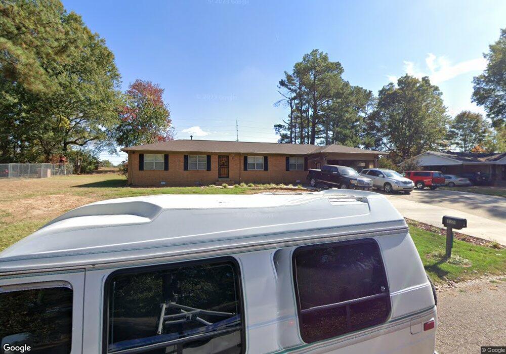
1556 Michael St Covington, TN 38019
Estimated Value: $160,251 - $238,000
Studio
3
Baths
1,996
Sq Ft
$93/Sq Ft
Est. Value
About This Home
This home is located at 1556 Michael St, Covington, TN 38019 and is currently estimated at $185,313, approximately $92 per square foot. 1556 Michael St is a home located in Tipton County with nearby schools including Crestview Elementary School, Crestview Middle School, and Covington High School.
Ownership History
Date
Name
Owned For
Owner Type
Purchase Details
Closed on
Apr 13, 2016
Sold by
Sanders Maxine Gilliam
Bought by
Sanders Maxine Gilliam and Sanders Jerry L
Current Estimated Value
Purchase Details
Closed on
Mar 3, 1997
Sold by
Nelson J R
Bought by
Gilliam Sanders Maxine
Home Financials for this Owner
Home Financials are based on the most recent Mortgage that was taken out on this home.
Original Mortgage
$63,701
Interest Rate
7.88%
Purchase Details
Closed on
Jun 29, 1981
Bought by
Nelson Nelson J and Nelson Shela W
Purchase Details
Closed on
Dec 20, 1976
Purchase Details
Closed on
Jan 1, 1976
Purchase Details
Closed on
Jan 1, 1970
Create a Home Valuation Report for This Property
The Home Valuation Report is an in-depth analysis detailing your home's value as well as a comparison with similar homes in the area
Purchase History
| Date | Buyer | Sale Price | Title Company |
|---|---|---|---|
| Sanders Maxine Gilliam | -- | -- | |
| Gilliam Sanders Maxine | $63,000 | -- | |
| Nelson Nelson J | -- | -- | |
| -- | -- | -- | |
| -- | $29,000 | -- | |
| -- | $19,500 | -- |
Source: Public Records
Mortgage History
| Date | Status | Borrower | Loan Amount |
|---|---|---|---|
| Previous Owner | Not Available | $63,701 |
Source: Public Records
Tax History
| Year | Tax Paid | Tax Assessment Tax Assessment Total Assessment is a certain percentage of the fair market value that is determined by local assessors to be the total taxable value of land and additions on the property. | Land | Improvement |
|---|---|---|---|---|
| 2025 | -- | $34,200 | $4,875 | $29,325 |
| 2024 | -- | $34,200 | $4,875 | $29,325 |
| 2023 | $866 | $34,200 | $4,875 | $29,325 |
| 2022 | $786 | $23,950 | $3,575 | $20,375 |
| 2021 | $786 | $23,950 | $3,575 | $20,375 |
| 2020 | $785 | $23,950 | $3,575 | $20,375 |
| 2019 | $663 | $17,675 | $2,750 | $14,925 |
| 2018 | $663 | $17,675 | $2,750 | $14,925 |
| 2017 | $663 | $17,675 | $2,750 | $14,925 |
| 2016 | $663 | $17,675 | $2,750 | $14,925 |
| 2015 | $662 | $17,675 | $2,750 | $14,925 |
| 2014 | $662 | $17,663 | $0 | $0 |
Source: Public Records
Map
Nearby Homes
- 0 Hwy 51
- 1844 Wooten St
- 1186 U S 51
- LOT 7 Oil Mill Rd
- LOT 5 Oil Mill Rd
- LOT 3 Oil Mill Rd
- LOT 4 Oil Mill Rd
- LOT 8 Oil Mill Rd
- LOT 6 Oil Mill Rd
- 1015 Wortham Dr
- 451 Yarbrough Rd
- 664 Rialto Rd
- 900 Peete St
- 902 Hatchie Ave
- 417 Turner Ln
- 2051 Solo Rd
- 301 N Maple St
- 212 Feezor St
- 215 N Maple St
- 320 N High St
- 1546 Michael St
- 111 Steven Ave
- 105 Steven Ave
- 1557 Michael St
- 1565 Michael St
- 1536 Michael St
- 1549 Michael St
- 1541 Michael St
- 219 Steven Ave
- 1528 Michael St
- 1533 Michael St
- 1566 Andrew St
- 1416 Tennessee 3
- 1588 Andrew St
- 1467 Highway 51 N
- 220 Steven Ave
- 1530 Andrew St
- 1518 Michael St
- 1416 U S 51
- 1449 U S 51
Your Personal Tour Guide
Ask me questions while you tour the home.