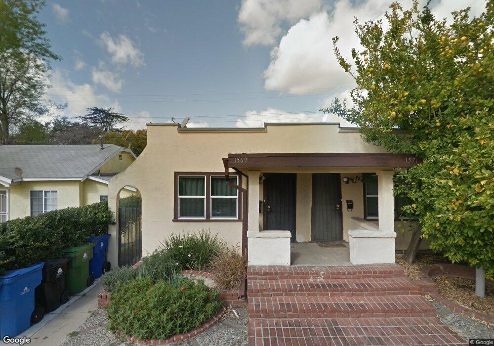
1565 Munson Ave Los Angeles, CA 90042
Eagle Rock NeighborhoodEstimated Value: $966,000 - $1,398,000
2
Beds
2
Baths
1,143
Sq Ft
$1,004/Sq Ft
Est. Value
About This Home
This home is located at 1565 Munson Ave, Los Angeles, CA 90042 and is currently estimated at $1,147,461, approximately $1,003 per square foot. 1565 Munson Ave is a home located in Los Angeles County with nearby schools including Toland Way Elementary School, Eagle Rock High School, and Irving STEAM Magnet School.
Ownership History
Date
Name
Owned For
Owner Type
Purchase Details
Closed on
Jul 17, 2002
Sold by
Moloney Rory P and Maness Mary
Bought by
Pulido Susie
Current Estimated Value
Home Financials for this Owner
Home Financials are based on the most recent Mortgage that was taken out on this home.
Original Mortgage
$232,000
Outstanding Balance
$96,637
Interest Rate
6.6%
Estimated Equity
$1,050,824
Purchase Details
Closed on
Apr 23, 2002
Sold by
Nicholson Gary
Bought by
Maness Mary and Moloney Rory P
Create a Home Valuation Report for This Property
The Home Valuation Report is an in-depth analysis detailing your home's value as well as a comparison with similar homes in the area
Home Values in the Area
Average Home Value in this Area
Purchase History
| Date | Buyer | Sale Price | Title Company |
|---|---|---|---|
| Pulido Susie | $290,000 | Commonwealth Title | |
| Maness Mary | -- | -- |
Source: Public Records
Mortgage History
| Date | Status | Borrower | Loan Amount |
|---|---|---|---|
| Open | Pulido Susie | $232,000 | |
| Closed | Pulido Susie | $43,500 |
Source: Public Records
Tax History Compared to Growth
Tax History
| Year | Tax Paid | Tax Assessment Tax Assessment Total Assessment is a certain percentage of the fair market value that is determined by local assessors to be the total taxable value of land and additions on the property. | Land | Improvement |
|---|---|---|---|---|
| 2025 | $5,201 | $419,996 | $333,107 | $86,889 |
| 2024 | $5,136 | $411,762 | $326,576 | $85,186 |
| 2023 | $5,038 | $403,689 | $320,173 | $83,516 |
| 2022 | $4,803 | $395,775 | $313,896 | $81,879 |
| 2021 | $4,742 | $388,016 | $307,742 | $80,274 |
| 2020 | $4,788 | $384,038 | $304,587 | $79,451 |
| 2019 | $4,600 | $376,509 | $298,615 | $77,894 |
| 2018 | $4,560 | $369,127 | $292,760 | $76,367 |
| 2016 | $4,353 | $354,795 | $281,393 | $73,402 |
| 2015 | $4,290 | $349,467 | $277,167 | $72,300 |
| 2014 | $4,315 | $342,622 | $271,738 | $70,884 |
Source: Public Records
Map
Nearby Homes
- 1607 Campus Rd
- 4666 York Blvd
- 1336 Armadale Ave
- 4707 Toland Way
- 4654 Toland Way
- 1747 N Avenue 46
- 4854 Buchanan St
- 4925 Buchanan St
- 2161 Ridgeview Ave
- 4780 Hub St
- 4500 Mont Eagle Place
- 2035 Las Colinas Ave
- 1113 N Avenue 50
- 2402 Langdale Ave
- 4824 Toland Way
- 1745 College View Place
- 1048 Dexter St
- 5117 Stratford Rd
- 1553 Verbena Way
- 1037 N Avenue 50
- 1570 N Avenue 47
- 1561 Munson Ave
- 1557 Munson Ave
- 1576 N Avenue 47
- 1574 N Avenue 47
- 1575 Munson Ave
- 1575 Munson Ave Unit 1/2
- 1575 Munson Ave
- 1553 Munson Ave
- 1541 Campus Rd
- 1549 Munson Ave
- 1570 Munson Ave
- 1574 Munson Ave
- 1569 N Avenue 47
- 1563 N Avenue 47
- 1573 N Avenue 47
- 1562 Munson Ave
- 1551 Campus Rd
- 1557 N Avenue 47
- 1575 N Avenue 47