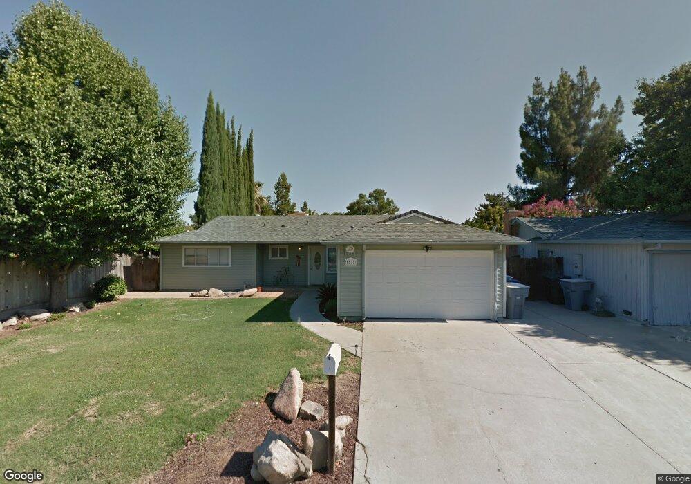
1571 Scott Ave Clovis, CA 93611
Estimated Value: $336,000 - $373,638
3
Beds
2
Baths
1,268
Sq Ft
$284/Sq Ft
Est. Value
About This Home
This home is located at 1571 Scott Ave, Clovis, CA 93611 and is currently estimated at $359,879, approximately $283 per square foot. 1571 Scott Ave is a home located in Fresno County with nearby schools including Jefferson Elementary School, Clark Intermediate School, and Clovis High School.
Ownership History
Date
Name
Owned For
Owner Type
Purchase Details
Closed on
Mar 21, 2019
Sold by
Garnica Giovanni
Bought by
Garnica William
Current Estimated Value
Purchase Details
Closed on
Mar 7, 2011
Sold by
Pacific Mortgage Servicing Lp
Bought by
Garnica Giovanni
Purchase Details
Closed on
Jun 18, 2010
Sold by
Padgett Krista Michelle
Bought by
Pacific Mortgage Servicing Lp
Purchase Details
Closed on
Nov 20, 2001
Sold by
Rhodes Jeffrey and Rhodes Alison
Bought by
Padgett Krista Michelle
Home Financials for this Owner
Home Financials are based on the most recent Mortgage that was taken out on this home.
Original Mortgage
$101,250
Interest Rate
6.8%
Create a Home Valuation Report for This Property
The Home Valuation Report is an in-depth analysis detailing your home's value as well as a comparison with similar homes in the area
Home Values in the Area
Average Home Value in this Area
Purchase History
| Date | Buyer | Sale Price | Title Company |
|---|---|---|---|
| Garnica William | -- | None Available | |
| Garnica Giovanni | $129,000 | Chicago Title Company | |
| Pacific Mortgage Servicing Lp | $114,000 | None Available | |
| Padgett Krista Michelle | $135,000 | North American Title Co |
Source: Public Records
Mortgage History
| Date | Status | Borrower | Loan Amount |
|---|---|---|---|
| Previous Owner | Padgett Krista Michelle | $101,250 | |
| Closed | Padgett Krista Michelle | $33,750 |
Source: Public Records
Tax History
| Year | Tax Paid | Tax Assessment Tax Assessment Total Assessment is a certain percentage of the fair market value that is determined by local assessors to be the total taxable value of land and additions on the property. | Land | Improvement |
|---|---|---|---|---|
| 2025 | $1,963 | $165,259 | $49,576 | $115,683 |
| 2023 | $1,925 | $158,843 | $47,651 | $111,192 |
| 2022 | $1,864 | $155,729 | $46,717 | $109,012 |
| 2021 | $1,812 | $152,676 | $45,801 | $106,875 |
| 2020 | $1,805 | $151,112 | $45,332 | $105,780 |
| 2019 | $1,770 | $148,150 | $44,444 | $103,706 |
| 2018 | $1,732 | $145,246 | $43,573 | $101,673 |
| 2017 | $1,703 | $142,399 | $42,719 | $99,680 |
| 2016 | $1,645 | $139,608 | $41,882 | $97,726 |
| 2015 | $1,620 | $137,512 | $41,253 | $96,259 |
| 2014 | $1,591 | $134,819 | $40,445 | $94,374 |
Source: Public Records
Map
Nearby Homes
- 1622 Dennis Ave
- 1515 Keats Ave
- 1559 Poe Ln
- 1428 Miami Ave
- 1721 Beverly Ave
- 1273 Bundy Ave
- 1606 Barstow Ave
- 1334 Shirley Ave
- 2214 Fordham Ave
- 1584 Laverne Ave
- 1876 Cougar Ln
- 2306 Stanford Ave
- 3497 Shaw Ave
- 1895 Dennis Ave
- 1228 Jefferson Ave
- 1488 Alamos Ave
- 860 Mcarthur Ave
- 760 Sunnyside Ave
- 2627 Stanford Ave
- 2612 Renn Ave
- 1581 Scott Ave
- 1645 Scott Place
- 1635 Scott Place
- 1582 Stanford Cir
- 1589 Scott Ave
- 1625 Scott Place
- 1590 Stanford Cir
- 1701 Fordham Ave
- 1597 Scott Ave
- 1556 Scott Ave
- 1615 Scott Place
- 1580 Stanford Cir
- 1598 Stanford Cir
- 1702 Stanford Ave
- 1546 Scott Ave
- 1646 Scott Place
- 1634 Scott Place
- 1624 Scott Place
- 1712 Stanford Ave
- 1536 Scott Ave
Your Personal Tour Guide
Ask me questions while you tour the home.