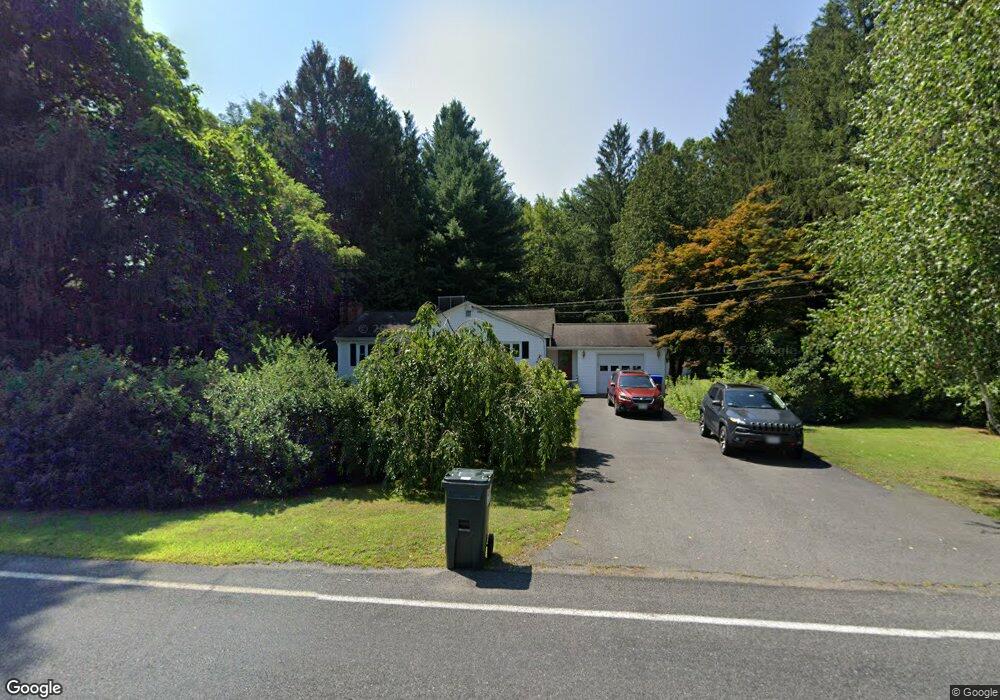
159 Plumtree Rd Sunderland, MA 01375
Estimated Value: $411,000 - $497,000
3
Beds
1
Bath
1,656
Sq Ft
$275/Sq Ft
Est. Value
About This Home
This home is located at 159 Plumtree Rd, Sunderland, MA 01375 and is currently estimated at $456,151, approximately $275 per square foot. 159 Plumtree Rd is a home located in Franklin County with nearby schools including Sunderland Elementary School and Frontier Regional School.
Ownership History
Date
Name
Owned For
Owner Type
Purchase Details
Closed on
Jan 28, 2013
Sold by
Judith Brosky Lt
Bought by
Johnson Karl A and Johnson Patricia A
Current Estimated Value
Purchase Details
Closed on
Jun 29, 2012
Sold by
Brosky Judith A and Brosky Richard L
Bought by
Johnson Patricia A and Johnson Karl A
Purchase Details
Closed on
Feb 23, 2012
Sold by
Brosky Richard L
Bought by
Brosky Judith A
Purchase Details
Closed on
Mar 31, 2011
Sold by
Brosky Maurice and Brosky Judith
Bought by
Brosky Richard L
Purchase Details
Closed on
Apr 29, 2010
Sold by
Brosky Maurice G and Brosky Judith Ann
Bought by
Brosky Richard L
Create a Home Valuation Report for This Property
The Home Valuation Report is an in-depth analysis detailing your home's value as well as a comparison with similar homes in the area
Home Values in the Area
Average Home Value in this Area
Purchase History
| Date | Buyer | Sale Price | Title Company |
|---|---|---|---|
| Johnson Karl A | -- | -- | |
| Johnson Karl A | -- | -- | |
| Johnson Patricia A | $233,000 | -- | |
| Brosky Judith A | -- | -- | |
| Brosky Judith A | -- | -- | |
| Brosky Richard L | -- | -- | |
| Brosky Richard L | -- | -- | |
| Brosky Richard L | -- | -- |
Source: Public Records
Mortgage History
| Date | Status | Borrower | Loan Amount |
|---|---|---|---|
| Previous Owner | Brosky Richard L | $108,000 | |
| Previous Owner | Brosky Richard L | $50,000 |
Source: Public Records
Tax History
| Year | Tax Paid | Tax Assessment Tax Assessment Total Assessment is a certain percentage of the fair market value that is determined by local assessors to be the total taxable value of land and additions on the property. | Land | Improvement |
|---|---|---|---|---|
| 2025 | $46 | $353,100 | $128,000 | $225,100 |
| 2024 | $4,640 | $353,100 | $128,000 | $225,100 |
| 2023 | $4,238 | $331,100 | $116,300 | $214,800 |
| 2022 | $4,272 | $290,600 | $99,700 | $190,900 |
| 2021 | $4,035 | $260,500 | $92,400 | $168,100 |
| 2020 | $4,021 | $260,400 | $92,400 | $168,000 |
| 2019 | $3,885 | $253,400 | $89,700 | $163,700 |
| 2018 | $3,711 | $247,400 | $86,200 | $161,200 |
| 2017 | $3,502 | $244,200 | $86,200 | $158,000 |
| 2016 | $3,496 | $238,500 | $84,400 | $154,100 |
| 2015 | $3,413 | $238,500 | $84,400 | $154,100 |
| 2014 | $3,320 | $237,500 | $84,400 | $153,100 |
Source: Public Records
Map
Nearby Homes
- 38 S Plain Rd
- 6 Shattuck Rd
- 3 Frost Ln
- 10 Depot Rd
- 113 Juggler Meadow Rd
- 167 Rolling Ridge Rd
- 12 Teawaddle Ln
- Lot 3 Roosevelt St
- 100 Depot Rd
- 185 Cherry Ln
- Lot A Kingman Rd
- 15 Crestview Dr
- 59 N Hatfield Rd
- 26 Falls Rd
- Lot A January Hills Rd
- 0 Straits Rd
- 26 S Main St
- 7 Christian Ln
- 0 Greenfield Rd Unit 73472322
- 0 North St Unit 73407299
- 139 Plumtree Rd
- 0 Plumtree Rd Toye 116 Unit 30285389
- 147 Plumtree Rd
- 167 Plumtree Rd
- 168 Plumtree Rd
- 158 Plumtree Rd
- 145 Plumtree Rd
- 175 Plumtree Rd
- 152 Plumtree Rd
- 141 Plumtree Rd
- 184 Plumtree Rd
- 179 Plumtree Rd
- 143 Plumtree Rd
- 144 Plumtree Rd
- 137 Plumtree Rd
- 188 Plumtree Rd
- 121 N Plain Rd
- 130 Plumtree Rd
- 187 Plumtree Rd
- 169 Plumtree Rd
Your Personal Tour Guide
Ask me questions while you tour the home.