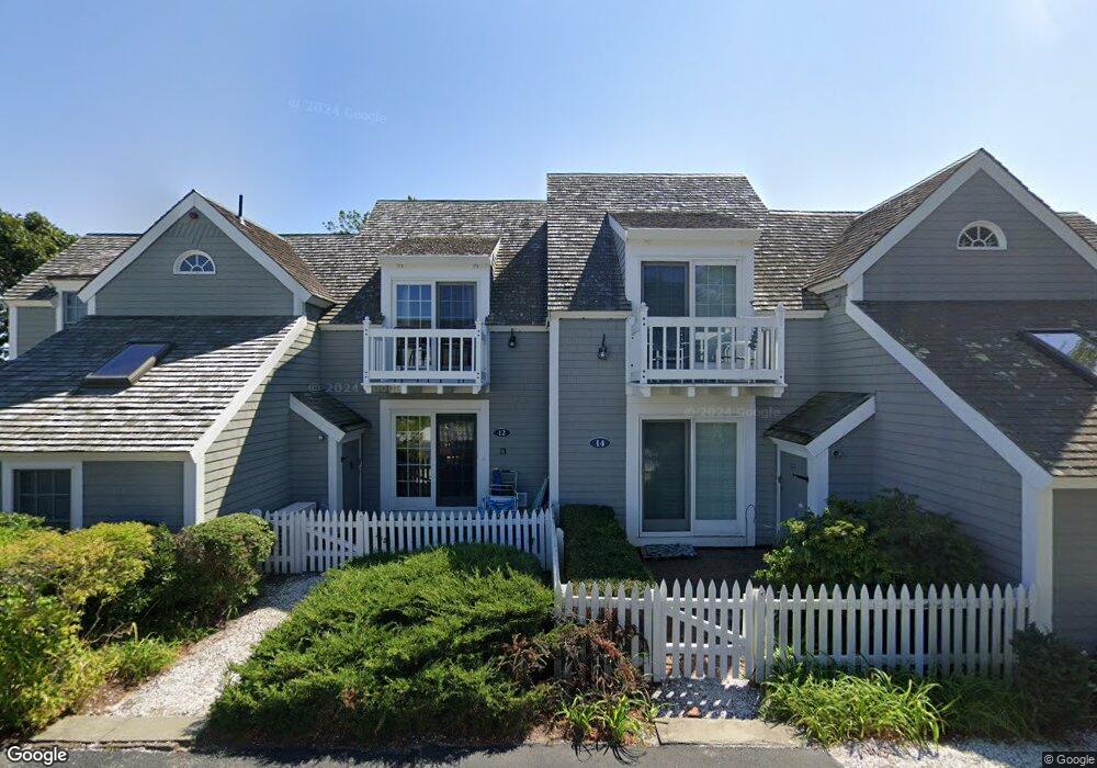
16 Barneys Ave Mashpee, MA 02649
New Seabury-Popponesset Island NeighborhoodEstimated Value: $902,000 - $1,016,000
2
Beds
2
Baths
985
Sq Ft
$961/Sq Ft
Est. Value
About This Home
This home is located at 16 Barneys Ave, Mashpee, MA 02649 and is currently estimated at $946,130, approximately $960 per square foot. 16 Barneys Ave is a home located in Barnstable County with nearby schools including Kenneth C. Coombs School, Quashnet School, and Mashpee Middle School.
Ownership History
Date
Name
Owned For
Owner Type
Purchase Details
Closed on
Aug 12, 2005
Sold by
Mawrey Alison and Mawrey Robert S
Bought by
Finnance Beth M
Current Estimated Value
Home Financials for this Owner
Home Financials are based on the most recent Mortgage that was taken out on this home.
Original Mortgage
$359,650
Outstanding Balance
$187,470
Interest Rate
5.54%
Estimated Equity
$758,660
Purchase Details
Closed on
Jun 14, 1996
Sold by
Reidy Charles P and Reidy Jane M
Bought by
Many Joanne
Home Financials for this Owner
Home Financials are based on the most recent Mortgage that was taken out on this home.
Original Mortgage
$159,300
Interest Rate
7.97%
Mortgage Type
Purchase Money Mortgage
Create a Home Valuation Report for This Property
The Home Valuation Report is an in-depth analysis detailing your home's value as well as a comparison with similar homes in the area
Home Values in the Area
Average Home Value in this Area
Purchase History
| Date | Buyer | Sale Price | Title Company |
|---|---|---|---|
| Finnance Beth M | $520,000 | -- | |
| Many Joanne | $177,000 | -- |
Source: Public Records
Mortgage History
| Date | Status | Borrower | Loan Amount |
|---|---|---|---|
| Open | Finnance Beth M | $359,650 | |
| Previous Owner | Many Joanne | $159,300 |
Source: Public Records
Tax History
| Year | Tax Paid | Tax Assessment Tax Assessment Total Assessment is a certain percentage of the fair market value that is determined by local assessors to be the total taxable value of land and additions on the property. | Land | Improvement |
|---|---|---|---|---|
| 2025 | $5,467 | $825,900 | $0 | $825,900 |
| 2024 | $5,120 | $796,200 | $0 | $796,200 |
| 2023 | $4,714 | $672,400 | $0 | $672,400 |
| 2022 | $4,305 | $526,900 | $0 | $526,900 |
| 2021 | $4,350 | $479,600 | $0 | $479,600 |
| 2020 | $4,528 | $498,100 | $0 | $498,100 |
| 2019 | $4,334 | $478,900 | $0 | $478,900 |
| 2018 | $4,034 | $452,200 | $0 | $452,200 |
| 2017 | $4,036 | $439,200 | $0 | $439,200 |
| 2016 | $3,950 | $427,500 | $0 | $427,500 |
| 2015 | $3,710 | $407,200 | $0 | $407,200 |
| 2014 | $3,820 | $406,800 | $0 | $406,800 |
Source: Public Records
Map
Nearby Homes
- 21 Milestone Way Unit 620
- 33 Landmark Ave
- 15 Brant Rock Rd Unit 765
- 11 Milestone Way Unit 624
- 6 Hammock Pond Rd
- 6 Hammock Pond Rd Unit 6
- 25 Milestone Way Unit 25
- 25 Milestone Way
- 3 Hyannis Point Rd Unit 790
- 3 Hyannis Point Rd
- 46 Greensward Cir
- 40 Triton Way
- 101 Greensward Rd
- 251 Shore Dr Unit D2
- 251 Shore Dr Unit C2
- 251 Shore Dr Unit C2
- 251 Shore Dr Unit D2
- 16 Slice Way
- 42 Fells Pond Rd
- 22 Mid Iron Way Unit 7511
- 12 Barneys Ave
- 12 Barneys Ave Unit 12
- 12 Barneys Ave Unit 703
- 10 Barneys Ave
- 8 Barneys Ave
- 5 Flying Cloud Cir
- 7 Flying Cloud Cir
- 5 Flying Cloud Cir Unit 714
- 7 Flying Cloud Cir Unit 7
- 7 Flying Cloud Cir Unit 713
- 14 Brant Rock Rd
- 25 Flying Cloud Cir Unit 25
- 25 Flying Cloud Cir
- 21 Flying Cloud Cir
- 21 Flying Cloud Cir Unit 21
- 21 Flying Cloud Cir Unit 733
- 48 Landmark Ave
- 46 Landmark Ave
- 10 Flying Cloud Cir
- 5 Colemans Way
Your Personal Tour Guide
Ask me questions while you tour the home.