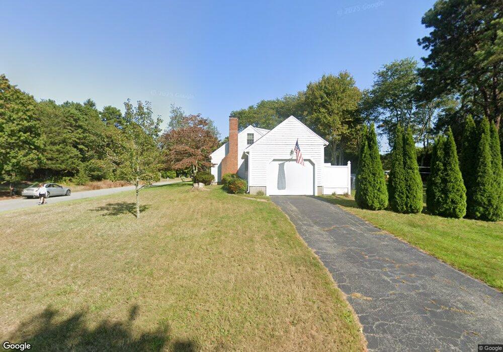
16 Furlong Way Cotuit, MA 02635
Cotuit NeighborhoodEstimated Value: $640,000 - $850,000
3
Beds
1
Bath
1,346
Sq Ft
$564/Sq Ft
Est. Value
About This Home
This home is located at 16 Furlong Way, Cotuit, MA 02635 and is currently estimated at $759,772, approximately $564 per square foot. 16 Furlong Way is a home located in Barnstable County with nearby schools including West Villages Elementary School, Barnstable United Elementary School, and Barnstable Intermediate School.
Ownership History
Date
Name
Owned For
Owner Type
Purchase Details
Closed on
Sep 10, 2001
Sold by
Stec Joseph J Est
Bought by
Horton Todd A
Current Estimated Value
Home Financials for this Owner
Home Financials are based on the most recent Mortgage that was taken out on this home.
Original Mortgage
$130,000
Outstanding Balance
$50,914
Interest Rate
7.05%
Mortgage Type
Purchase Money Mortgage
Estimated Equity
$708,858
Create a Home Valuation Report for This Property
The Home Valuation Report is an in-depth analysis detailing your home's value as well as a comparison with similar homes in the area
Home Values in the Area
Average Home Value in this Area
Purchase History
| Date | Buyer | Sale Price | Title Company |
|---|---|---|---|
| Horton Todd A | $198,000 | -- |
Source: Public Records
Mortgage History
| Date | Status | Borrower | Loan Amount |
|---|---|---|---|
| Open | Horton Todd A | $130,000 |
Source: Public Records
Tax History Compared to Growth
Tax History
| Year | Tax Paid | Tax Assessment Tax Assessment Total Assessment is a certain percentage of the fair market value that is determined by local assessors to be the total taxable value of land and additions on the property. | Land | Improvement |
|---|---|---|---|---|
| 2025 | $6,102 | $730,800 | $244,100 | $486,700 |
| 2024 | $4,444 | $563,900 | $244,100 | $319,800 |
| 2023 | $4,270 | $510,100 | $221,900 | $288,200 |
| 2022 | $4,098 | $396,300 | $152,700 | $243,600 |
| 2021 | $4,022 | $364,300 | $155,000 | $209,300 |
| 2020 | $4,154 | $354,700 | $155,000 | $199,700 |
| 2019 | $4,100 | $345,100 | $164,400 | $180,700 |
| 2018 | $4,138 | $348,300 | $191,600 | $156,700 |
| 2017 | $4,027 | $341,300 | $191,600 | $149,700 |
| 2016 | $3,900 | $338,800 | $189,100 | $149,700 |
| 2015 | $3,920 | $340,300 | $189,900 | $150,400 |
Source: Public Records
Map
Nearby Homes
- 220 Dunrobin Rd
- 226 Dunrobin Rd
- 783
- 4701 Falmouth Rd
- 428 Main St
- 70 Cape Dr Unit 14D
- 75 Bob White Run
- 15 Hampton Ct Unit 15
- 15 Hampton Ct
- 70 Simons Rd Unit E
- 70 Simons Rd
- 16 Spring Brook Ln
- 80 Curlew Way
- 45 Simons Rd Unit A
- 15 E Riverview Ave Unit 15E
- 6 Mayfair Ct
- 6 Mayfair Ct Unit 6
- 24 Hampton Ct Unit 24
- 24 Hampton Ct
- 4 Bishops Park
- 55 Trout Brook Rd
- 144 Trout Brook Rd
- 43 Trout Brook Rd
- 54 Trout Brook Rd
- 75 Trout Brook Rd
- 23 Trout Brook Rd
- 76 Trout Brook Rd
- 35 Smokehouse Ln
- 34 Trout Brook Rd
- 32 Furlong Way
- 89 Trout Brook Rd
- 25 Furlong Way
- 75 Smokehouse Ln
- 44 Sampsons House Knob
- 44 Sampsons House Knob
- 215 Main St
- 41 Furlong Way
- 101 Trout Brook Rd
- 100 Trout Brook Rd
- 207 Main St