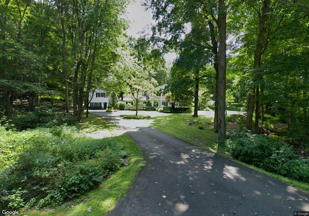
16 Peaceable St Redding, CT 06896
Estimated Value: $882,000 - $944,000
4
Beds
3
Baths
2,276
Sq Ft
$402/Sq Ft
Est. Value
About This Home
This home is located at 16 Peaceable St, Redding, CT 06896 and is currently estimated at $913,964, approximately $401 per square foot. 16 Peaceable St is a home located in Fairfield County with nearby schools including Redding Elementary School, John Read Middle School, and Joel Barlow High School.
Ownership History
Date
Name
Owned For
Owner Type
Purchase Details
Closed on
Aug 24, 2005
Sold by
Carter John M and Carter Karen S
Bought by
Sackman Jay M
Current Estimated Value
Home Financials for this Owner
Home Financials are based on the most recent Mortgage that was taken out on this home.
Original Mortgage
$450,000
Interest Rate
5.68%
Purchase Details
Closed on
Oct 24, 2000
Sold by
Wong Roger B and Wong Carmen
Bought by
Carter John and Carter Karen
Purchase Details
Closed on
Dec 5, 1990
Sold by
Adams Anthony
Bought by
Wong Roger
Create a Home Valuation Report for This Property
The Home Valuation Report is an in-depth analysis detailing your home's value as well as a comparison with similar homes in the area
Home Values in the Area
Average Home Value in this Area
Purchase History
| Date | Buyer | Sale Price | Title Company |
|---|---|---|---|
| Sackman Jay M | $689,000 | -- | |
| Carter John | $335,000 | -- | |
| Wong Roger | $260,000 | -- |
Source: Public Records
Mortgage History
| Date | Status | Borrower | Loan Amount |
|---|---|---|---|
| Open | Wong Roger | $417,000 | |
| Closed | Wong Roger | $450,000 | |
| Closed | Wong Roger | $100,000 |
Source: Public Records
Tax History Compared to Growth
Tax History
| Year | Tax Paid | Tax Assessment Tax Assessment Total Assessment is a certain percentage of the fair market value that is determined by local assessors to be the total taxable value of land and additions on the property. | Land | Improvement |
|---|---|---|---|---|
| 2025 | $14,678 | $496,900 | $146,300 | $350,600 |
| 2024 | $14,271 | $496,900 | $146,300 | $350,600 |
| 2023 | $13,759 | $496,900 | $146,300 | $350,600 |
| 2022 | $13,403 | $402,000 | $158,000 | $244,000 |
| 2021 | $11,885 | $397,800 | $158,000 | $239,800 |
| 2020 | $11,546 | $397,800 | $158,000 | $239,800 |
| 2019 | $8,670 | $397,800 | $158,000 | $239,800 |
| 2018 | $12,618 | $397,800 | $158,000 | $239,800 |
| 2017 | $13,062 | $441,000 | $172,800 | $268,200 |
| 2016 | $12,895 | $441,000 | $172,800 | $268,200 |
| 2015 | $12,749 | $441,000 | $172,800 | $268,200 |
| 2014 | $12,749 | $441,000 | $172,800 | $268,200 |
Source: Public Records
Map
Nearby Homes
- 7 Peaceable St
- 66 Portland Ave
- 64 Portland Ave
- 26 Wilridge Rd
- 269 Thunder Lake Rd
- 0 Mountain Rd
- 54 Mountain Rd
- 311 Old Branchville Rd
- 20 Georgetown Rd
- 0 Old Mill Rd
- 15 Laurel Hill Rd
- 219 Redding Rd
- 00 Old Mill Rd
- 175 Mountain Rd
- 96 Georgetown Rd
- 283 Redding Rd
- 22 Ledgewood Rd
- 299 Redding Rd
- 95 Ridgewood Rd
- 134 Nod Rd
- 18 Peaceable St
- 10 Peaceable St
- 11 Peaceable St
- 15 Peaceable St
- 14 Peaceable St
- 20 Peaceable St
- 12 Peaceable St
- 6 Peaceable St
- 95 Apple Ln
- 24 Peaceable St
- 3 Peaceable St
- 31 Peaceable St
- 19 Peaceable St
- 26 Peaceable St
- 4 Peaceable St
- 15 Portland Hill Rd
- 5 Portland Hill Rd
- 5A Portland Hill Rd
- 10 Mountain Rd
- 11 Portland Hill Rd