Estimated Value: $384,786 - $402,000
2
Beds
2
Baths
1,279
Sq Ft
$309/Sq Ft
Est. Value
About This Home
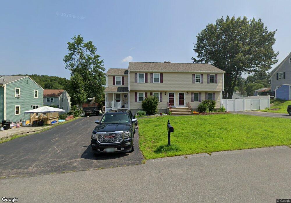
This home is located at 16 Phillip Rd Unit R, Derry, NH 03038 and is currently estimated at $395,697, approximately $309 per square foot. 16 Phillip Rd Unit R is a home located in Rockingham County with nearby schools including South Range Elementary School, West Running Brook Middle School, and Pinkerton Academy.
Ownership History
Date
Name
Owned For
Owner Type
Purchase Details
Closed on
Aug 27, 2019
Sold by
Nolan Stephen P and Deputy Mark R
Bought by
Stephen P Nolan Sr Ret
Current Estimated Value
Purchase Details
Closed on
Aug 6, 2018
Sold by
Guidi Elanor Phyllis E
Bought by
Nolan Stephen P and Deputy Mark R
Home Financials for this Owner
Home Financials are based on the most recent Mortgage that was taken out on this home.
Original Mortgage
$120,000
Interest Rate
5.5%
Mortgage Type
Adjustable Rate Mortgage/ARM
Create a Home Valuation Report for This Property
The Home Valuation Report is an in-depth analysis detailing your home's value as well as a comparison with similar homes in the area
Home Values in the Area
Average Home Value in this Area
Purchase History
| Date | Buyer | Sale Price | Title Company |
|---|---|---|---|
| Stephen P Nolan Sr Ret | -- | -- | |
| Nolan Stephen P | $160,000 | -- |
Source: Public Records
Mortgage History
| Date | Status | Borrower | Loan Amount |
|---|---|---|---|
| Previous Owner | Nolan Stephen P | $120,000 |
Source: Public Records
Tax History Compared to Growth
Tax History
| Year | Tax Paid | Tax Assessment Tax Assessment Total Assessment is a certain percentage of the fair market value that is determined by local assessors to be the total taxable value of land and additions on the property. | Land | Improvement |
|---|---|---|---|---|
| 2024 | $6,472 | $346,300 | $0 | $346,300 |
| 2023 | $6,078 | $293,900 | $0 | $293,900 |
| 2022 | $5,596 | $293,900 | $0 | $293,900 |
| 2021 | $5,494 | $221,900 | $0 | $221,900 |
| 2020 | $5,401 | $221,900 | $0 | $221,900 |
| 2019 | $5,025 | $192,400 | $89,000 | $103,400 |
| 2018 | $5,008 | $192,400 | $89,000 | $103,400 |
| 2017 | $4,874 | $168,900 | $84,500 | $84,400 |
| 2016 | $4,570 | $168,900 | $84,500 | $84,400 |
| 2015 | $3,002 | $102,700 | $42,300 | $60,400 |
| 2014 | $3,021 | $102,700 | $42,300 | $60,400 |
| 2013 | $3,231 | $102,600 | $41,400 | $61,200 |
Source: Public Records
Map
Nearby Homes
- 30 Kendall Pond Rd Unit 77
- 30 Kendall Pond Rd Unit 87
- 5 Sunnyside Ln Unit R
- 65 Fordway Extension Unit 211
- 23 Pleasant St
- 37 Highland Ave Unit 1
- 23 Oak St
- 90L Derryfield Rd
- 90L Derryfield Rd Unit L
- 24 South Ave
- 29 Central St
- 31 South Ave Unit B
- 31 South Ave Unit L
- 8 Birch St
- 144 Rockingham Rd
- 139 Rockingham Rd Unit 21
- 139 Rockingham Rd Unit 30
- 100 Rockingham Rd Unit 9
- 18 Maple St Unit 1
- 84 E Broadway
- 16 Phillip Rd Unit L
- 18 Phillip Rd Unit R
- 18 Phillip Rd Unit L
- 14 Phillip Rd Unit R
- 14 Phillip Rd Unit L
- 13 Brian Ave Unit R
- 13 Brian Ave Unit L
- 11 Brian Ave Unit R
- 11 Brian Ave Unit L
- 14L Phillip Rd Unit L
- 9 Brian Ave Unit R
- 9 Brian Ave Unit L
- 17 Phillip Rd Unit R
- 17 Phillip Rd Unit L
- 15 Phillip Rd Unit R
- 15 Phillip Rd Unit L
- 15 Phillip Rd Unit 15
- 15 Brian Ave
- 15 Brian Ave Unit R
- 15 Brian Ave Unit L