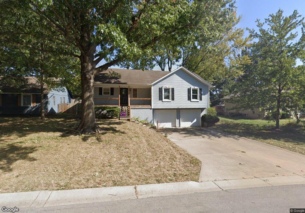
1601 NE Westwind Dr Lees Summit, MO 64086
Estimated Value: $271,354 - $313,000
3
Beds
2
Baths
1,200
Sq Ft
$250/Sq Ft
Est. Value
About This Home
This home is located at 1601 NE Westwind Dr, Lees Summit, MO 64086 and is currently estimated at $300,089, approximately $250 per square foot. 1601 NE Westwind Dr is a home located in Jackson County with nearby schools including Underwood Elementary School, Bernard C. Campbell Middle School, and Lee's Summit North High School.
Ownership History
Date
Name
Owned For
Owner Type
Purchase Details
Closed on
Oct 19, 2012
Sold by
Westley Gloria F
Bought by
Westley Gloria F and Gloria F Westley Living Trust
Current Estimated Value
Home Financials for this Owner
Home Financials are based on the most recent Mortgage that was taken out on this home.
Original Mortgage
$95,000
Interest Rate
3.59%
Mortgage Type
New Conventional
Purchase Details
Closed on
Jul 13, 2009
Sold by
Westley Gloria F
Bought by
Westley Gloria F and The Gloria F Westley Living Trust
Create a Home Valuation Report for This Property
The Home Valuation Report is an in-depth analysis detailing your home's value as well as a comparison with similar homes in the area
Home Values in the Area
Average Home Value in this Area
Purchase History
| Date | Buyer | Sale Price | Title Company |
|---|---|---|---|
| Westley Gloria F | -- | Assured Quality Title Co | |
| Westley Gloria F | -- | Assured Quality Title Co | |
| Westley Gloria F | -- | None Available |
Source: Public Records
Mortgage History
| Date | Status | Borrower | Loan Amount |
|---|---|---|---|
| Closed | Westley Gloria F | $95,000 |
Source: Public Records
Tax History
| Year | Tax Paid | Tax Assessment Tax Assessment Total Assessment is a certain percentage of the fair market value that is determined by local assessors to be the total taxable value of land and additions on the property. | Land | Improvement |
|---|---|---|---|---|
| 2025 | $2,616 | $38,695 | $6,851 | $31,844 |
| 2024 | $2,597 | $36,227 | $5,713 | $30,514 |
| 2023 | $2,597 | $36,227 | $5,713 | $30,514 |
| 2022 | $2,362 | $29,260 | $6,061 | $23,199 |
| 2021 | $2,411 | $29,260 | $6,061 | $23,199 |
| 2020 | $2,315 | $27,826 | $6,061 | $21,765 |
| 2019 | $2,252 | $27,826 | $6,061 | $21,765 |
| 2018 | $2,235 | $25,627 | $3,498 | $22,129 |
| 2016 | $2,201 | $24,985 | $3,762 | $21,223 |
Source: Public Records
Map
Nearby Homes
- 1133 NE Mulberry St
- 1138 NE Mulberry St
- 1701 NE Auburn Dr
- 1118 NE Deerbrook Terrace
- 1213 NE Ball Dr
- 812 NE Mulberry St
- 809 NE Cedar St
- 816 NE Pollard St
- 1708 NE Balboa St
- 1300 NE Browning Ln
- 1717 NE Luther Rd
- 1700 NE Bluff St
- 1708 NE Bluff St
- 1704 NE Bluff St
- 905 NE Country Ln
- 1616 NE Bluff St
- 1345 NE Foxwood Dr
- 401 NE Mulberry St
- 400 NE Mulberry St
- 1325 NE Foxwood Dr
- 1605 NE Westwind Dr
- 1539 NE Westwind Dr
- 1609 NE Westwind Dr
- 1142 NE Mulberry St
- 1146 NE Mulberry St
- 1600 NE Westwind Dr
- 1604 NE Westwind Dr
- 1535 NE Westwind Dr
- 1150 NE Mulberry St
- 1608 NE Westwind Dr
- 1530 NE Westwind Dr
- 1613 NE Westwind Dr
- 1134 NE Mulberry St
- 1612 NE Westwind Dr
- 1154 NE Mulberry St
- 1531 NE Westwind Dr
- 1527 NE Westwind Dr
- 1617 NE Westwind Dr
- 1130 NE Mulberry St
- 1145 NE Mulberry St
Your Personal Tour Guide
Ask me questions while you tour the home.