
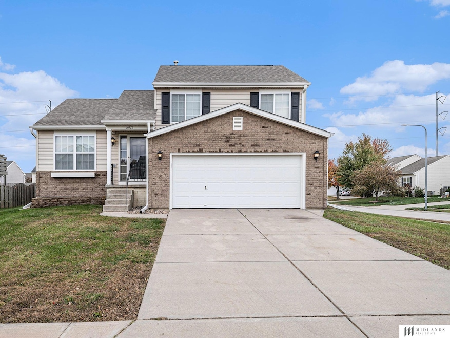
16125 Greenleaf St Omaha, NE 68136
Millard Park Neighborhood
3
Beds
3
Baths
1,622
Sq Ft
2006
Built
Highlights
- Vaulted Ceiling
- Corner Lot
- Forced Air Heating and Cooling System
- Black Elk Elementary School Rated A-
- 2 Car Attached Garage
About This Home
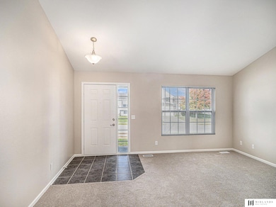
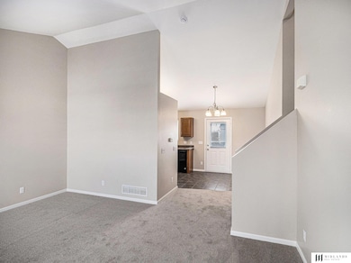
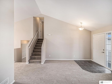
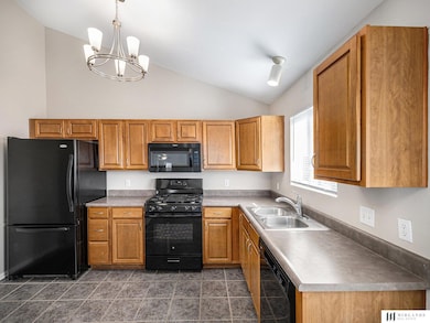
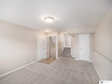
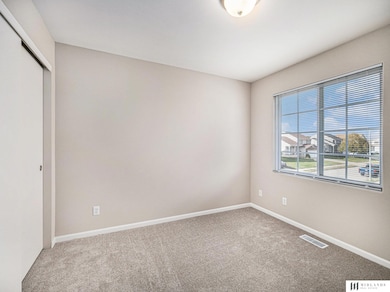
Come see this completely refreshed, neutral pallet, 3 bedroom, 3 bathroom multi-level home in Millard! Enjoy the spacious open concept living areas with vaulted ceilings. Upstairs are three bedrooms, including the primary bedroom with ensuite bath. The finished basement offers extra living space and the 3rd bathroom and laundry area. Corner lot and a 2 car attached garage. Application Fees apply, one application per each adult required.
Home Details
Home Type
- Single Family
Est. Annual Taxes
- $4,421
Year Built
- Built in 2006
Lot Details
- Corner Lot
Parking
- 2 Car Attached Garage
Interior Spaces
- 1,622 Sq Ft Home
- Multi-Level Property
- Vaulted Ceiling
- Partially Finished Basement
Kitchen
- Oven or Range
- Microwave
- Freezer
- Dishwasher
- Disposal
Bedrooms and Bathrooms
- 3 Bedrooms
- 3 Bathrooms
Schools
- Black Elk Elementary School
- Harry Andersen Middle School
- Millard South High School
Utilities
- Forced Air Heating and Cooling System
- Heating System Uses Natural Gas
Community Details
- Springhill Subdivision
Listing and Financial Details
- Property Available on 11/4/25
- Assessor Parcel Number 011579405
Map
About the Listing Agent
JoAnne joined Midlands Real Estate in 2017 as an owner and REALTOR®. She has owned and managed rental properties for over 20 years. As a lifelong resident of the Omaha Metro area, she has extensive knowledge of local communities and the market. She would love to put her knowledge and passion to work for you whether you're buying, selling, or investing.
JoAnne's Other Listings
Source: Great Plains Regional MLS
MLS Number: 22531625
APN: 011579405
Disclaimer: Certain information contained herein is derived from information provided by parties other than Homes.com. All information provided is deemed reliable, but is not guaranteed to be accurate and should be independently verified.
![]() Listing information is provided by Participants of the Great Plains Regional Multiple Listing Service Inc.
Listing information is provided by Participants of the Great Plains Regional Multiple Listing Service Inc.
IDX information is provided exclusively for personal, non-commercial use, and may not be used for any purpose other than to identify prospective properties consumers may be interested in purchasing.
Information is deemed reliable but not guaranteed.
Copyright 2025, Great Plains Regional MLS LLC
Nearby Homes
- 16122 Birch Ave
- 16050 Cary St
- 16334 Heather St
- 7910 S 159th St
- 7816 S 161st St
- 7730 S 161st Terrace
- 7734 S 162nd St
- 16431 Cary St
- 16113 Timberlane Dr
- 16125 Timberlane Dr
- 16528 Briar St
- 16130 Timberlane Dr
- 15818 Timberlane Dr
- 16521 Redwood St
- 7007 S 156th Ave
- 7916 Rock Creek Cir
- 16113 Josephine St
- 8903 S 166th St
- 8809 S 167th St
- 16498 Cinnamon Dr
- 14814 Giles Rd
- 6710 S 165th Ave
- 7507 S 147th St
- 15551 Adams St
- 7565 S 146th St
- 8711 S 143rd St
- 7007 S 145th St
- 18217 Cary St
- 9004 David Cir
- 7822 S 184th Ave
- 16751 Morgan Ave
- 6816 S 137th Plaza
- 5806 S 141st Plaza
- 17801 Cypress Dr
- 17665 Welch Plaza
- 13106 Chandler Road Plaza
- 19224 Olive Plaza
- 6720 S 191st St
- 6709 S 191st Ave
- 19156 Drexel Cir