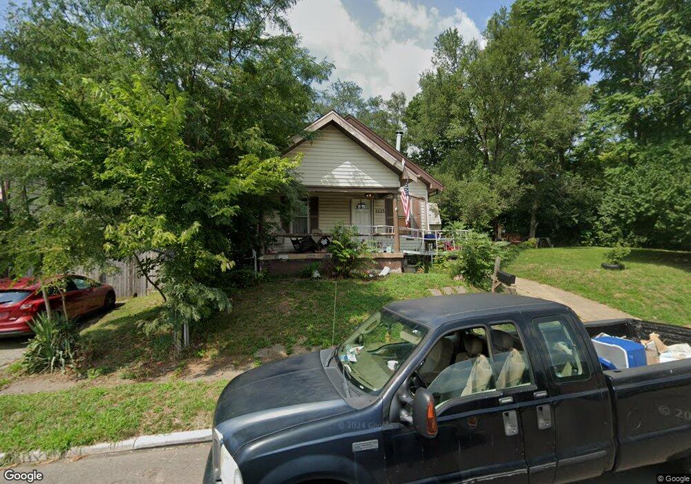
1615 Smith Ave Middletown, OH 45044
Meadowlawn NeighborhoodEstimated Value: $75,000 - $98,639
2
Beds
1
Bath
800
Sq Ft
$111/Sq Ft
Est. Value
About This Home
This home is located at 1615 Smith Ave, Middletown, OH 45044 and is currently estimated at $88,410, approximately $110 per square foot. 1615 Smith Ave is a home located in Butler County with nearby schools including Amanda Elementary School, Highview 6th Grade Center, and Middletown Middle School.
Ownership History
Date
Name
Owned For
Owner Type
Purchase Details
Closed on
Apr 9, 2001
Sold by
Profitt Opal M
Bought by
Shearer Robert and Shearer Pamela S
Current Estimated Value
Home Financials for this Owner
Home Financials are based on the most recent Mortgage that was taken out on this home.
Original Mortgage
$39,000
Interest Rate
7.05%
Mortgage Type
Balloon
Purchase Details
Closed on
Aug 29, 1996
Sold by
Profitt Leslie M
Bought by
Shearer Robert L and Shearer Pamela
Purchase Details
Closed on
Feb 1, 1985
Create a Home Valuation Report for This Property
The Home Valuation Report is an in-depth analysis detailing your home's value as well as a comparison with similar homes in the area
Home Values in the Area
Average Home Value in this Area
Purchase History
| Date | Buyer | Sale Price | Title Company |
|---|---|---|---|
| Shearer Robert | $36,000 | -- | |
| Shearer Robert L | $36,000 | -- | |
| -- | $19,300 | -- |
Source: Public Records
Mortgage History
| Date | Status | Borrower | Loan Amount |
|---|---|---|---|
| Closed | Shearer Robert | $39,000 | |
| Closed | Shearer Robert L | $0 |
Source: Public Records
Tax History
| Year | Tax Paid | Tax Assessment Tax Assessment Total Assessment is a certain percentage of the fair market value that is determined by local assessors to be the total taxable value of land and additions on the property. | Land | Improvement |
|---|---|---|---|---|
| 2025 | $829 | $19,680 | $3,470 | $16,210 |
| 2024 | $829 | $19,680 | $3,470 | $16,210 |
| 2023 | $540 | $23,680 | $3,470 | $20,210 |
| 2022 | $262 | $13,370 | $3,470 | $9,900 |
| 2021 | $258 | $13,370 | $3,470 | $9,900 |
| 2020 | $269 | $13,370 | $3,470 | $9,900 |
| 2019 | $852 | $11,750 | $4,090 | $7,660 |
| 2018 | $189 | $11,750 | $4,090 | $7,660 |
| 2017 | $190 | $11,750 | $4,090 | $7,660 |
| 2016 | $89 | $10,100 | $4,090 | $6,010 |
| 2015 | $88 | $10,100 | $4,090 | $6,010 |
| 2014 | $468 | $10,100 | $4,090 | $6,010 |
| 2013 | $468 | $16,580 | $4,090 | $12,490 |
Source: Public Records
Map
Nearby Homes
- 1503 Brown St
- 1619 Lafayette Ave
- 1621 Lafayette Ave
- 1507 Meadow Ave
- 2220 Yankee Rd
- 1808 Meadow Ave
- 1306 Michigan Ave
- ALWICK Plan at Stonybrook - Stonybrook Crossing
- QUENTIN Plan at Stonybrook - Stonybrook Crossing
- SHELBURN Plan at Stonybrook - Stonybrook Crossing
- SAXON Plan at Stonybrook - Stonybrook Crossing
- BEACHWOOD Plan at Stonybrook - Stonybrook Crossing
- ASHTON Plan at Stonybrook - Stonybrook Crossing
- VALE Plan at Stonybrook - Stonybrook Crossing
- BUCHANAN Plan at Stonybrook - Stonybrook Crossing
- BELLEVILLE Plan at Stonybrook - Stonybrook Crossing
- 1507 Pershing Ave
- 1505 Pershing Ave
- 2804 Yankee Rd
- 802 17th Ave
- 1635 Smith Ave
- 1611 Smith Ave
- 1627 Smith Ave
- 1609 Smith Ave
- 1629 Smith Ave
- 1605 Smith Ave
- 1614 Smith Ave
- 1633 Smith Ave
- 1612 Smith Ave
- 1610 Smith Ave
- 1603 Smith Ave
- 1601 Smith Ave
- 1842 Yankee Rd
- 1604 Smith Ave
- 1846 Yankee Rd
- 1602 Smith Ave
- 1901 Finley St
- 1850 Yankee Rd
- 1525 Smith Ave
- 1613 Taylor Ave
Your Personal Tour Guide
Ask me questions while you tour the home.