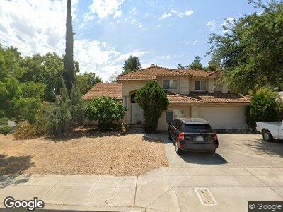
1617 E Muncie Ave Fresno, CA 93720
Woodward Park NeighborhoodEstimated Value: $538,999 - $628,000
3
Beds
3
Baths
2,177
Sq Ft
$261/Sq Ft
Est. Value
About This Home
This home is located at 1617 E Muncie Ave, Fresno, CA 93720 and is currently estimated at $569,250, approximately $261 per square foot. 1617 E Muncie Ave is a home located in Fresno County with nearby schools including Maple Creek Elementary School, Kastner Intermediate School, and Clovis West High School.
Ownership History
Date
Name
Owned For
Owner Type
Purchase Details
Closed on
Sep 21, 2023
Sold by
Eidson Bill and Eidson Atsuyo
Bought by
Eidson Bill
Current Estimated Value
Home Financials for this Owner
Home Financials are based on the most recent Mortgage that was taken out on this home.
Original Mortgage
$133,000
Outstanding Balance
$131,378
Interest Rate
6.88%
Mortgage Type
New Conventional
Estimated Equity
$413,015
Purchase Details
Closed on
Jul 17, 1996
Sold by
Bilbrey Travis A and Bilbrey Beverly J
Bought by
Eidson Bill and Harada Atsuyo
Create a Home Valuation Report for This Property
The Home Valuation Report is an in-depth analysis detailing your home's value as well as a comparison with similar homes in the area
Home Values in the Area
Average Home Value in this Area
Purchase History
| Date | Buyer | Sale Price | Title Company |
|---|---|---|---|
| Eidson Bill | -- | Mortgage Connect | |
| Eidson Bill | $146,000 | Commonwealth Land Title Ins |
Source: Public Records
Mortgage History
| Date | Status | Borrower | Loan Amount |
|---|---|---|---|
| Open | Eidson Bill | $133,000 | |
| Previous Owner | Eidson Bill | $165,000 |
Source: Public Records
Tax History Compared to Growth
Tax History
| Year | Tax Paid | Tax Assessment Tax Assessment Total Assessment is a certain percentage of the fair market value that is determined by local assessors to be the total taxable value of land and additions on the property. | Land | Improvement |
|---|---|---|---|---|
| 2023 | $2,698 | $228,528 | $64,171 | $164,357 |
| 2022 | $2,660 | $224,048 | $62,913 | $161,135 |
| 2021 | $2,585 | $219,656 | $61,680 | $157,976 |
| 2020 | $2,574 | $217,405 | $61,048 | $156,357 |
| 2019 | $2,522 | $213,143 | $59,851 | $153,292 |
| 2018 | $2,466 | $208,965 | $58,678 | $150,287 |
| 2017 | $2,422 | $204,869 | $57,528 | $147,341 |
| 2016 | $2,340 | $200,852 | $56,400 | $144,452 |
| 2015 | $2,303 | $197,836 | $55,553 | $142,283 |
| 2014 | $2,259 | $193,961 | $54,465 | $139,496 |
Source: Public Records
Map
Nearby Homes
- 1662 E Kenosha Ave
- 1526 E Niles Ave
- 1801 E Omaha Ave
- 8153 N Cedar Ave Unit 127
- 8153 N Cedar Ave Unit 106
- 8147 N Cedar Ave Unit 115
- 8147 N Cedar Ave Unit 203
- 8147 N Cedar Ave Unit 223
- 1415 E Portland Ave
- 1862 E Jordan Ave
- 1816 E Frederick Ave
- 1934 E Omaha Ave
- 1866 E Goshen Ave
- 1928 E Portland Ave
- 1892 E Goshen Ave
- 2072 E Lexington Ave
- 3052 E Trenton Ave
- 1177 E Kenosha Ave
- 2113 E Portland Ave
- 7518 N Trellis Cir
- 1617 E Muncie Ave
- 1601 E Muncie Ave
- 8115 N Rowell Ave
- 1646 E Lexington Ave
- 1616 E Muncie Ave
- 8101 N Rowell Ave
- 1600 E Muncie Ave
- 8150 N Rowell Ave
- 1645 E Lexington Ave
- 1658 E Lexington Ave
- 1588 E Muncie Ave
- 1577 E Muncie Ave
- 8166 N Rowell Ave
- 8087 N Rowell Ave
- 1615 E Niles Ave
- 1657 E Lexington Ave
- 1599 E Niles Ave
- 1576 E Muncie Ave
- 1664 E Lexington Ave