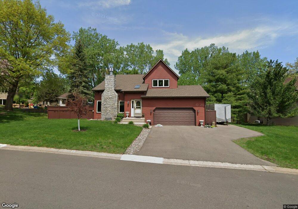
1617 Sherwood Way Saint Paul, MN 55122
Estimated Value: $477,053 - $519,000
4
Beds
4
Baths
1,588
Sq Ft
$311/Sq Ft
Est. Value
About This Home
This home is located at 1617 Sherwood Way, Saint Paul, MN 55122 and is currently estimated at $493,513, approximately $310 per square foot. 1617 Sherwood Way is a home located in Dakota County with nearby schools including Thomas Lake Elementary School, Falcon Ridge Middle School, and Eastview Senior High School.
Ownership History
Date
Name
Owned For
Owner Type
Purchase Details
Closed on
Oct 12, 2018
Sold by
Spelbrink Mary C
Bought by
Heim Timothy and Heim Barbara
Current Estimated Value
Home Financials for this Owner
Home Financials are based on the most recent Mortgage that was taken out on this home.
Original Mortgage
$333,841
Outstanding Balance
$291,129
Interest Rate
4.5%
Mortgage Type
FHA
Estimated Equity
$202,384
Create a Home Valuation Report for This Property
The Home Valuation Report is an in-depth analysis detailing your home's value as well as a comparison with similar homes in the area
Home Values in the Area
Average Home Value in this Area
Purchase History
| Date | Buyer | Sale Price | Title Company |
|---|---|---|---|
| Heim Timothy | $340,000 | All American Title Co Inc |
Source: Public Records
Mortgage History
| Date | Status | Borrower | Loan Amount |
|---|---|---|---|
| Open | Heim Timothy | $333,841 |
Source: Public Records
Tax History Compared to Growth
Tax History
| Year | Tax Paid | Tax Assessment Tax Assessment Total Assessment is a certain percentage of the fair market value that is determined by local assessors to be the total taxable value of land and additions on the property. | Land | Improvement |
|---|---|---|---|---|
| 2024 | $4,508 | $422,300 | $119,100 | $303,200 |
| 2023 | $4,508 | $415,000 | $119,500 | $295,500 |
| 2022 | $3,828 | $394,100 | $119,200 | $274,900 |
| 2021 | $3,570 | $345,000 | $103,600 | $241,400 |
| 2020 | $3,488 | $316,100 | $98,700 | $217,400 |
| 2019 | $3,247 | $301,700 | $94,000 | $207,700 |
| 2018 | $3,347 | $296,700 | $89,500 | $207,200 |
| 2017 | $3,270 | $295,900 | $85,300 | $210,600 |
| 2016 | $3,356 | $277,400 | $81,200 | $196,200 |
| 2015 | $3,273 | $269,922 | $77,777 | $192,145 |
| 2014 | -- | $267,742 | $75,595 | $192,147 |
| 2013 | -- | $238,094 | $67,583 | $170,511 |
Source: Public Records
Map
Nearby Homes
- 1517 Covington Ln
- 4765 Penkwe Cir
- 4681 Ridge Cliff Dr
- 4677 Ridge Cliff Dr
- 4731 Walden Dr
- 4646 1/2 Penkwe Way
- 4633 Stonecliffe Dr
- 1719 Nokia Way
- 1761 Karis Way
- 4679 Sorrel Point
- 4628 Pinetree Curve
- 1655 Walnut Ln
- 4714 Lenore Ln
- XXXX Eriks Blvd
- 4694 Lenore Ln
- 4682 Lenore Ln
- 1676 Hickory Ln
- 1743 Galaxie Ct
- 12640 Eveleth Path
- 1778 Walnut Ln
- 1607 Sherwood Way
- 4858 Sheffield Ln
- 4860 Sheffield Ln
- 1597 Sherwood Way
- 1618 Sherwood Way
- 1624 Sherwood Way
- 4854 Sheffield Ln
- 1612 Sherwood Way
- 1628 Sherwood Way
- 1606 Sherwood Way
- 1593 Sherwood Way
- 4850 Sheffield Ln
- 4859 Sheffield Ln
- 1635 Sherwood Way
- 1632 Sherwood Way
- 1594 Sherwood Way
- 1592 Sherwood Ct
- 4846 Sheffield Ln
- 1587 Sherwood Way
- 1636 Sherwood Way