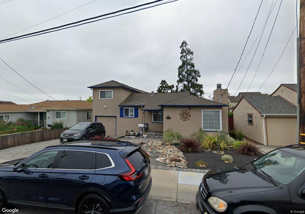
16267 Maubert Ave San Leandro, CA 94578
Estimated Value: $745,000 - $1,027,000
3
Beds
2
Baths
1,696
Sq Ft
$517/Sq Ft
Est. Value
About This Home
This home is located at 16267 Maubert Ave, San Leandro, CA 94578 and is currently estimated at $876,215, approximately $516 per square foot. 16267 Maubert Ave is a home located in Alameda County with nearby schools including Hillside Elementary, Edendale Middle, and San Lorenzo High School.
Ownership History
Date
Name
Owned For
Owner Type
Purchase Details
Closed on
Jul 26, 2024
Sold by
Cannon Candyce Ann and Cayanan Victor Rhoel
Bought by
Cayanon Cannon Family Trust and Cayanan
Current Estimated Value
Purchase Details
Closed on
Mar 22, 1997
Sold by
Cannon Candyce A and Cannon Robert K
Bought by
Cayanan Victor R and Cannon Candyce A
Home Financials for this Owner
Home Financials are based on the most recent Mortgage that was taken out on this home.
Original Mortgage
$27,200
Interest Rate
7.63%
Create a Home Valuation Report for This Property
The Home Valuation Report is an in-depth analysis detailing your home's value as well as a comparison with similar homes in the area
Home Values in the Area
Average Home Value in this Area
Purchase History
| Date | Buyer | Sale Price | Title Company |
|---|---|---|---|
| Cayanon Cannon Family Trust | -- | None Listed On Document | |
| Cayanan Victor R | $27,500 | Placer Title Company |
Source: Public Records
Mortgage History
| Date | Status | Borrower | Loan Amount |
|---|---|---|---|
| Previous Owner | Cayanan Victor R | $27,200 |
Source: Public Records
Tax History
| Year | Tax Paid | Tax Assessment Tax Assessment Total Assessment is a certain percentage of the fair market value that is determined by local assessors to be the total taxable value of land and additions on the property. | Land | Improvement |
|---|---|---|---|---|
| 2025 | $4,392 | $308,999 | $93,093 | $222,906 |
| 2024 | $4,392 | $302,803 | $91,267 | $218,536 |
| 2023 | $4,380 | $303,729 | $89,478 | $214,251 |
| 2022 | $4,304 | $290,775 | $87,724 | $210,051 |
| 2021 | $4,180 | $284,936 | $86,004 | $205,932 |
| 2020 | $4,082 | $288,943 | $85,122 | $203,821 |
| 2019 | $4,077 | $283,277 | $83,453 | $199,824 |
| 2018 | $3,758 | $272,724 | $81,817 | $190,907 |
| 2017 | $3,588 | $267,377 | $80,213 | $187,164 |
| 2016 | $3,420 | $262,135 | $78,640 | $183,495 |
| 2015 | $3,344 | $258,200 | $77,460 | $180,740 |
| 2014 | $3,293 | $253,143 | $75,943 | $177,200 |
Source: Public Records
Map
Nearby Homes
- 1672 162nd Ave
- 1550 162nd Ave Unit 69
- 1550 162nd Ave Unit 47
- 16251 Carolyn St
- 1654 164th Ave
- 16330 Ridgehaven Dr Unit 802
- 0 Lindview Dr
- 16005 Mateo St
- 16520 Los Banos St
- 15976 Carolyn St
- 1510 165th Ave
- 1521 159th Ave
- 16557 E 14th St
- 2505 Miramar Ave Unit 122
- 2500 Miramar Ave Unit 101
- 1410 Thrush Ave Unit 3
- 15675 Liberty St
- 1625 Thrush Ave
- 16605 Rolando Ave
- 19100 Crest Ave Unit 100
- 16263 Maubert Ave
- 16275 Maubert Ave
- 16253 Maubert Ave
- 16283 Maubert Ave
- 1661 163rd Ave
- 16226 Calypso Ct
- 1675 163rd Ave
- 16262 Maubert Ave
- 16256 Maubert Ave
- 16268 Maubert Ave
- 16249 Maubert Ave
- 1695 163rd Ave
- 16222 Calypso Ct
- 16246 Maubert Ave
- 16276 Maubert Ave
- 1663 163rd Ave
- 16218 Calypso Ct
- 16240 Maubert Ave
- 16245 Maubert Ave
- 1643 163rd Ave