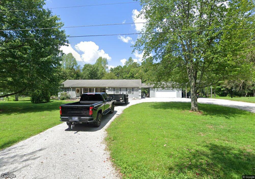
164 Phillips Subdivision Rd Clarkrange, TN 38553
Estimated Value: $330,000 - $406,000
3
Beds
2
Baths
2,100
Sq Ft
$173/Sq Ft
Est. Value
About This Home
This home is located at 164 Phillips Subdivision Rd, Clarkrange, TN 38553 and is currently estimated at $362,711, approximately $172 per square foot. 164 Phillips Subdivision Rd is a home located in Fentress County.
Ownership History
Date
Name
Owned For
Owner Type
Purchase Details
Closed on
Aug 25, 2010
Sold by
Hall Donnie
Bought by
Norris Michelle D
Current Estimated Value
Home Financials for this Owner
Home Financials are based on the most recent Mortgage that was taken out on this home.
Original Mortgage
$152,000
Outstanding Balance
$100,791
Interest Rate
4.6%
Mortgage Type
Cash
Estimated Equity
$261,920
Purchase Details
Closed on
Apr 17, 2007
Bought by
Hall Donnie
Purchase Details
Closed on
Oct 3, 1997
Bought by
Freytag Wesley D and Freytag Kathie
Purchase Details
Closed on
Sep 19, 1996
Bought by
Sexton Charles B
Create a Home Valuation Report for This Property
The Home Valuation Report is an in-depth analysis detailing your home's value as well as a comparison with similar homes in the area
Purchase History
| Date | Buyer | Sale Price | Title Company |
|---|---|---|---|
| Norris Michelle D | $152,000 | -- | |
| Hall Donnie | $30,000 | -- | |
| Freytag Wesley D | $7,700 | -- | |
| Sexton Charles B | $15,000 | -- |
Source: Public Records
Mortgage History
| Date | Status | Borrower | Loan Amount |
|---|---|---|---|
| Open | Sexton Charles B | $152,000 |
Source: Public Records
Tax History
| Year | Tax Paid | Tax Assessment Tax Assessment Total Assessment is a certain percentage of the fair market value that is determined by local assessors to be the total taxable value of land and additions on the property. | Land | Improvement |
|---|---|---|---|---|
| 2025 | $883 | $65,400 | $2,200 | $63,200 |
| 2024 | $883 | $65,400 | $2,200 | $63,200 |
| 2023 | $883 | $65,400 | $2,200 | $63,200 |
| 2022 | $762 | $39,900 | $2,050 | $37,850 |
| 2021 | $762 | $39,900 | $2,050 | $37,850 |
| 2020 | $762 | $39,900 | $2,050 | $37,850 |
| 2019 | $762 | $39,900 | $2,050 | $37,850 |
| 2018 | $762 | $39,900 | $2,050 | $37,850 |
| 2017 | $784 | $39,525 | $2,050 | $37,475 |
| 2016 | $784 | $39,525 | $2,050 | $37,475 |
| 2015 | $784 | $39,528 | $0 | $0 |
| 2014 | $784 | $39,528 | $0 | $0 |
Source: Public Records
Map
Nearby Homes
- 2019 Martha Washington Rd
- 0 Old Martha Washington Rd
- 6604 S York Hwy
- 2047 Todd Rd
- 106 MacA Ridge Cir
- 2570 Martha Washington Rd
- 164 Green Acres
- 145 Rhum Rd
- 6105 S York Hwy
- 6105 S South York Hwy
- 6006 S York Hwy
- 1070 N Shady Lane Loop
- 6940 S York Hwy
- 1188 Clarkrange Monterey Hwy
- 892 Norris Rd
- 5740 S York Hwy
- 5715 S York Highway 127 Hwy
- 1011 Fox Ridge Dr
- 1079 South Ln
- 5651 S York Hwy
- 158 Phillips Subdivision Rd
- 154 Phillips Subdivision Rd
- 157 Phillips Subdivision Rd
- 127 Phillips Subdivision Rd
- 2063 Martha Washington Rd
- 175 Phillips Subdivision Rd
- 150 Phillips Subdivision Rd
- 176 Phillips Subdivision Rd
- 2059 Martha Washington Rd
- 2053 Martha Washington Rd
- 146 Phillips Subdivision Rd
- 2065 Martha Washington Rd
- 2061 Martha Washington Rd
- 199 Phillips Subdivision Rd
- 199 Phillips Subdivision Rd
- 198 Phillips Subdivision Rd
- 2021 Martha Washington Rd
- 2060 Martha Washington Rd
- 2062 Martha Washington Rd
- 129 Phillips Subdivision Rd
Your Personal Tour Guide
Ask me questions while you tour the home.