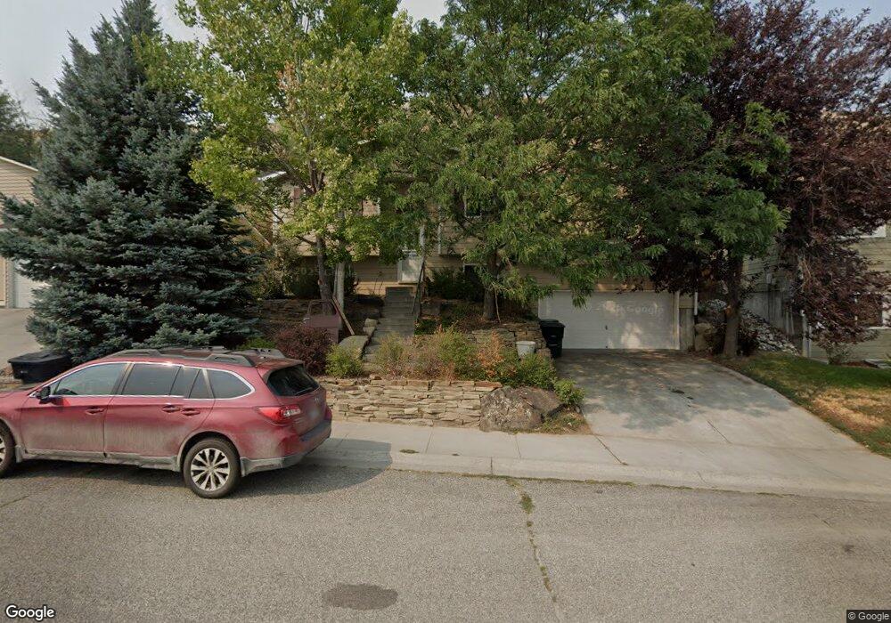
1647 Vuecrest Dr Billings, MT 59101
North Side Billings NeighborhoodEstimated Value: $268,000 - $363,000
4
Beds
2
Baths
1,906
Sq Ft
$169/Sq Ft
Est. Value
About This Home
This home is located at 1647 Vuecrest Dr, Billings, MT 59101 and is currently estimated at $321,265, approximately $168 per square foot. 1647 Vuecrest Dr is a home located in Yellowstone County with nearby schools including McKinley School, Riverside Junior High School, and Billings Senior High School.
Ownership History
Date
Name
Owned For
Owner Type
Purchase Details
Closed on
Nov 21, 2017
Sold by
Scheppele Ryan H
Bought by
Arneson John and Arneson Leah
Current Estimated Value
Purchase Details
Closed on
Aug 22, 2008
Sold by
Roberts Laura L
Bought by
Scheppele Ryan H
Home Financials for this Owner
Home Financials are based on the most recent Mortgage that was taken out on this home.
Original Mortgage
$182,070
Interest Rate
6.37%
Mortgage Type
FHA
Create a Home Valuation Report for This Property
The Home Valuation Report is an in-depth analysis detailing your home's value as well as a comparison with similar homes in the area
Home Values in the Area
Average Home Value in this Area
Purchase History
| Date | Buyer | Sale Price | Title Company |
|---|---|---|---|
| Arneson John | -- | Stewart Title | |
| Scheppele Ryan H | -- | None Available |
Source: Public Records
Mortgage History
| Date | Status | Borrower | Loan Amount |
|---|---|---|---|
| Previous Owner | Scheppele Ryan H | $182,070 |
Source: Public Records
Tax History Compared to Growth
Tax History
| Year | Tax Paid | Tax Assessment Tax Assessment Total Assessment is a certain percentage of the fair market value that is determined by local assessors to be the total taxable value of land and additions on the property. | Land | Improvement |
|---|---|---|---|---|
| 2025 | $2,254 | $282,800 | $40,738 | $242,062 |
| 2024 | $2,254 | $229,600 | $40,400 | $189,200 |
| 2023 | $2,303 | $229,600 | $40,400 | $189,200 |
| 2022 | $2,278 | $201,000 | $0 | $0 |
| 2021 | $2,212 | $201,000 | $0 | $0 |
| 2020 | $2,223 | $195,800 | $0 | $0 |
| 2019 | $2,123 | $195,800 | $0 | $0 |
| 2018 | $2,042 | $184,500 | $0 | $0 |
| 2017 | $1,707 | $184,500 | $0 | $0 |
| 2016 | $1,862 | $175,000 | $0 | $0 |
| 2015 | $1,821 | $175,000 | $0 | $0 |
| 2014 | $1,622 | $82,097 | $0 | $0 |
Source: Public Records
Map
Nearby Homes
- 823 N 18th St
- 722 N 17th St
- 901 N 19th St
- 612 N 15th St
- 2004 9th Ave N
- 945 N 23rd St
- 2214 6th Ave N
- 715 N 24th St
- 1130 N 23rd St
- 307 Moccasin Trail
- 1121 N 24th St
- 1143 N 24th St
- 1114 N 24th St
- TBD Tumbleweed Dr
- 521 Indian Trail
- Lot C Alkali Creek Rd
- 1363 Montana Ave Unit 301
- 1363 Montana Ave Unit 303
- 1363 Montana Ave Unit 302
- 607 26th St W
- 1639 Vuecrest Dr
- 1655 Vuecrest Dr
- 1631 Vuecrest Dr
- 1663 Vuecrest Dr
- 1640 Vuecrest Dr
- 1623 Vuecrest Dr
- 1671 Vuecrest Dr
- 822/820 N 16th St
- 832 N 16th St
- 1679 Vuecrest Dr
- 1565 Park Place
- 937 N 17th St Unit B
- 937 N 17th St Unit D
- 937 N 17th St
- 830 N 16th St
- 1687 Vuecrest Dr
- 0 Vuecrest Dr
- Block 4 Lot 1 Vuecrest Dr
- 00 Vuecrest Dr
- 1555 Park Place