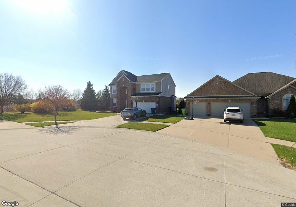
16490 Lilac Ct Unit 1 Macomb, MI 48044
Estimated Value: $325,000 - $524,000
--
Bed
1
Bath
2,152
Sq Ft
$187/Sq Ft
Est. Value
About This Home
This home is located at 16490 Lilac Ct Unit 1, Macomb, MI 48044 and is currently estimated at $402,385, approximately $186 per square foot. 16490 Lilac Ct Unit 1 is a home located in Macomb County with nearby schools including Floyd Ebeling Elementary School, Bemis Junior High School, and Henry Ford II High School.
Ownership History
Date
Name
Owned For
Owner Type
Purchase Details
Closed on
Oct 29, 2010
Sold by
Lombardo Homes Of S E Michigan Llc
Bought by
Moody Scott A and Moody Dana M
Current Estimated Value
Home Financials for this Owner
Home Financials are based on the most recent Mortgage that was taken out on this home.
Original Mortgage
$230,743
Outstanding Balance
$154,016
Interest Rate
4.5%
Mortgage Type
FHA
Estimated Equity
$248,369
Create a Home Valuation Report for This Property
The Home Valuation Report is an in-depth analysis detailing your home's value as well as a comparison with similar homes in the area
Home Values in the Area
Average Home Value in this Area
Purchase History
| Date | Buyer | Sale Price | Title Company |
|---|---|---|---|
| Moody Scott A | -- | Greater Macomb Title Agency | |
| Lombardo Homes Of S E Michigan Llc | -- | None Available |
Source: Public Records
Mortgage History
| Date | Status | Borrower | Loan Amount |
|---|---|---|---|
| Open | Lombardo Homes Of S E Michigan Llc | $230,743 |
Source: Public Records
Tax History Compared to Growth
Tax History
| Year | Tax Paid | Tax Assessment Tax Assessment Total Assessment is a certain percentage of the fair market value that is determined by local assessors to be the total taxable value of land and additions on the property. | Land | Improvement |
|---|---|---|---|---|
| 2025 | $3,777 | $183,300 | $0 | $0 |
| 2024 | $2,505 | $174,800 | $0 | $0 |
| 2023 | $2,372 | $163,400 | $0 | $0 |
| 2022 | $3,529 | $144,600 | $0 | $0 |
| 2021 | $3,337 | $135,800 | $0 | $0 |
| 2020 | $2,184 | $133,000 | $0 | $0 |
| 2019 | $3,106 | $126,900 | $0 | $0 |
| 2018 | $3,016 | $131,300 | $0 | $0 |
| 2017 | $2,976 | $126,530 | $32,500 | $94,030 |
| 2016 | $2,800 | $126,530 | $0 | $0 |
| 2015 | $2,701 | $117,360 | $0 | $0 |
| 2014 | $2,701 | $104,720 | $21,500 | $83,220 |
Source: Public Records
Map
Nearby Homes
- 16729 White Plains Dr
- 47340 Chrys Rd
- 16115 Nathan Dr
- 16170 Musket Dr
- 16230 21 Mile Rd
- 47165 Susan Rd
- 46980 Country Ln Unit 8
- 47687 Tilch Rd
- 17338 Tower Dr
- 48341 Anthony Dr
- 15613 Valerie Dr
- 46969 Fox Run Dr
- 17609 21 Mile Rd
- 17903 Red Oaks Dr
- 47159 Meadowbrook Dr
- 16282 Sassafras Ln
- 17115 Scarborough Dr
- 46421 Imperial Ln
- 16378 Jake Dr
- 15297 Spruce Dr
- 16490 Lilac Ct
- 16472 Lilac Ct
- 47706 Gloede Rd
- 47674 Gloede Rd
- 47642 Gloede Rd
- 16499 Lilac Ct
- 16481 Lilac Ct
- 47770 Gloede Rd
- 16497 Peace Valley Ct Unit 2
- 16497 Peace Valley Ct
- 47610 Gloede Rd
- 47802 Gloede Rd
- 47659 Gloede Rd
- 47723 Gloede Rd
- 47578 Gloede Rd
- 47691 Gloede Rd
- 16470 Peace Valley Ct
- 47627 Gloede Rd
- 47755 Gloede Rd
- 47834 Gloede Rd