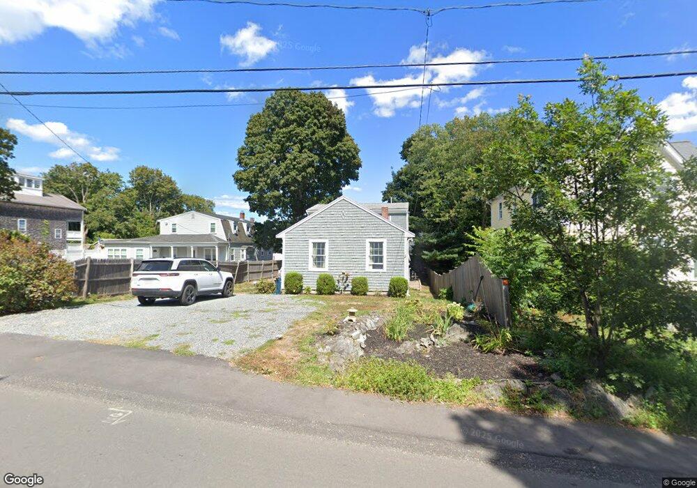
165 Wompatuck Rd Hingham, MA 02043
Crow Point NeighborhoodEstimated Value: $907,000 - $1,041,000
2
Beds
1
Bath
720
Sq Ft
$1,314/Sq Ft
Est. Value
About This Home
This home is located at 165 Wompatuck Rd, Hingham, MA 02043 and is currently estimated at $945,789, approximately $1,313 per square foot. 165 Wompatuck Rd is a home located in Plymouth County with nearby schools including William L. Foster Elementary School, Hingham Middle School, and Hingham High School.
Ownership History
Date
Name
Owned For
Owner Type
Purchase Details
Closed on
Mar 13, 2007
Sold by
Colantonio and Colantonio B Camille
Bought by
Colantonio Erica D
Current Estimated Value
Purchase Details
Closed on
Aug 2, 2004
Sold by
Colantonio Erica D and Colantonio Camille B
Bought by
5 & 7 8Ths Llc
Purchase Details
Closed on
Jun 16, 2004
Sold by
Wasserman Peter A and Wasserman Janet E
Bought by
Colantonio Erica D and Colantonio Camille B
Purchase Details
Closed on
Jun 29, 2001
Sold by
Slupski John C and Slupski Robina Ag
Bought by
Wasserman Peter A and Wasserman Janet E
Purchase Details
Closed on
Jun 3, 1994
Sold by
Bamford Evelyn M
Bought by
Slupski John C and Gangemi Robina A
Create a Home Valuation Report for This Property
The Home Valuation Report is an in-depth analysis detailing your home's value as well as a comparison with similar homes in the area
Home Values in the Area
Average Home Value in this Area
Purchase History
| Date | Buyer | Sale Price | Title Company |
|---|---|---|---|
| Colantonio Erica D | -- | -- | |
| 5 & 7 8Ths Llc | -- | -- | |
| Colantonio Erica D | $319,000 | -- | |
| Wasserman Peter A | $210,000 | -- | |
| Slupski John C | $121,000 | -- | |
| Slupski John C | $121,000 | -- |
Source: Public Records
Mortgage History
| Date | Status | Borrower | Loan Amount |
|---|---|---|---|
| Open | Slupski John C | $20,000 | |
| Open | Slupski John C | $304,000 |
Source: Public Records
Tax History
| Year | Tax Paid | Tax Assessment Tax Assessment Total Assessment is a certain percentage of the fair market value that is determined by local assessors to be the total taxable value of land and additions on the property. | Land | Improvement |
|---|---|---|---|---|
| 2025 | $7,873 | $736,500 | $401,100 | $335,400 |
| 2024 | $7,246 | $667,800 | $401,100 | $266,700 |
| 2023 | $6,553 | $655,300 | $401,100 | $254,200 |
| 2022 | $6,479 | $560,500 | $309,600 | $250,900 |
| 2021 | $6,442 | $545,900 | $309,600 | $236,300 |
| 2020 | $6,210 | $538,600 | $309,600 | $229,000 |
| 2019 | $6,190 | $524,100 | $309,600 | $214,500 |
| 2018 | $0 | $516,000 | $309,600 | $206,400 |
| 2017 | $5,795 | $473,100 | $296,700 | $176,400 |
| 2016 | $5,697 | $456,100 | $282,600 | $173,500 |
| 2015 | $5,454 | $435,300 | $269,200 | $166,100 |
Source: Public Records
Map
Nearby Homes
- 16 Foley Beach Rd
- 81 Kimball Beach Rd
- 37 Foley Beach Rd
- 160 Hms Stayner Dr
- 160 Hms Stayner Dr Unit 160
- 132 Hms Stayner Dr Unit 132
- 151 Stayner Dr Unit 151
- 17 Paige St
- 28 Marsh St
- 2 Langlee Rd
- 12 Daley Rd
- 130 Broad Reach Unit 206
- 64 Broad Reach Unit 107
- 64 Broad Reach Unit 310
- 54 Broad Reach Unit 104
- 23 Shipyard Dr Unit 206
- 51 Broad Reach Unit T23A
- 300 River St Unit 12
- 43 Park View Dr
- 10 Shipyard Dr Unit 313
- 161 Wompatuck Rd
- 171 Wompatuck Rd
- 171 Wompatuck Rd
- 157 Wompatuck Rd
- 157 Wompatuck Rd
- 177 Wompatuck Rd
- 50 Kimball Beach Rd
- 48 Kimball Beach Rd
- 164 Wompatuck Rd
- 46 Kimball Beach Rd
- 172 Wompatuck Rd
- 56 Kimball Beach Rd
- 160 Wompatuck Rd
- 181 Wompatuck Rd
- 149 Wompatuck Rd
- 158 Wompatuck Rd
- 44 Kimball Beach Rd
- 185 Wompatuck Rd
- 182 Wompatuck Rd
- 42 Kimball Beach Rd
Your Personal Tour Guide
Ask me questions while you tour the home.